Thundershowers Tonight, More Storms Tuesday
Several rounds of showers and storms are possible as we go through the next seven days. Fortunately, there will be some decent weather mixed in. Temperatures will remain above average with highs in the 80s by the end of the week.
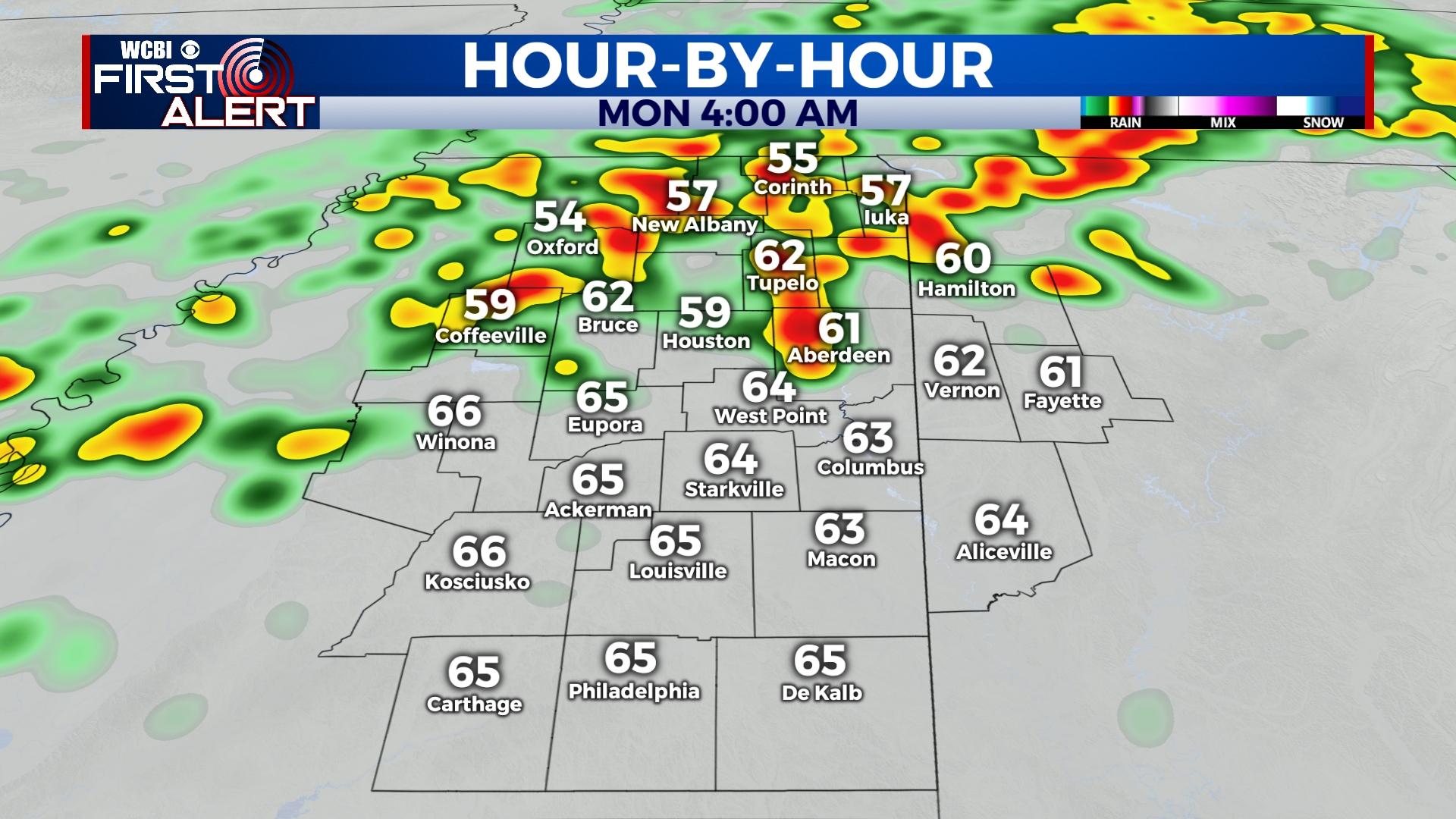
SUNDAY NIGHT: Showers are possible before midnight, but rain and thunder will become likely between 12am and 8am. Some storms could produce quick downpours and gusty winds. Temperatures will remain fairly steady in the upper 50s to low 60s.
MONDAY: Rain and thunder will remain possible through lunchtime, but most of the day should be dry. We could even see a few peeks of sun in the afternoon. Highs will be in the low 70s with northwesterly winds.
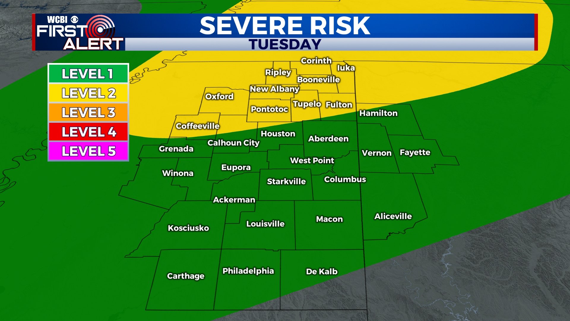
TUESDAY: Although most of the day will be dry, an approaching storm system will again bring the chance for scattered storms late in the day on Tuesday. At this time, a level 2 risk for severe weather is in effect for areas along and north of I-22, with a level 1 risk in effect for other areas. Widespread severe weather is not likely, but some storms could produce gusty winds. The threat for tornadoes appears to be very low in our area, but a brief tornado can never be ruled completely out. The best chance for storms will be between 1pm and 10pm. We’ll continue to monitor and make changes as necessary. Temperatures will rise to near 80 in the afternoon.
WEDNESDAY-THURSDAY: Rain will exit the area by Wednesday morning, leaving us dry for the middle portion of the week. We’ll see a mix of some sun and clouds on Wednesday and Thursday with highs in the upper 70s and low 80s. Overnight lows will be in the 50s.
FRIDAY-SUNDAY: Rain chances return to the forecast for Friday and Saturday, with some storms possible on Saturday. Sunday looks to be dry and mostly cloudy. Highs will be in the 80s on Friday, and into the 70s for the weekend.


Leave a Reply