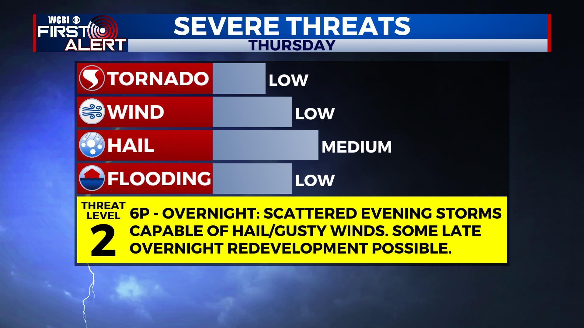
Thursday evening storms ahead of sunny weekend
COLUMBUS, Mississippi (WCBI) – Unseasonably warm air continues Thursday with an evening storm threat. A slight break in the heat moves in Friday before near record temperatures move in next week.
THURSDAY/THURSDAY NIGHT: Most of the day should be dry, very warm, and breezy at times with highs in the upper 80s. Scattered to numerous showers and storms arrive just before sunset, and some of this activity could be severe with gusty winds and hail the primary concerns. The tornado potential remains low, but it is not zero. Activity should diminish overnight, but there remains potential of redeveloping storms toward daybreak Friday along the advancing front. Should this occur, a low probability severe risk would also exist.
FRIDAY: Early morning showers or storms will quickly clear out, leaving some sunshine mixed with clouds for the rest of the day. Strong southwest to west breezes could gust up to 25 mph as highs reach the upper 70s. An isolated redeveloping shower remains possible in far northeast MS later in the afternoon.
WEEKEND: Saturday looks fantastic with lows in the 50s and daytime highs nearing 80 degrees with plentiful sunshine. Mother’s Day Sunday starts cooler in the lower to middle 50s, but highs rebound into the upper 80s to near 90 degrees by afternoon.

NEXT WEEK: The heat continues to build as highs reach the low 90s by Tuesday and Wednesday. Near record highs are possible.