Trending cooler for mid-week
COLUMBUS, Mississippi (WCBI) – Temperatures will trend down over the next few days. Warmer weather returns by the end of the week, bringing another threat for storms Friday.
TUESDAY: A weak front is set to move through the region today, bringing a mixture of clouds and sunshine and highs in the upper 60s. Limited to no rain is expected. Afternoon breezes could exceed 20 mph.
TUESDAY NIGHT: Winds relax as the sky slowly clears after midnight, suggesting temperatures have a chance to fall into the upper 30s – much cooler!
WED/THU: A stretch of really nice days is ahead with lots of sunshine and comfortable temperatures. Highs will reach the 60s Wednesday and dip into the 30s again Wednesday night. A warming trend returns Thursday as highs bounce back into the 70s.
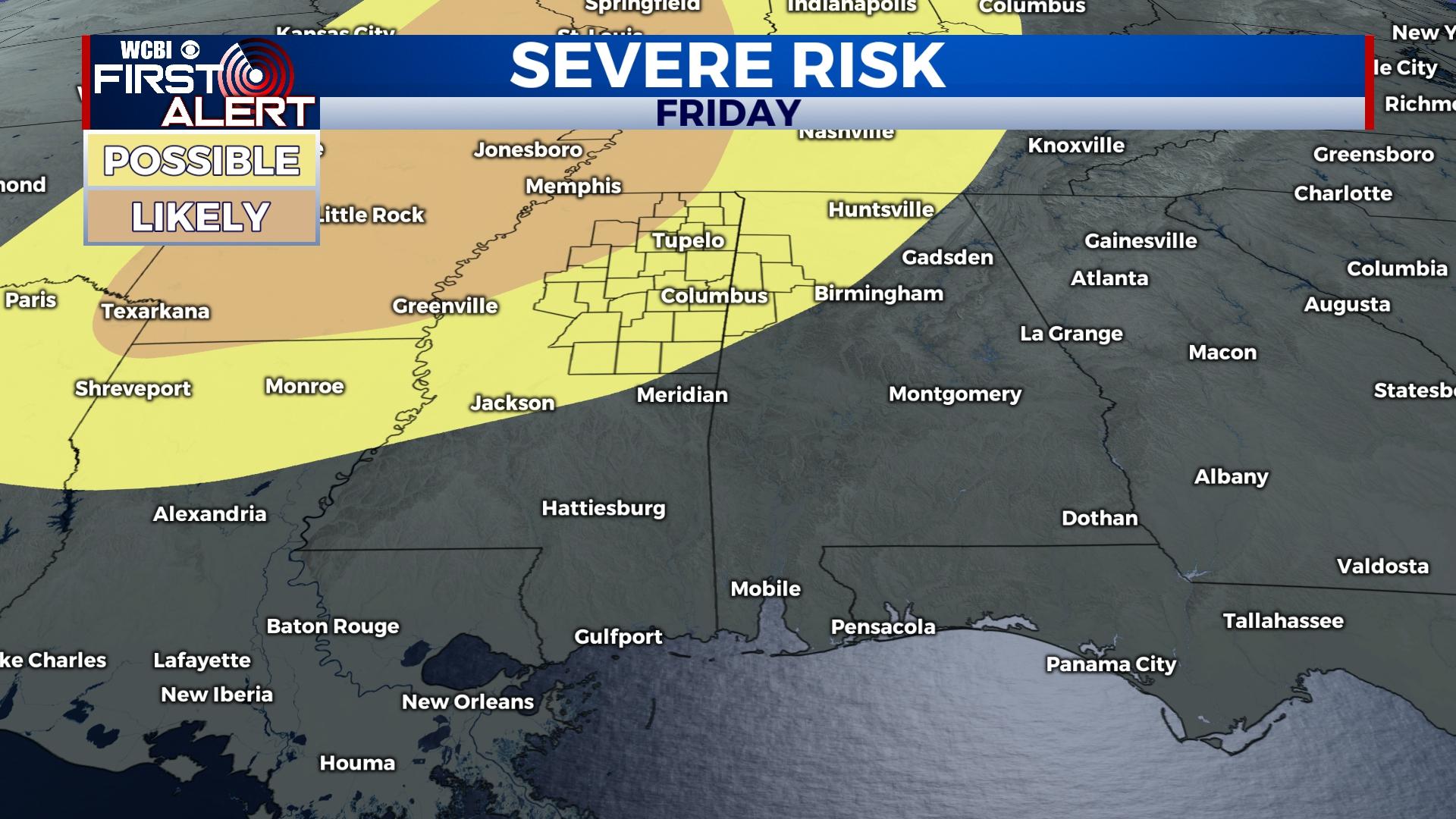
FRIDAY: Warm, humid, and unstable air builds back into the region, and with the approach of yet another Pacific front, showers and storms are possible in the late afternoon & evening hours. Some of these storms could turn severe, especially for the northern half of the state…roughly north of US 82. Storm coverage could stay relatively scattered, which means not everyone will see a storm or severe weather.
WEEKEND: After Friday evening’s severe threat, a few showers could stick around Saturday as highs stay in the upper 70s to near 80°. Sunday looks quite nice, but showers move back in early next week.