Trending warmer with severe storms on Wednesday
COLUMBUS, Mississippi (WCBI) – The weather trends warmer through mid week as severe storms become likely again on Wednesday.
MONDAY: Plenty of sun is on tap again today as conditions begin to warm from the weekend. Highs should reach the lower to middle 70s today as a warm front begins lifting across the state.
TUESDAY: With Monday’s front moving north, much warmer weather is in store. Expect a mix of sun and clouds and highs in the 80s.
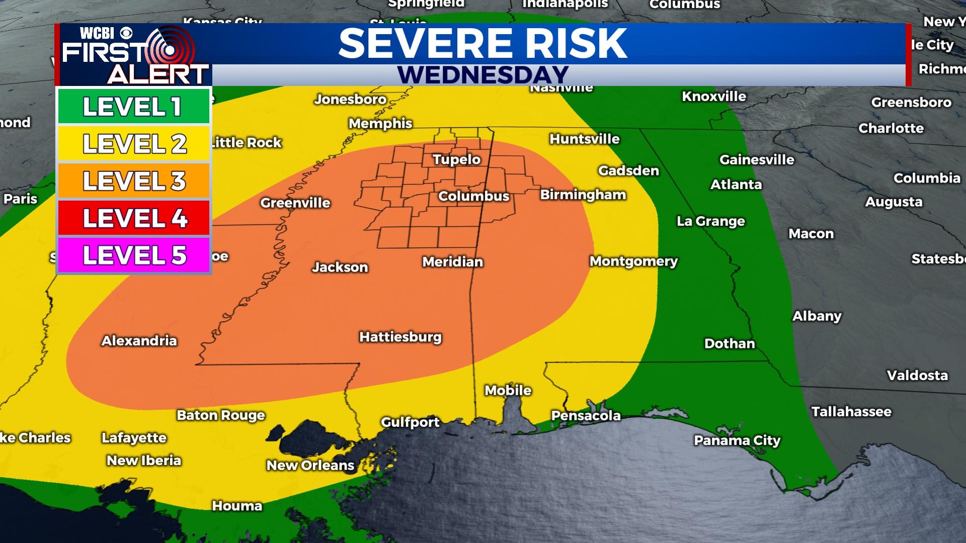
WEDNESDAY: Another potentially high impact weather day is shaping up for Wednesday. A strong line of showers and storms will sweep across the state, reaching our coverage area in peak heating hours of the afternoon and early evening. Preceding the line, very warm and increasingly unstable/humid air will promote the risk of significant severe weather along and potentially in advance of the line. Damaging winds and tornadoes are expected with this activity, so everyone should stay alert for more updates regarding this forecast. The main timeline to watch is 1p-8p Wednesday.
REST OF WEEK: Quieter weather moves in for the end of the week with near average conditions. Expect highs in the upper 60s to low 70s and morning lows in the 40s.
WEEKEND: Forecast confidence remains low, but another round of at least scattered showers could develop Saturday. For now, the widespread coverage of rain and potential storms looks to stay south of the WCBI coverage area. We’ll keep you posted!