Two rounds of cold fronts bring rain and potential severe chance
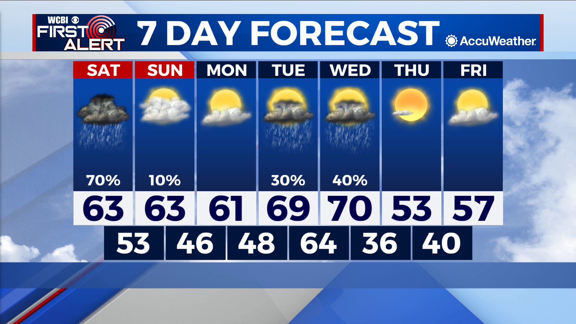
COLUMBUS – SUMMARY: Rain chances on Saturday as well as midweek next week bring opportunity to play catch-up with our yearly rain totals. Storms next week also bring some chance for severe weather back to the region.
SATURDAY: Highs will top out in the low 60s while lows hit the low 50s overnight. Rain will arrive in the area in the afternoon hours before the bulk of the storms makes its way through the region in the evening.
SUNDAY: A weak overnight cold front Saturday keeps us in the low 60s in the afternoon Sunday. Rain chances remain minimal despite mostly cloudy skies throughout the day. Lows bottom out in the mid to upper 40s overnight.
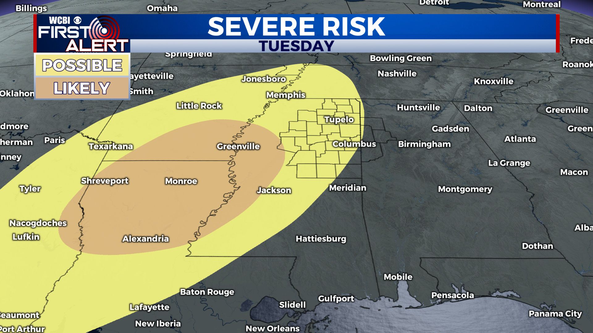
NEXT WEEK: Highs will increase to around 70 by the time our next cold front moves through the area Wednesday. Our next rain chance tags along with this front, bringing elevated potential for severe weather along with it. Exact timing and impacts are unclear to this point but the general timeline seems to be between Tuesday night and Wednesday morning. We will keep you updated on the situation as it evolves. Highs will drop into the low 50s after the front passes, while lows will drop into the mid to upper 30s.