Unsettled weather to start the new workweek
SUMMARY: A cold front to our northwest will help keep our weather unsettled as we kick off the new workweek. It is possible we’ll get back to normal summertime afternoon showers chances midweek. Temperatures will be below average in the mid to upper 80s, but it will be humid.
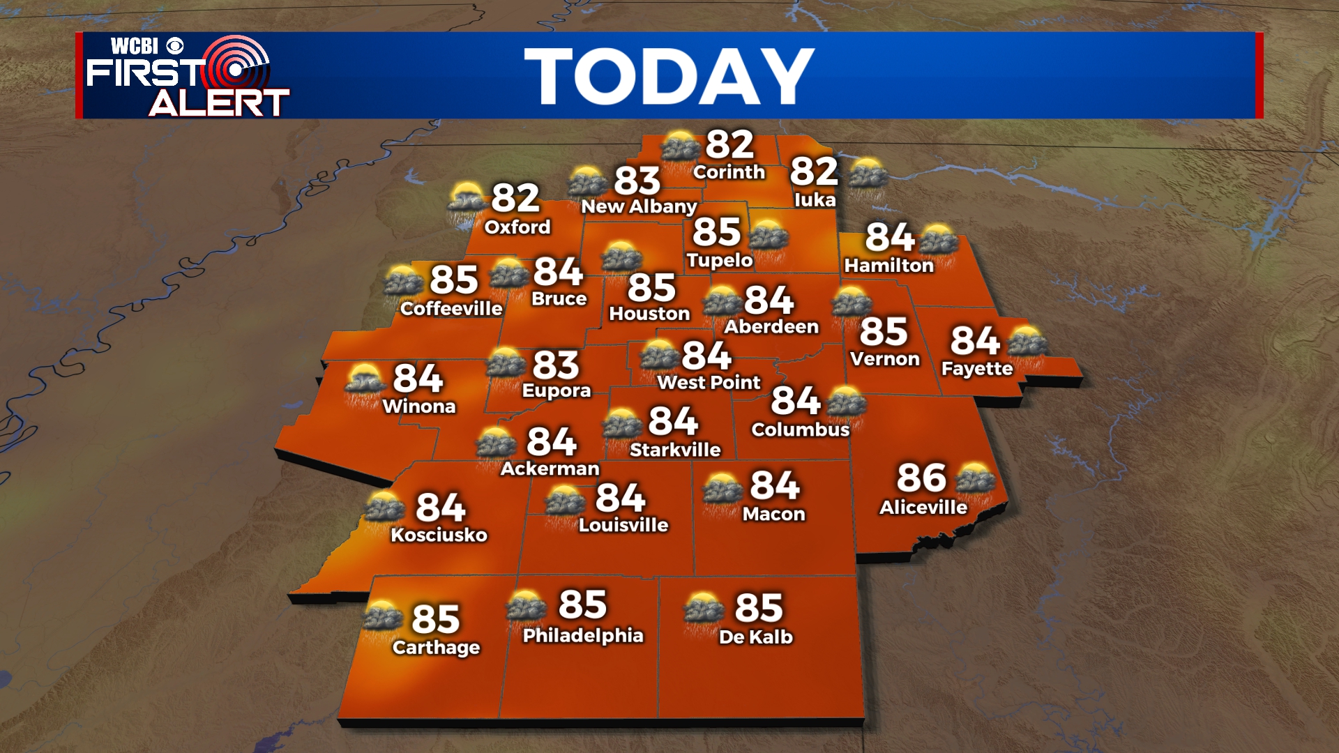
MONDAY: We’ll have a continuing chance of showers and storms for our Monday with mostly cloudy skies. Highs will be below average, but still humid & warm in the mid 80s. SW winds 10-15 mph. Gusts up to 20.
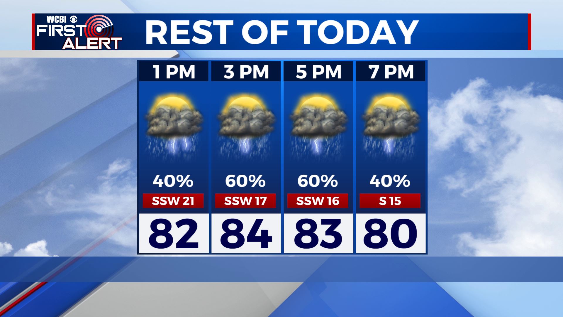
MONDAY NIGHT: Some scattered showers and storms are possible through most of the evening. Mostly cloudy skies overnight. Lows around 70 degrees.
TUESDAY: Scattered to widespread storms are still possible all day into the evening. Highs mid 80s once again thanks to the cloud cover.
WEDNESDAY-FRIDAY: Looking to be a bit drier with more of a mix of sun & clouds. Still can’t rule out the chance for afternoon isolated showers & storms. Staying warm & humid with highs in the upper 80s.
THE WEEKEND: Chances of those afternoon summertime showers & storms stick around. Staying warm & humid overall with a mix of sun & clouds. Highs in the upper 80s to lower 90s. Overnight lows in the lower 70s.
Stay connected with @WCBIWEATHER on Facebook, Twitter, Instagram and the WCBI News App


Leave a Reply