Warm, breezy days ahead…storms likely Wednesday PM
COLUMBUS, Mississippi (WCBI) – Hot weather highlights the next few days along with increased storm potential. Cooler air follows by Thursday & Friday.
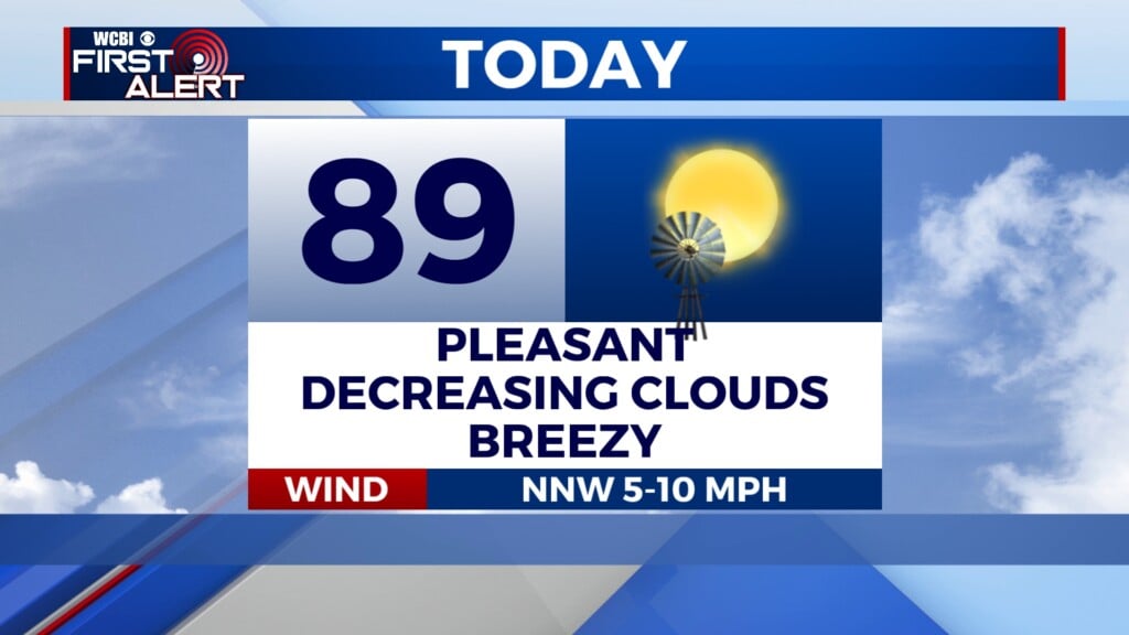
TUESDAY: Variably cloudy and borderline hot as temperatures reach the upper 80s for most. Expect a breezy day as well, with southerly wind gusts up to 25+ mph possible.
TUESDAY NIGHT: Clouds will remain widespread, and an isolated shower or two is possible. Lows will be in the upper 60s.
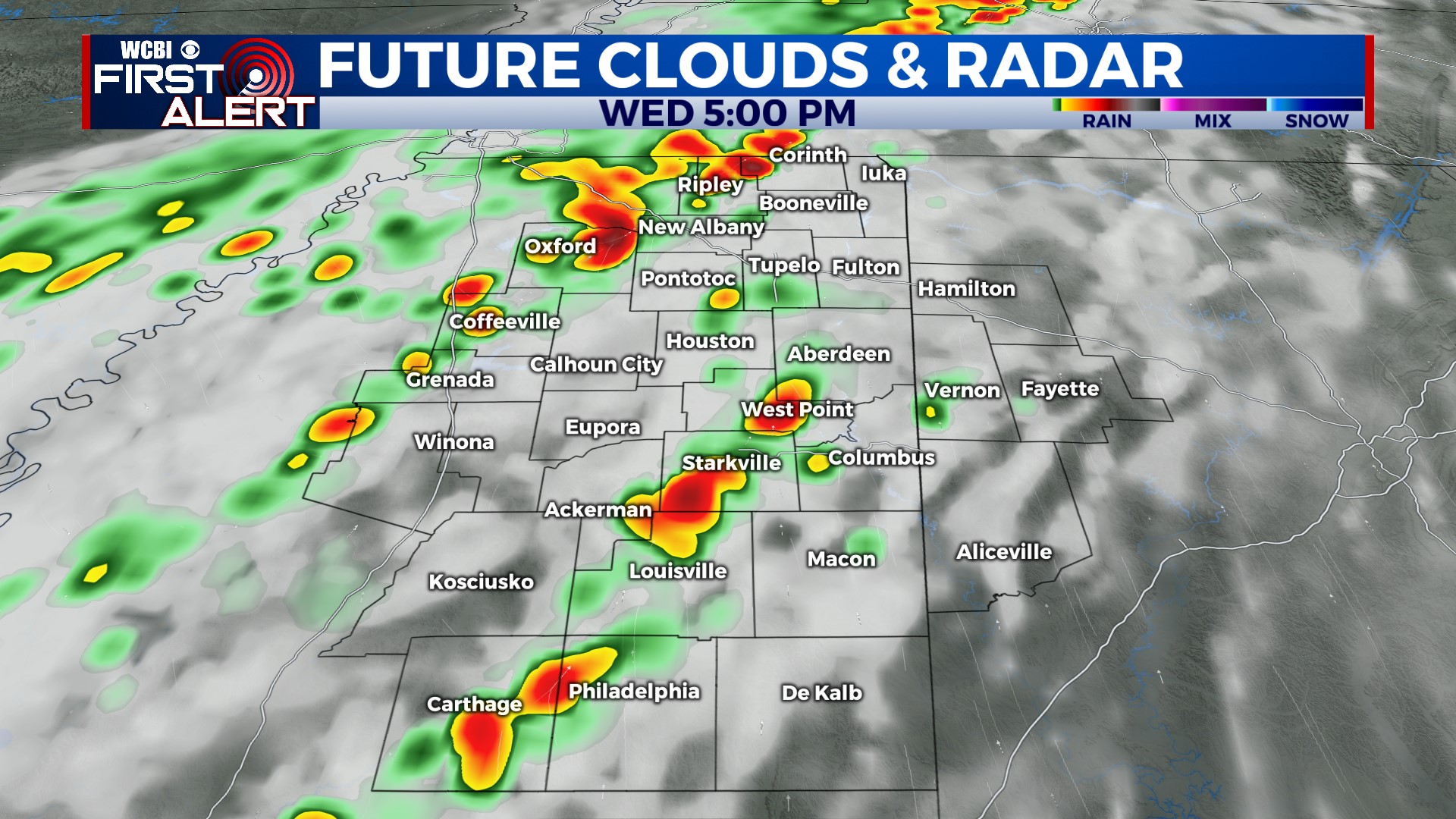
WEDNESDAY: Another breezy and very warm day is in store as highs stay in the mid to upper 80s. Showers and storms are likely Wednesday late-day into the evening as a strong front moves into the region. Large hail and damaging winds are possible in the strongest storms, and while the tornado threat is low, it is not zero. Eventually, the threat will transition to heavy rain, and some minor flooding could result as storms persist through the overnight hours.
THURSDAY: Showers and embedded storms will continue Thursday as temperatures back off significantly into the 60s and likely 50s by afternoon.
FRIDAY: Cool air will continue as will occasional rain chances – expect highs to stay in the upper 50s.
WEEKEND: The soggy pattern is expected to slowly break down Saturday with just scattered showers. Sunday looks completely dry with highs in the lower 70s.