Warm & breezy then some storm chances for Tuesday
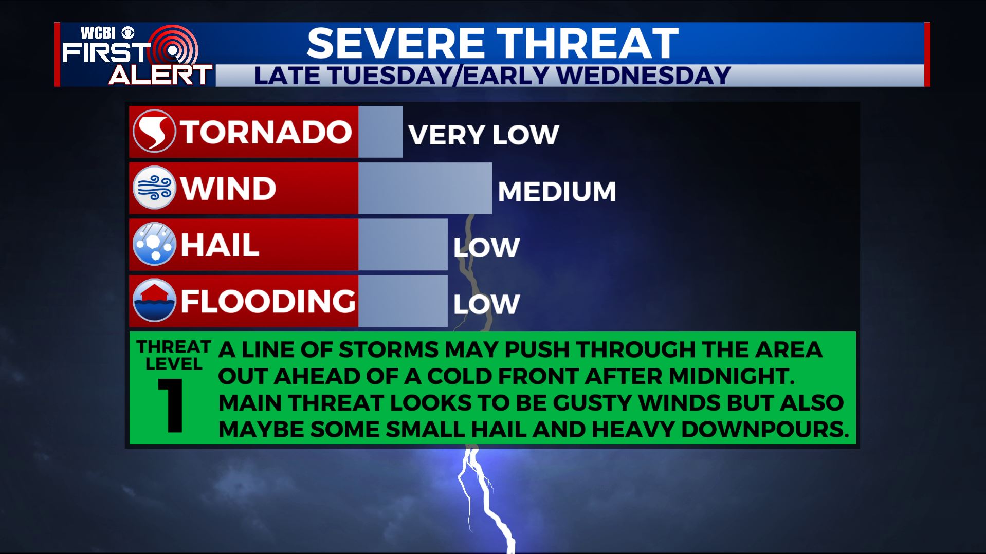
SUMMARY: Most of the week will feature sunny skies and dry weather. The one exception will be late tonight into early Wednesday morning when storms ahead of a cold front pushes through the Deep South. Stronger storms may contain heavy downpours, small hail and gusty winds. The 80s will make a comeback by the weekend.
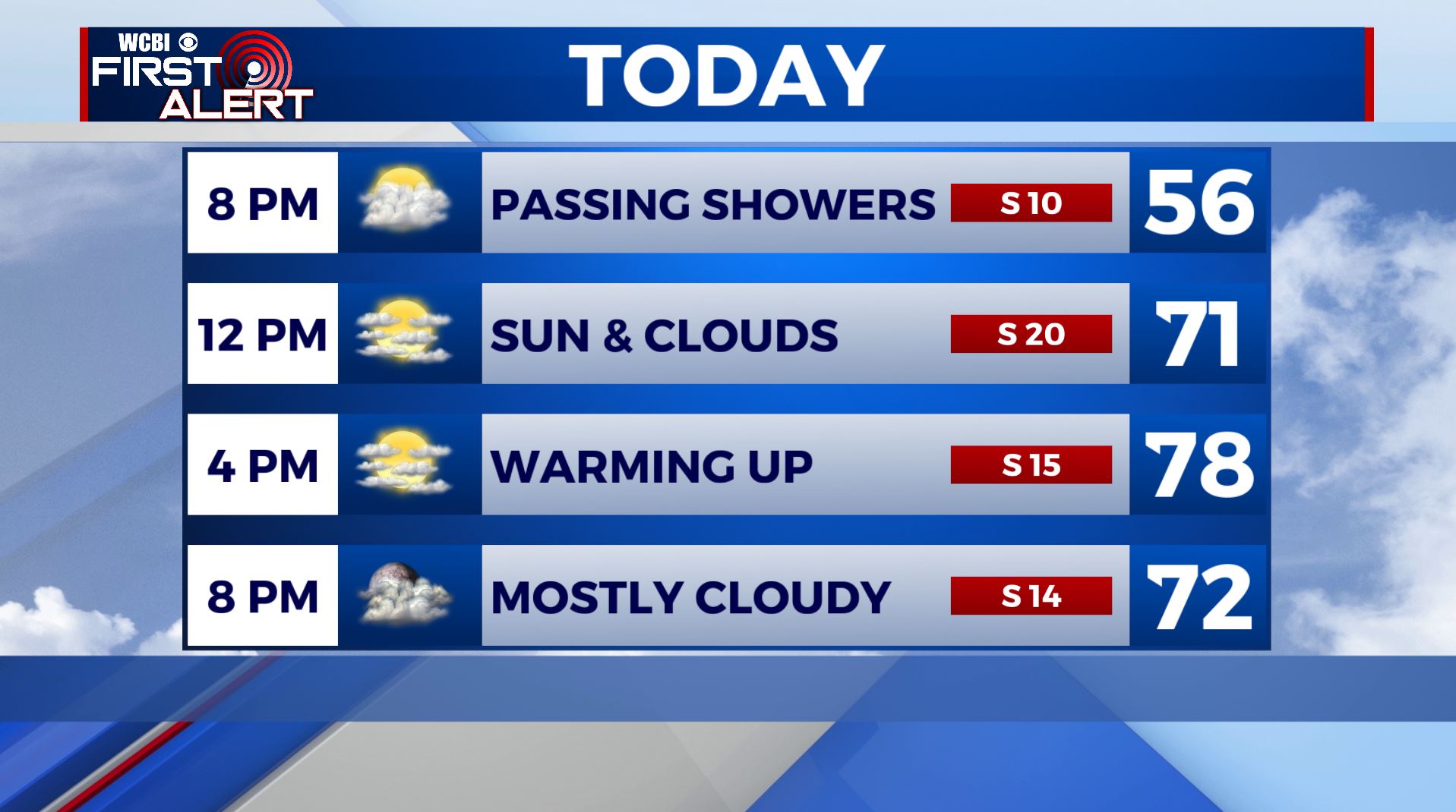
TUESDAY: We’re dealing with a few passing light showers this Tuesday morning as a weak disturbance is pushing through the region. We’ll see cloudy skies with some sunshine mixed in by the afternoon. Breezy & warmer with highs in the upper 70s to around 80. Winds S 10-20 mph.
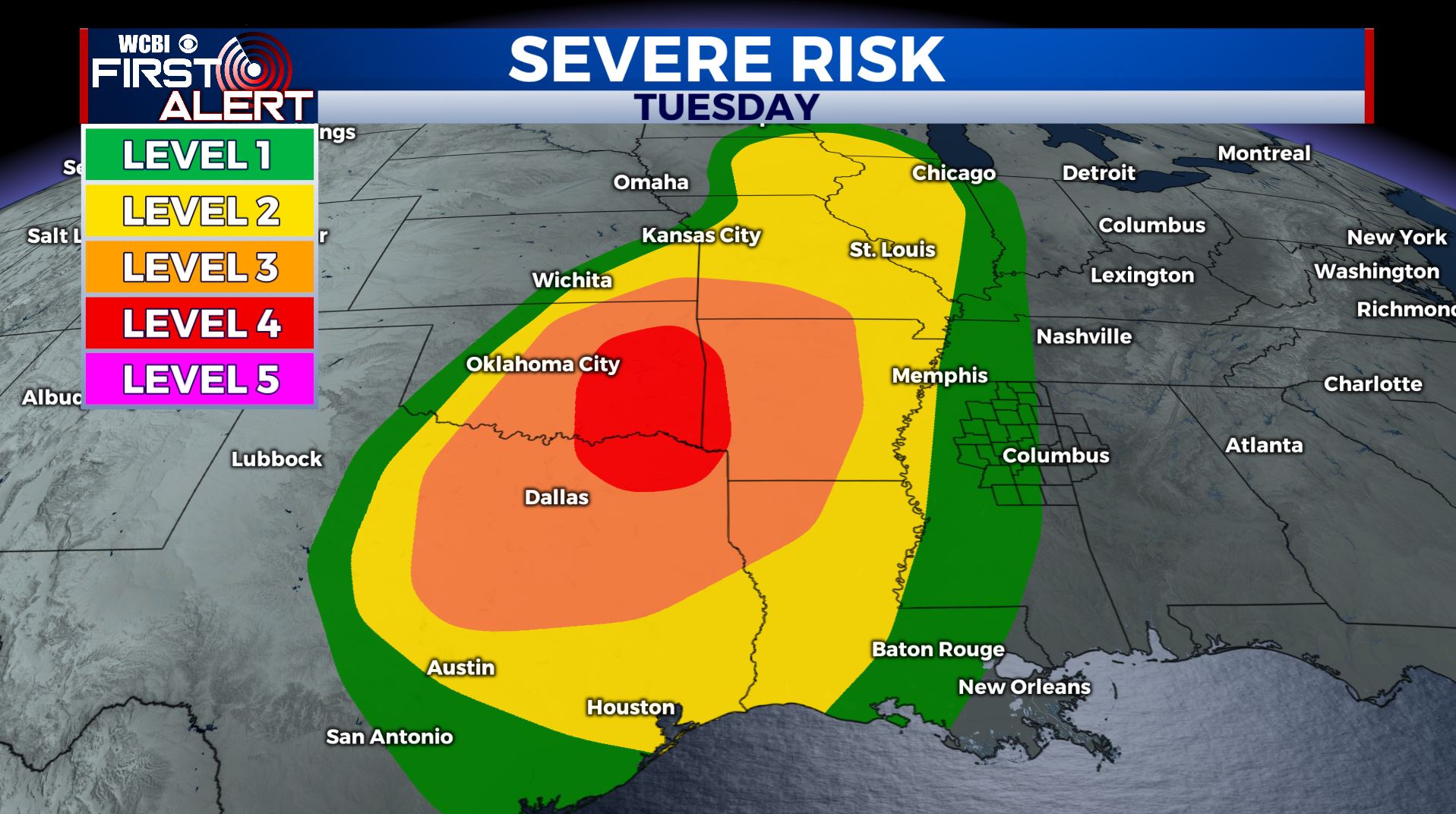
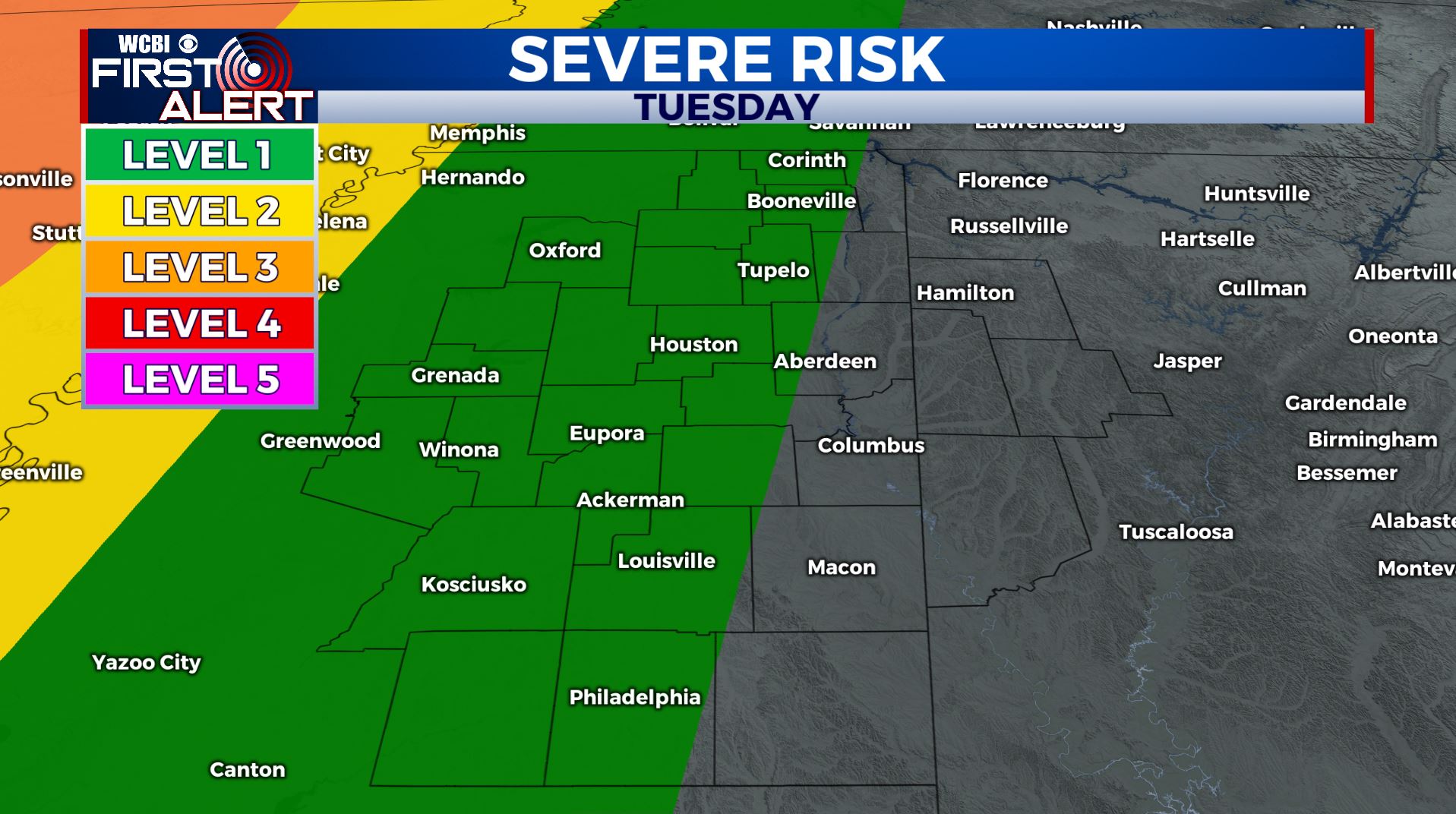
TUESDAY NIGHT-WEDNESDAY: All eyes today will be in the Central/Southern Plains for severe weather in that area late afternoon into the evening. A line of rain and storms will move from NW to SE, but should weaken as it moves through the WCBI Viewing Area overnight into early tomorrow morning. Heavy rainfall, small hail and damaging wind gusts will be the primary threats in stronger storms as they push into our western counties. We’ll clear out through the day on Wednesday, leaving us with a few peeks of sunshine by the afternoon. Afternoon highs will be in the mid 70s with overnight lows in the 60s as our winds switch up from the SW to NW behind the cold front.
WEDNESDAY NIGHT: Clear skies and quiet. Lows near 50.
THURSDAY-FRIDAY: Mostly sunny weather returns for the end of the week. A bit cooler with highs in the lower to mid 70s. Overnight lows will be in the 50s.
THE WEEKEND: Temperatures will steadily increase this upcoming weekend with afternoon highs into the mid and possibly upper 80s. Staying dry with lots of sunshine and a few clouds.
MONDAY: We could see some scattered showers return as we start a new week with a mix of sun & clouds. Highs remain warm in the 80s.
Stay connected with @WCBIWEATHER on Facebook, Twitter, Instagram, and the WCBI News App


Leave a Reply