Warm day into a wet overnight
COLUMBUS, Mississippi (WCBI)- Warm temperatures were felt across Mississippi today, some cities even broke their high temperature records! It was an overall pleasant day, but tonight’s changes may not be as pleasant for some.
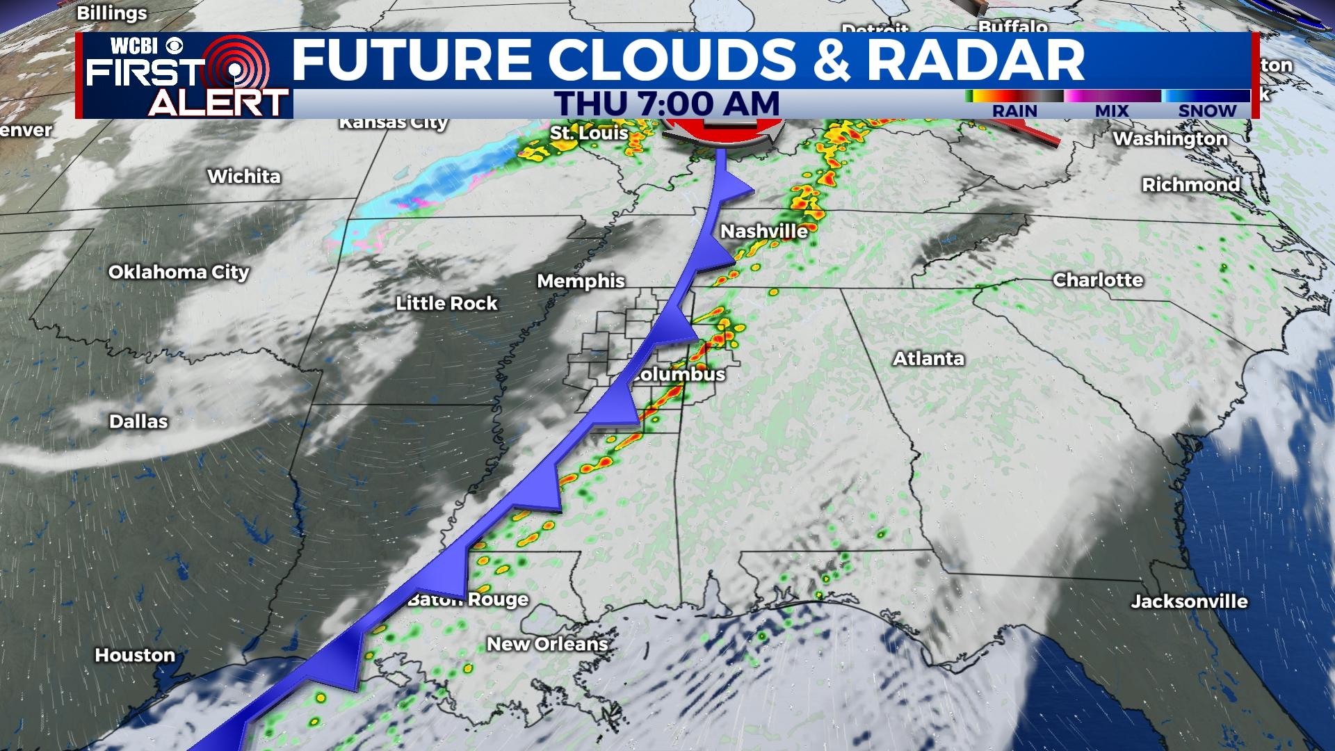
WEDNESDAY NIGHT: A cold front is getting ready to move into the Deep South tonight and into Thursday morning. Ahead of that front, rain showers and storms are likely. Heavier cloud coverage tonight will only allow the low temperatures to drop into the lower 60s.
THURSDAY: Heavy cloud coverage with rain showers and storms continue into Thursday morning. The heaviest of the rain will move through between 5AM and 10AM. The storms may produce a few rumbles of thunder, but the likelihood of this system becoming severe is low. Gusty winds and heavy rain are the hazards with the most potential. However, other forms of severe weather cannot be ruled out if it were to become slightly more intense. Once the cold front passes through Mississippi, the rain and a lot of the cloud coverage will move off to the East. This will give a relatively nice afternoon. The high temperatures will be in the middle to upper 60s. The cold air behind the front will move in for the overnight low temperatures, dropping to close to freezing again.
FRIDAY: Colder air continues for the end of our week. High temperatures are only going to reach into the low to middle 40s, despite there being plenty of sun. With clearer sky conditions, the overnight low temperatures will fall below freezing into the middle 20s.


