Warm days continue, colder air returns for weekend
COLUMBUS, Mississippi (WCBI) – An early taste of spring afternoons will continue through Friday. A cold front brings much cooler air Saturday into Sunday.
THURSDAY: A weak, stalled front draped near the region could help clouds increase somewhat late today, but the day stays generally sunny and warm. Expect highs to reach the upper 60s, similar to Wednesday.
FRIDAY: This still looks to be our warmest day since New Year’s. A stout southwest flow will develop ahead of the next front, and this signals the chance for highs to reach the low 70s under a mostly sunny sky.
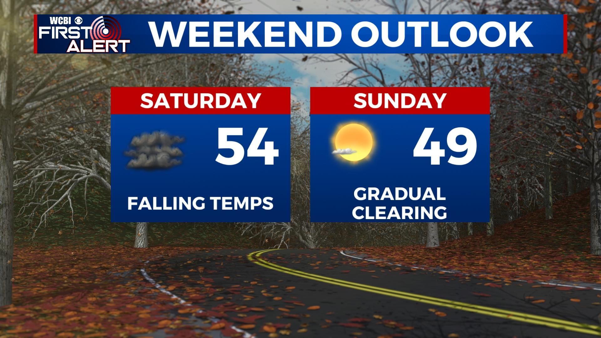
WEEKEND: The next front should move through sometime Saturday, ushering in much colder air behind it. Clouds will be widespread, but overall moisture still looks limited with the system. We will monitor any changes in short-term model guidance, but no measurable precipitation is expected at this time. Daytime temperatures may reach the 50s by midday but should fall quickly through the afternoon Saturday. Sunday starts cold in the 20s and only rebounds into the upper 40s despite sunshine.
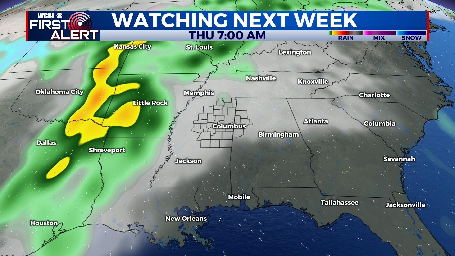
NEXT WEEK: The chilly air only lasts through Valentine’s Day Monday before a flip to much warmer air occurs. This will continue through the end of the week, and building warmth and moisture is likely to lead to showers and storms returning to the forecast Thursday. Until then, expect dry & sunny weather to hold.


Leave a Reply