Warm Friday and Saturday, feeling more like Christmas next week
SUMMARY: The exceptionally mild weather continues, with a couple more days in the 70s. Rain moves through with a cold front Saturday, but amounts look fairly low at this time. Then, we clear out and get much cooler next week, finally feeling more seasonable for this time of year. The week leading up to Christmas is looking fairly quiet, with a chance for some rain showers on Monday night into Tuesday. Highs will be in the 50s for much of the week.
FRIDAY: A very mild and muggy day in store, with a high in the low to mid 70s. Skies will be cloudy, with a few showers or sprinkles possible in northern areas.
FRIDAY NIGHT: A cold front will approach the region on Friday night, with temps actually slowly rising overnight from the low to the mid 60s. A few showers will be possible by morning.
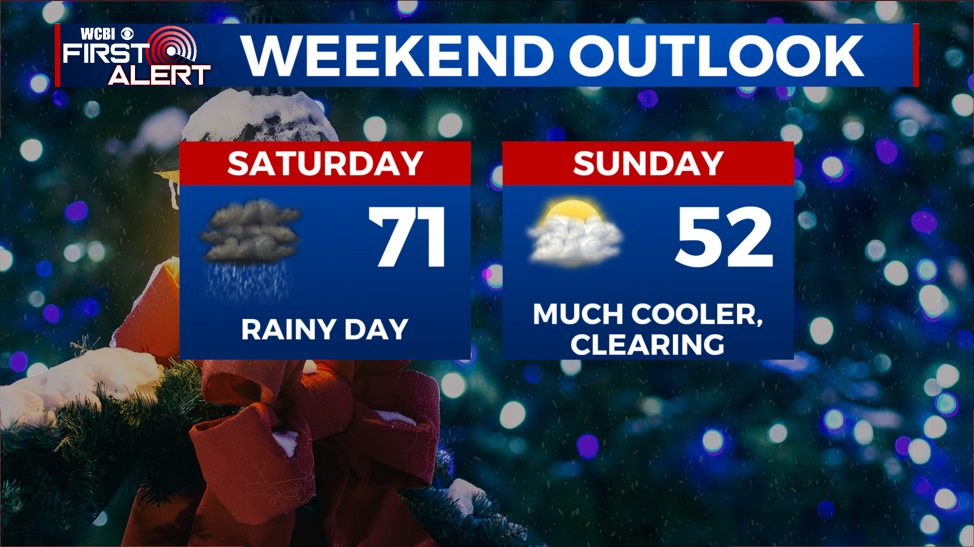
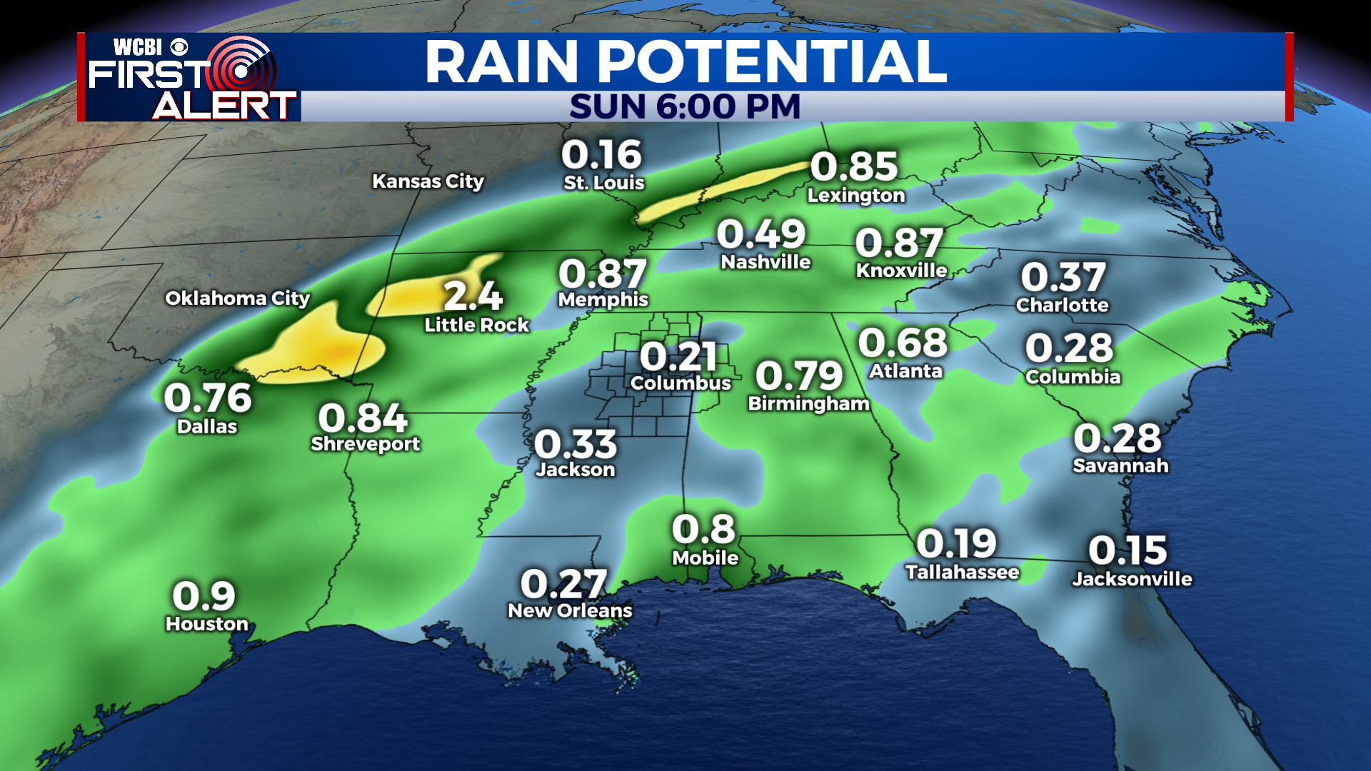
SATURDAY: As the front moves through, it will push a line of rain through the area. While there could be a rumble of thunder or 2 and some breezy winds, no severe weather is expected. The line of showers will be weakening as it moves through, so rainfall amounts look to be fairly low, likely less than a half inch for most.
SATURDAY NIGHT: Much cooler behind the front, with lows dropping down into the upper 30s and low 40s. Clouds will be slow to clear, so expect a mostly cloudy night.
SUNDAY TO THURSDAY: Clouds will slowly clear throughout the day on Sunday, but it will be much cooler. Highs will only be in the upper 40s to low 50s. Sunday night, with clear skies, temps will get close to the freezing mark in many spots. Clouds begin to return to the forecast on Monday afternoon, as an area of low pressure will slide right along the gulf coast. This will bring a chance for some showers Monday night, especially the further south you go. Highs will remain in the low 50s Monday. After a few morning showers, Tuesday will be dry with a high in the mid 50s and mostly cloudy skies. Wednesday, highs return to the upper 50s, with lots of sunshine expected as well. 60s make a comeback by Thursday with clouds on the increase once again.
EARLY LOOK AT CHRISTMAS WEEKEND: At this time, Christmas weekend is looking fairly calm and dry, with warmer than average temperatures. It won’t be extremely warm, but at this time I would expect partly cloudy skies and a high in the low to mid 60s on Christmas day. We’ll refine the forecast over the next 9 days! No snow for Santa in Mississippi this year, unfortunately.
CONNECT WITH @WCBIWEATHER ON TWITTER, FACEBOOK AND INSTAGRAM