Warm Halloween Day, Storms Halloween Night
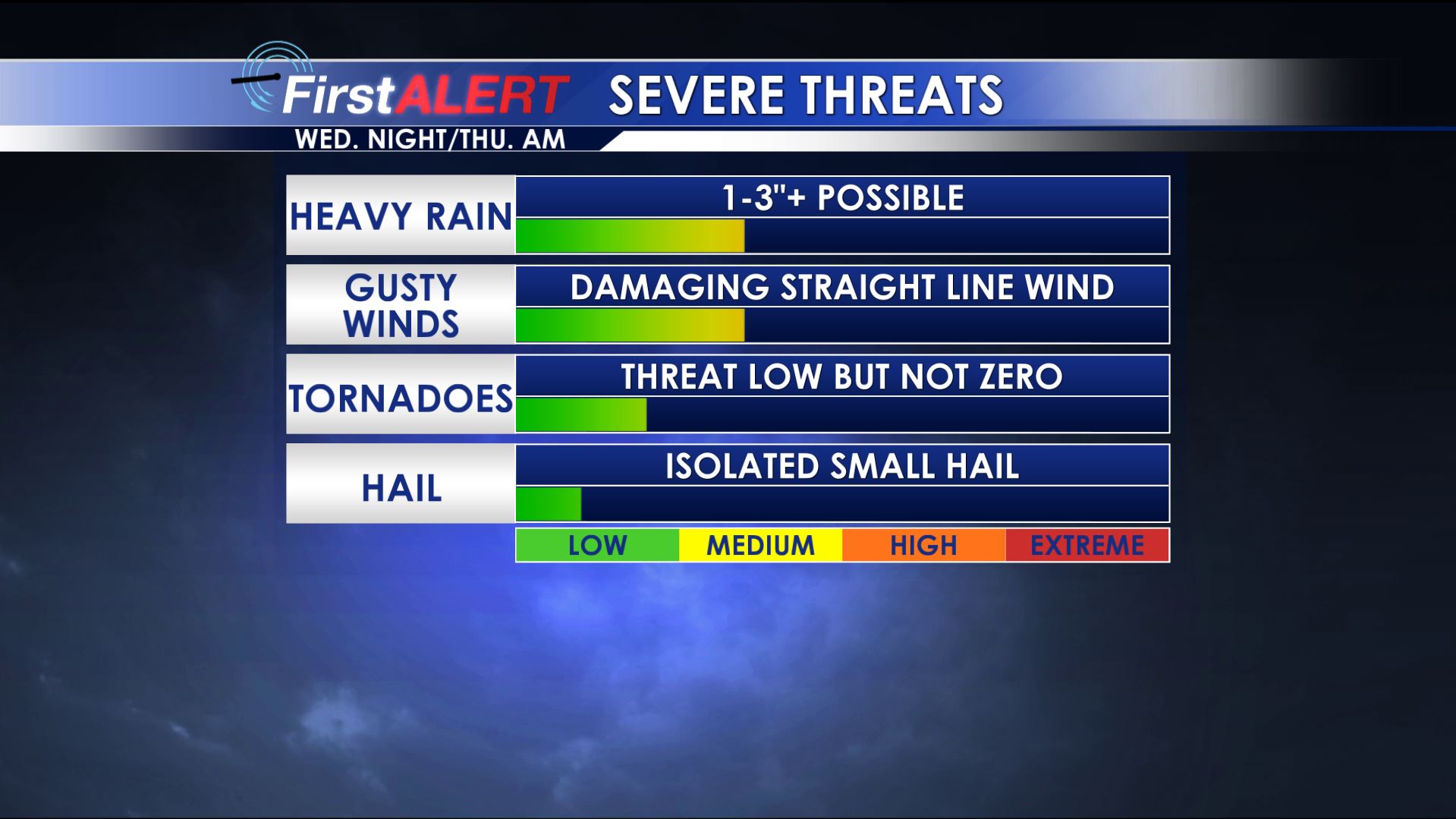
Severe Threats Wednesday Night
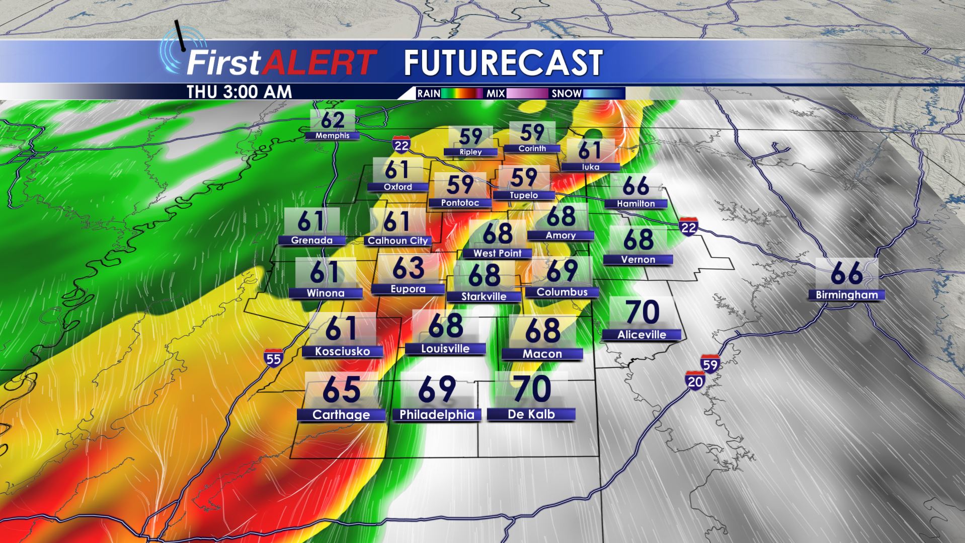
Thursday Morning Future Radar
TUESDAY NIGHT: Mainly clear conditions will hold for most of the night but some clouds may trickle in by sunrise. Lows will a few degrees either side of 60. Southerly winds hold on around 5 mph.
HALLOWEEN: Expect warm and breezy conditions under variably cloudy skies. While passing showers are possible during the day and early evening the vast majority of locations will remain rain free. Look for highs in the upper 70s to around 80. Southerly winds increase between 10 and 15 mph with some higher gusts.
WEDNESDAY EVENING/NIGHT: Trick-or-treaters should generally be OK with early evening temperatures in the 70s and just a small chance for a passing shower or storm. A bigger line of storms is more likely late in the evening and into Thursday morning. That line of storms has the potential to produce heavy rain and some damaging wind gusts. An isolated tornado still can’t be ruled out but the threat remains low on the spectrum here. Lows will be in the 60s.
THURSDAY: The heaviest rain and storms are likely during the morning hours with just lingering showers possible during the 2nd half of the day. Highs will be around 70. Total rainfall with this storm system may range from 1-3” or more.
THURSDAY NIGHT: Cooler 40s return under variably cloudy skies.
FRIDAY: The day may start off mostly cloudy but a few peaks of sun should develop. A few showers are also possible during the day but the chance of rain is just 20%. Cool highs in the upper 50s to around 60 are likely and that means even cooler conditions for high school football during the evening.
WEEKEND: We should have a mix of sun and clouds and mainly dry conditions. Look for highs in the 60s Saturday with warmer highs around 70 Sunday.
EARLY NEXT WEEK: Another potent storm system is possible Monday into Tuesday. It’s too early to tell how things will pan out but some heavy rain and more strong storms may affect parts of the region. It’ll be something to watch out for going forward.
Follow @WCBIWEATHER on Facebook, Twitter, Instagram, and Snapchat


Leave a Reply