Warm Monday followed by cooler but nicer weather this week
SUMMARY: This upcoming workweek will be a mostly quiet one overall. There is a chance for some light showers Monday and again late Thursday thanks to a couple of cold fronts that will push through, but we’re not expecting any major rainfall. Temperatures will start off above average before going down to below average by the weekend.
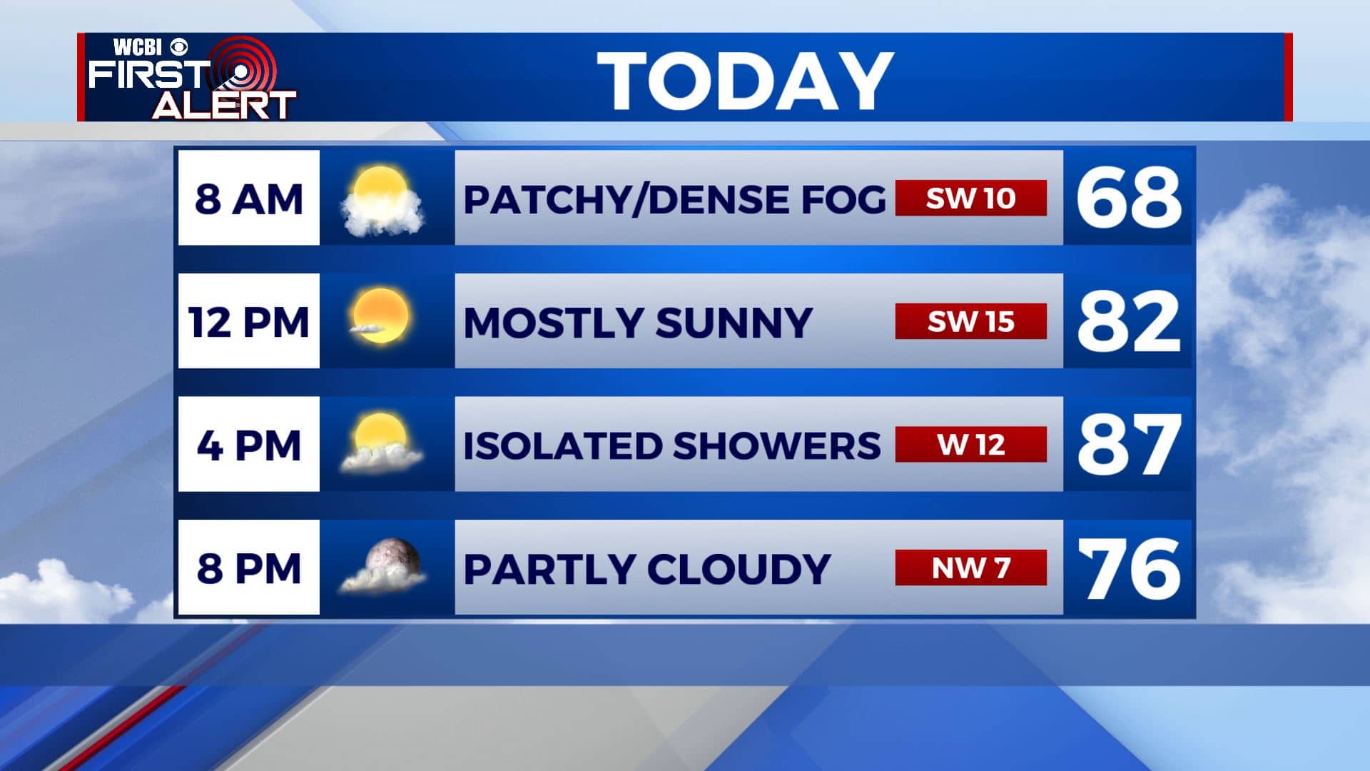
MONDAY: After dealing with some patchy to dense fog this morning, we’ll see an increase in clouds ahead of a cold front that will move through the area Monday afternoon. Maybe an isolated shower or two is possible, but not expecting much. Temperatures will be warmer and above average with highs in the mid to upper 80s. A bit breezy with SW winds 5-15 mph.

MONDAY NIGHT: Partly cloudy skies. Overnight lows cooler in the 50s. Light north winds.
TUESDAY: More sunshine returns for our Tuesday. A bit cooler but nice for mid-October with highs in the upper 70s. N winds 5-10 mph.
WEDNESDAY-THURSDAY: Temperatures will remain near average for the middle part of the workweek with lots of sunshine. Highs will be in the lower 80s with morning lows in the 50s. A shower or two is possible late in the day Thursday as our second cold front pushes through, but rain won’t be widespread.
FRIDAY-SUNDAY: The second cold front will clear the area by Friday morning, dropping temperatures significantly for Friday. Afternoon highs will only be in the 60s for Friday and Saturday with morning lows in the low 40s, maybe upper 30s across the area. This means some patchy frost is possible early Saturday morning. Temperatures will climb back into the 70s for Sunday, but the morning hours will still be chilly. We’ll have a mix of sun & clouds through the weekend.
Stay connected with @WCBIWEATHER on Facebook, Twitter, Instagram, and the WCBI News App


Leave a Reply