Warm and sunny for now, rain chances eventually return
After a short taste of fall-like weather, the warmer air and humidity will be returning over the next several days. We’ll remain mostly sunny through Thursday, but clouds and rain chances will increase Thursday night and Friday.
MONDAY NIGHT: Aside from a few clouds, skies will remain mostly clear tonight with lows near 60. Winds will be light out of the southeast.
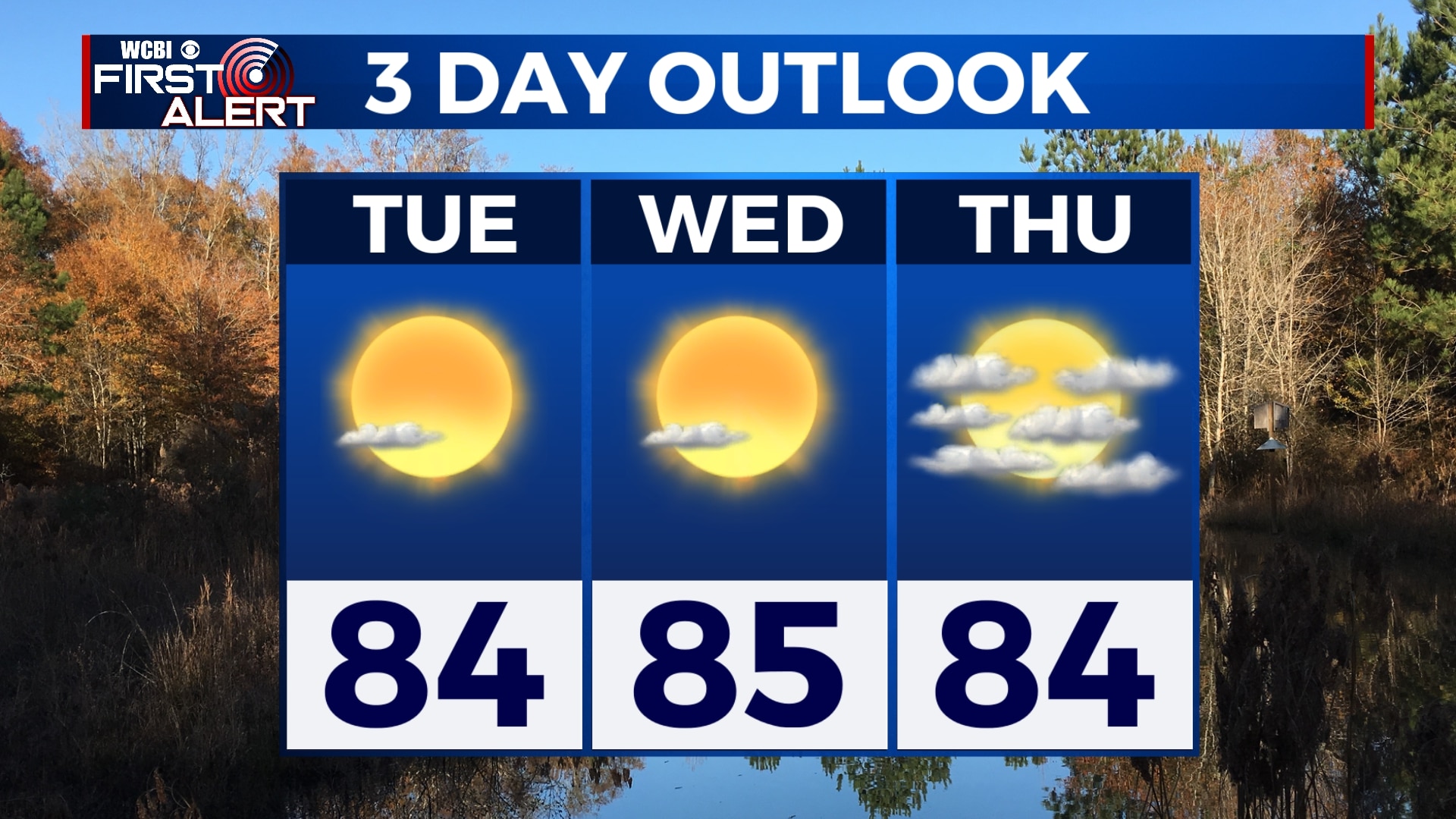
TUESDAY-THURSDAY: We’ll remain mostly sunny and warm through the middle of the week, but a few clouds will start to build in by the end of the week. Rain chances will remain low for now, but an isolated sprinkle or two is possible on Thursday. Highs will be in the mid 80s with increasing humidity. Morning lows will be in the low 60s.
FRIDAY: Showers and perhaps a few rumbles of thunder will be possible on Friday, but some sun could peek out through the day. We’re not looking for an all-day rain, but off-and-on showers are possible. Highs will be near 80.
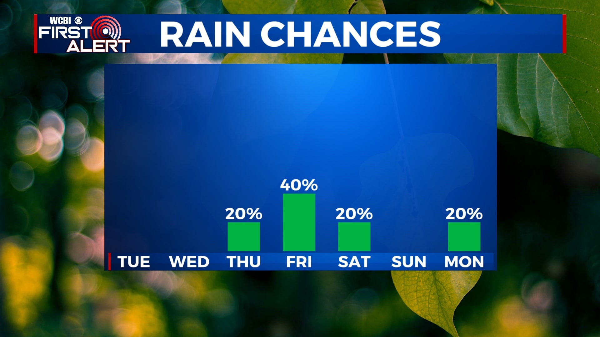
SATURDAY-SUNDAY: We’re expecting a cold front to move through Friday night that will help to clear much of the rain out before the weekend. However, an isolated shower can’t be ruled out, especially on Saturday. Generally, the weekend will be pretty nice with just a few clouds and highs in the 70s. Morning lows will be back into the 50s.
NEXT WEEK: Looking beyond the 7 day forecast, early indications are that another cold front will approach the area by the middle of next week and bring us the chance for rain and possibly a few storms. After that, it looks like we could be in for another cool down.
Follow WCBI Weather on Facebook, Twitter, and Instagram


Leave a Reply