Warm Wednesday, Stormy Thursday
TUESDAY NIGHT: Mainly clear and calm. Lows around 60 with light wind.
WEDNESDAY: Another warm and summer-like day is on the way. Look for highs in the mid to upper 80s with winds from the SSE between 5 and 15 mph. While most of the day will be dry there is a chance that a batch of storms and rain may move in from the west late in the afternoon and evening. For this we’re keeping a 30% chance of rain going.
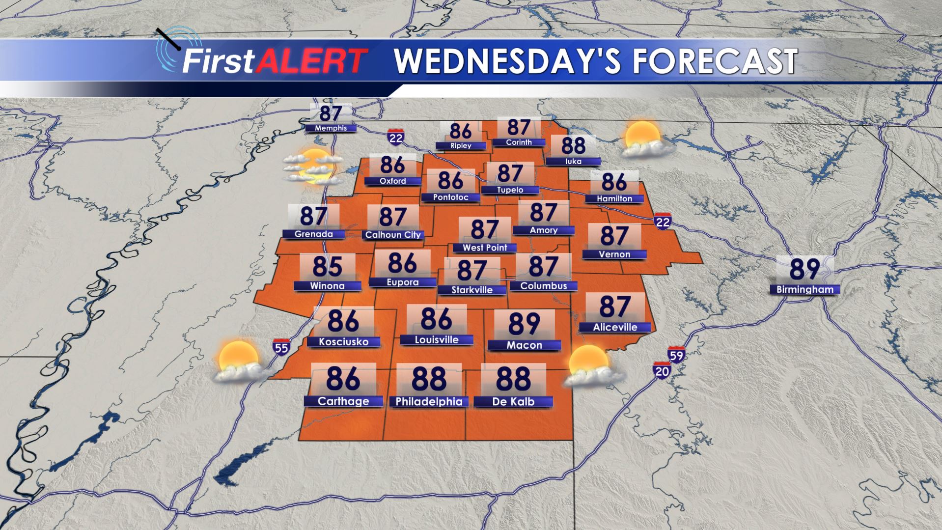
Wednesday’s Forecast
WEDNESDAY NIGHT: A shower or storms is possible but most spots are likely going to remain on the dry side. Mild lows in the mid to upper 60s are likely.
THURSDAY: There is a 90% chance of showers and storms. The latest data suggest a batch of strong to severe storms with damaging wind, hail, lightning, and heavy rain could affect the area anytime between late morning and late afternoon. The setup for tornadoes isn’t that good but you can never rule one out. We’ll try to fine tune things a bit better on Wednesday.
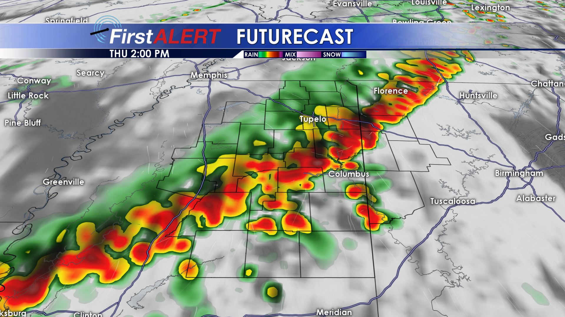
Thursday Afternoon Futurecast
FRIDAY-SUNDAY: More waves of showers and storms are likely around the region. Over time several inches of rain may fall and some additional strong/severe storms can’t be totally ruled out. Temperatures should fall back into the 70s for the weekend due to the increased cloud cover and chance of rain.
MONDAY-TUESDAY: A drier air mass settles back in and that should provide much needed sun and pleasant temperatures in the 70s to around 80°.
Follow @WCBIWEATHER on Facebook, Twitter, and Instagram


Leave a Reply