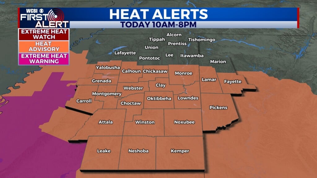
Warmer air this week, watching Wednesday for rain chance
COLUMBUS, Mississippi (WCBI) – After a beautiful weekend, temperatures are bouncing back into the 80s at times this week. Another strong cold front moves through Friday.
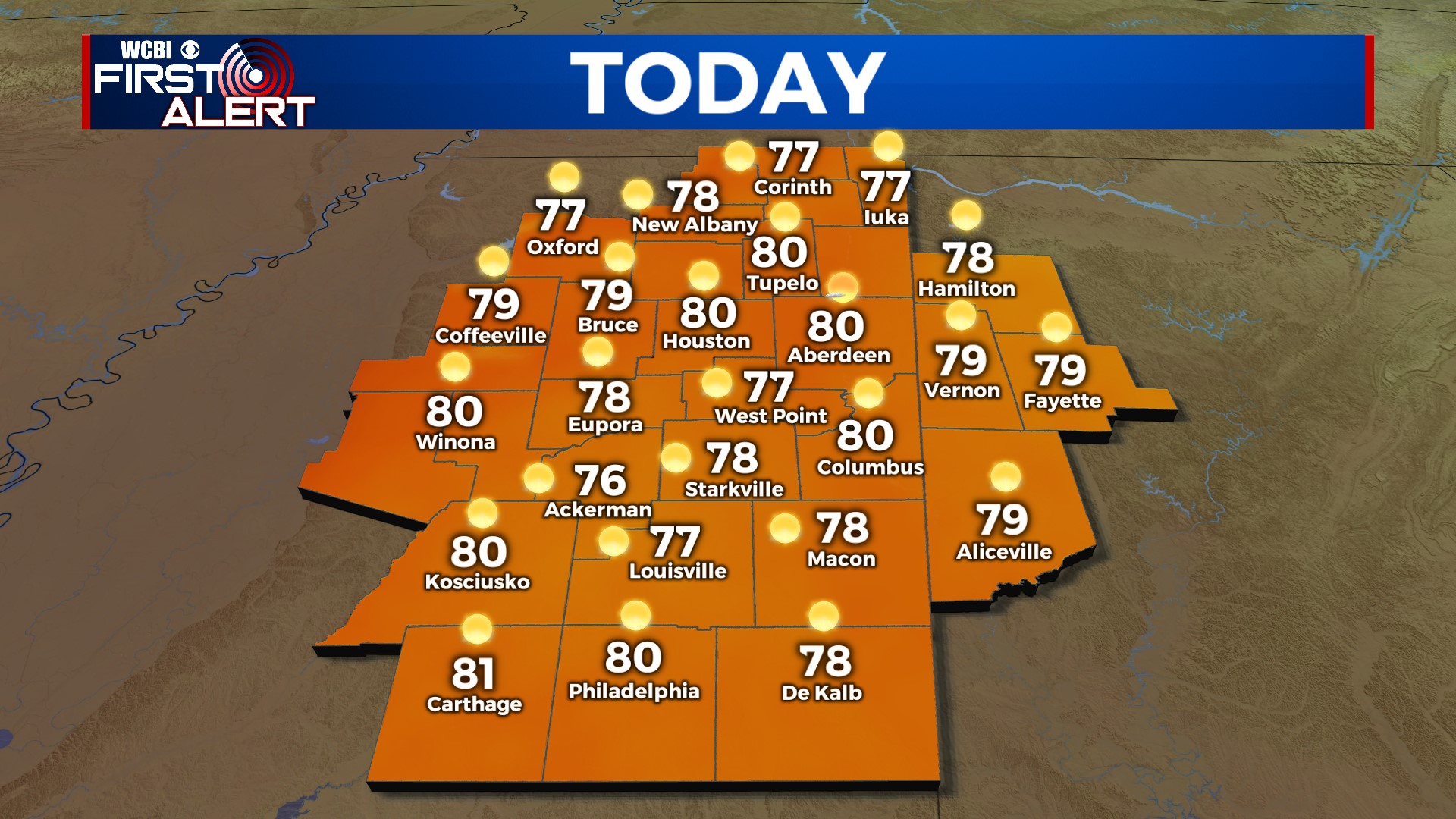
MONDAY: Full sun w/fall perfection! Highs will be near 80° with light southwest winds.
MONDAY NIGHT: Temperatures will still fall into the lower 50s, but it won’t be as chilly as previous nights.
TUESDAY: Clouds slowly increase through the day, becoming overcast late-day into the evening hours. Highs will still make it into lower 80s.
WEDNESDAY: The jury is still out as to exactly how things pan out, but there’s at least some hope for a little rain! An area of low pressure should slide along the Gulf Coast, bringing widespread and heavy rain to those areas. How far north the axis of rain extends is our wild card in the forecast. Right now, we’re hedging the bet most of the heavy rain will stay south/SE of the WCBI coverage area. However, we also expect at least some light rain Wednesday afternoon & evening. Stay tuned for updates!
THU/FRI: We’ll stay in the 70s Thursday, but low 80s are likely again Friday as the next front moves through. Moisture looks quite limited with this front, so not much rain is expected. Like last Friday, we’ll see a notable drop in temperature late, and we’ll likely wake up to upper 40s Saturday AM.