Warmer with sprinkles Monday, another cool down on the way
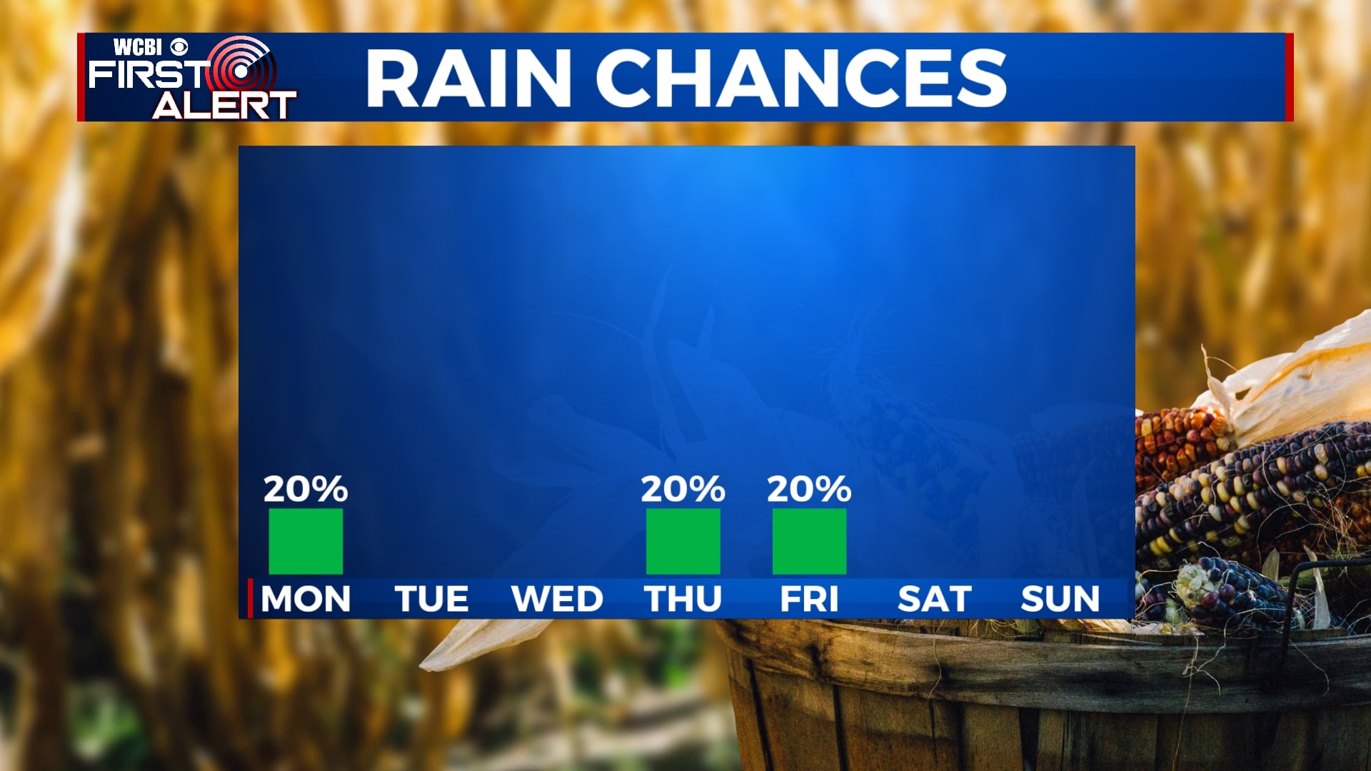
As the remnants of Hurricane Delta continue to move out of the area, most of us will remain dry for the next several days. There is a chance for some light showers Monday and again late Thursday, but we’re not expecting any major rainfall. Temperatures will start off above average before decreasing dramatically by the end of the week.
SUNDAY NIGHT: Mostly cloudy tonight with isolated sprinkles before midnight. Patchy to dense fog will develop after 2 am, reducing visibility to under half a mile in many locations. Lows will be in the low to mid 60s.
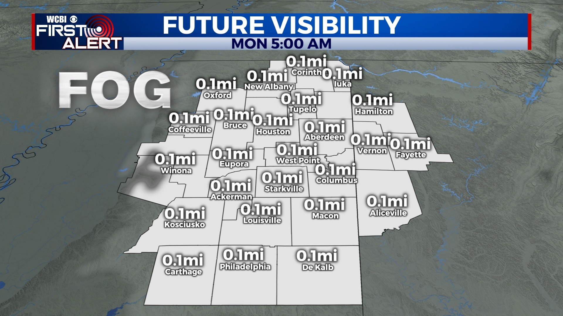
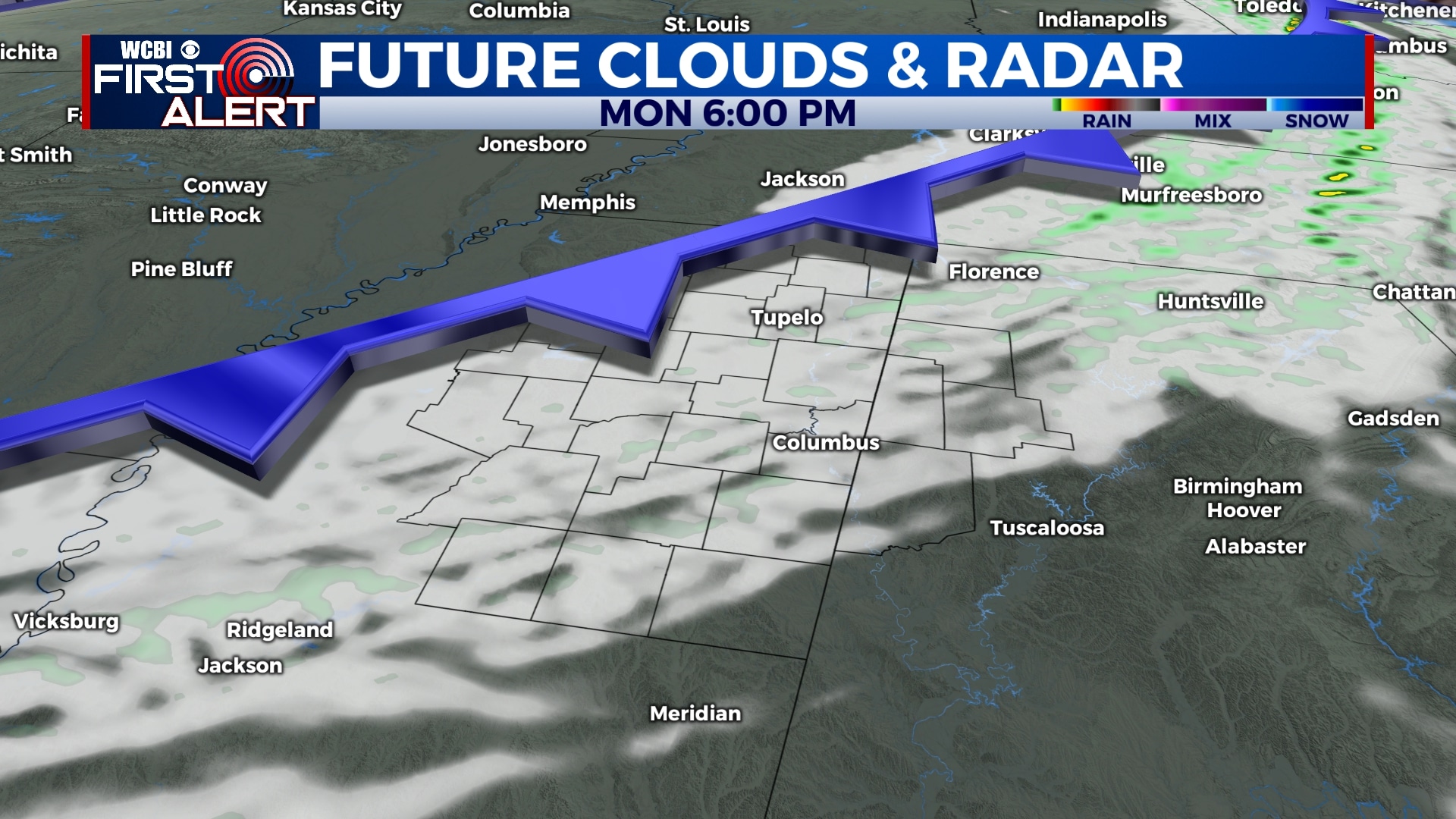
MONDAY: Monday will start off with fog in many spots, clearing up a bit by 9 am. We’ll range from mostly sunny to partly cloudy, with an increase in clouds as a cold front moves through the area. We could also see a shower or two by Monday evening, but most areas won’t see any rain. Temperatures will be warmer than we’ve been used to with highs in the mid to upper 80s. Some spots could get close to 90.
TUESDAY-THURSDAY: Temperatures will return to near normal for the middle of the week as sunshine returns. Highs will be in the upper 70s to low 80s with morning lows in the 50s. A shower or two is possible late in the day Thursday, but rain won’t be widespread.
FRIDAY-SUNDAY: Another cold front will clear the area late Thursday night, dropping temperatures significantly for Friday. Afternoon highs will be in the 60s for Friday and Saturday with morning lows as low as the low 40s across the area. This means some patchy frost is possible early Saturday morning. Temperatures will climb back into the 70s for Sunday, but the morning hours will still be chilly. Aside from some showers early Friday, skies will remain partly cloudy through the weekend.
Follow WCBI Weather on Facebook, Twitter, and Instagram


Leave a Reply