Warmer temperatures & humid air are on the way
SUMMARY: It’s once again a cool start to our day with temperatures in the upper 40s to lower 50s this Tuesday morning. A warming trend begins today as our winds start switching up to the SE, pumping in the warm & humid air from the Gulf of Mexico. Rain chances will slowly creep back into the forecast, but not looking to be a washout.
TUESDAY: Cool and dry with a few clouds this morning. Temperatures the mid 40s. A mix of clouds & sun in the afternoon. Humidity stays low as comfortable with highs in the mid 70s. Winds SE 5-10 mph.
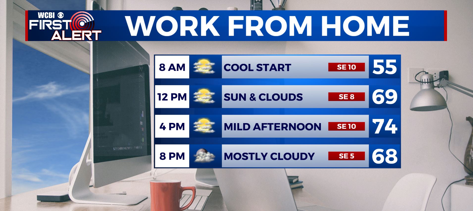
TUESDAY NIGHT: Mostly cloudy skies. Maybe a stray shower by sunrise. Lows in the mid 50s.
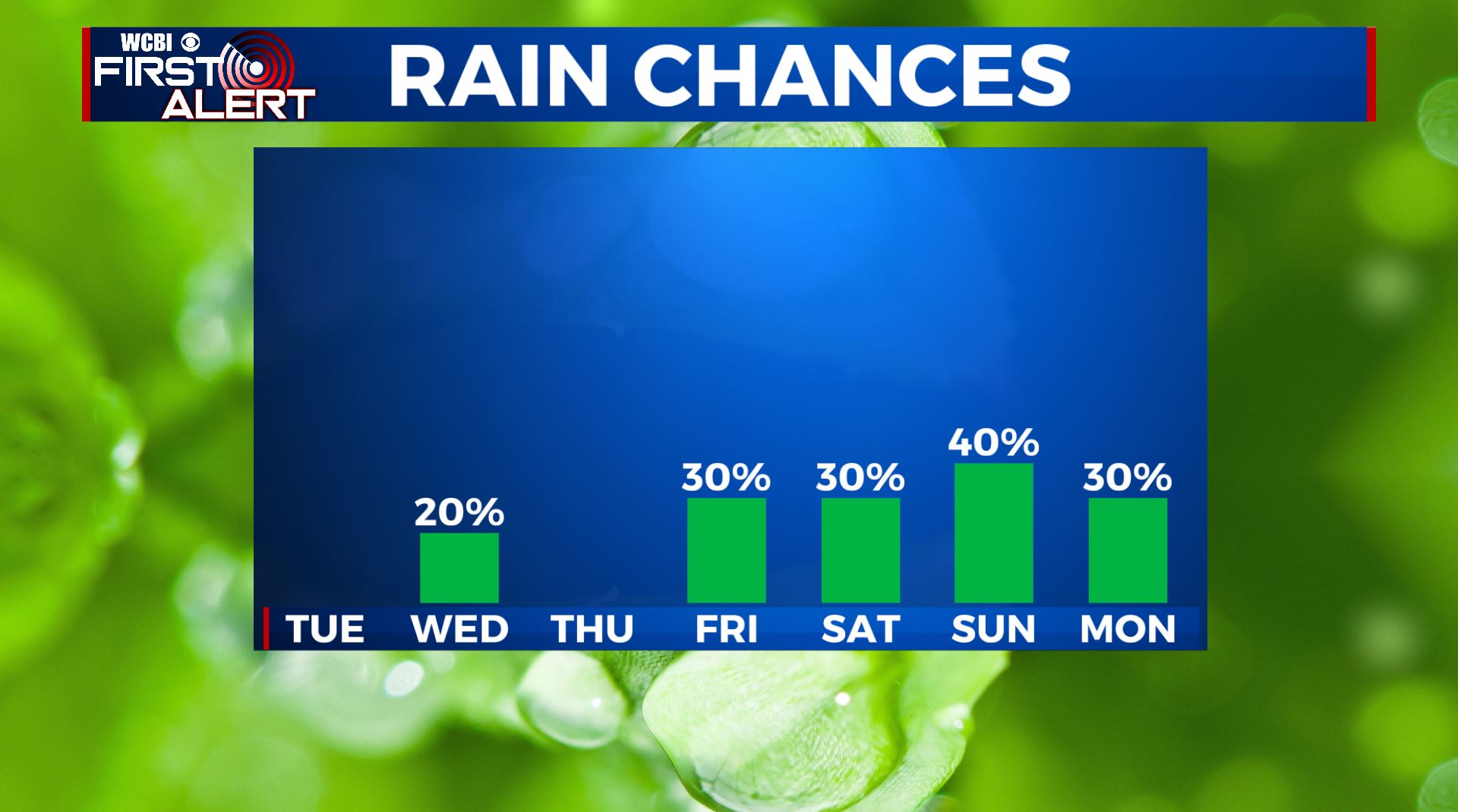
WEDNESDAY: Partly sunny with a slight chance of showers, especially in out northern counties as a disturbance pushes through in the morning. Temperatures continue to warm back up into the lower 80s for highs. Winds SE 5-10 mph.
WEDNESDAY NIGHT: Partly cloudy. Lows in the upper 50s to lower 60s.
THURSDAY: Partly cloudy with a chance of a stray shower or storm. Warmer highs in the mid 80s.
THURSDAY NIGHT: Partly cloudy. Lows in the lower 60s.
FRIDAY: Partly sunny. Scattered chances of showers and storms. Highs in the mid 80s.
WEEKEND: Partly sunny, warm & humid… simply more summer like. Highs in the mid to upper 80s and overnight lows in the mid 60s. It doesn’t look like a washout on either day but rain and storm chances remain both Saturday & Sunday.

Stay connected with @WCBIWEATHER on Facebook, Twitter, Instagram, and the WCBI News App


Leave a Reply