Warmer weather is here, severe storms possible Friday PM
COLUMBUS, Mississippi (WCBI) – Spring-like warmth has returned, and with it comes the chance of severe weather Friday afternoon and evening.
WEDNESDAY: Showers in the morning dissipate/move out by midday, leaving a dry and warm afternoon with highs in the 70s across the area.

THURSDAY: With more sunshine and no rain, expect highs to soar into the middle 80s by afternoon. A south breeze will certainly make it feel just like spring!
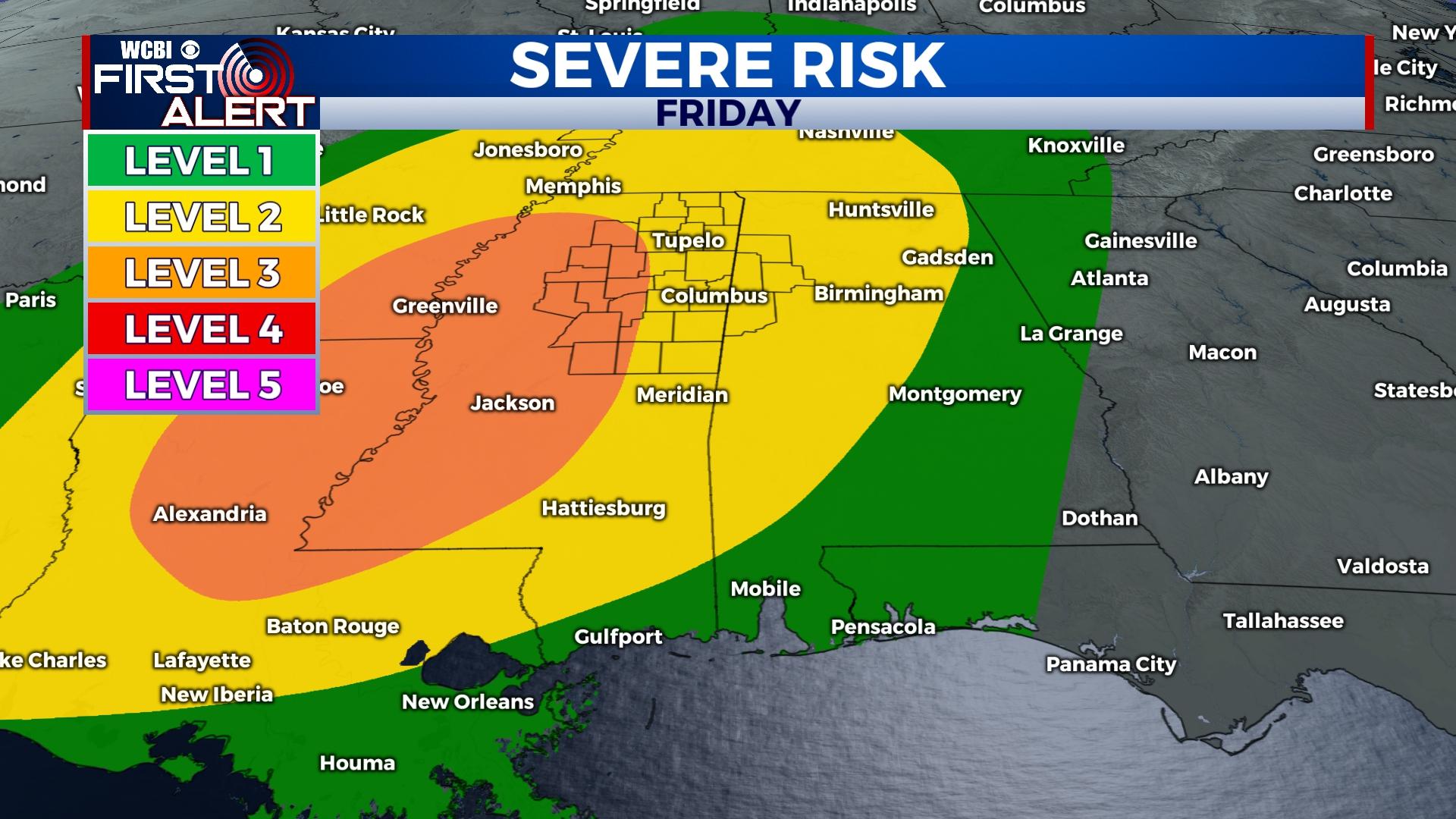
FRIDAY: A good portion of the day will be dry, warm, and increasingly humid. Highs will top out in the 80s ahead of a strong cold Pacific front. That front is set to bring showers and storms to the region late in the afternoon into the evening hours. Storms will be capable of producing all severe hazards, including tornadoes. The rough timeline continues to look like 3 PM to midnight from west to east. Stay tuned for further updates to the forecast, but definitely be weather aware and close to a reliable source of weather information!
WEEKEND: Saturday still looks quite nice with plenty of sunshine and highs in the upper 70s. The quiet weather doesn’t last – showers and storms return to the forecast Sunday evening ahead of an advancing warm front from the south.There are no major concerns for severe weather at this point, though this could change…stay tuned!
NEXT WEEK: Storms could persist into early Monday, but most will dry out by Monday afternoon. Temperatures steadily back off into the 60s by next Tuesday as dry weather prevails.


