Warmer Weather Sticks Around, Humidity Increases Midweek Followed by a Few Chances for Showers
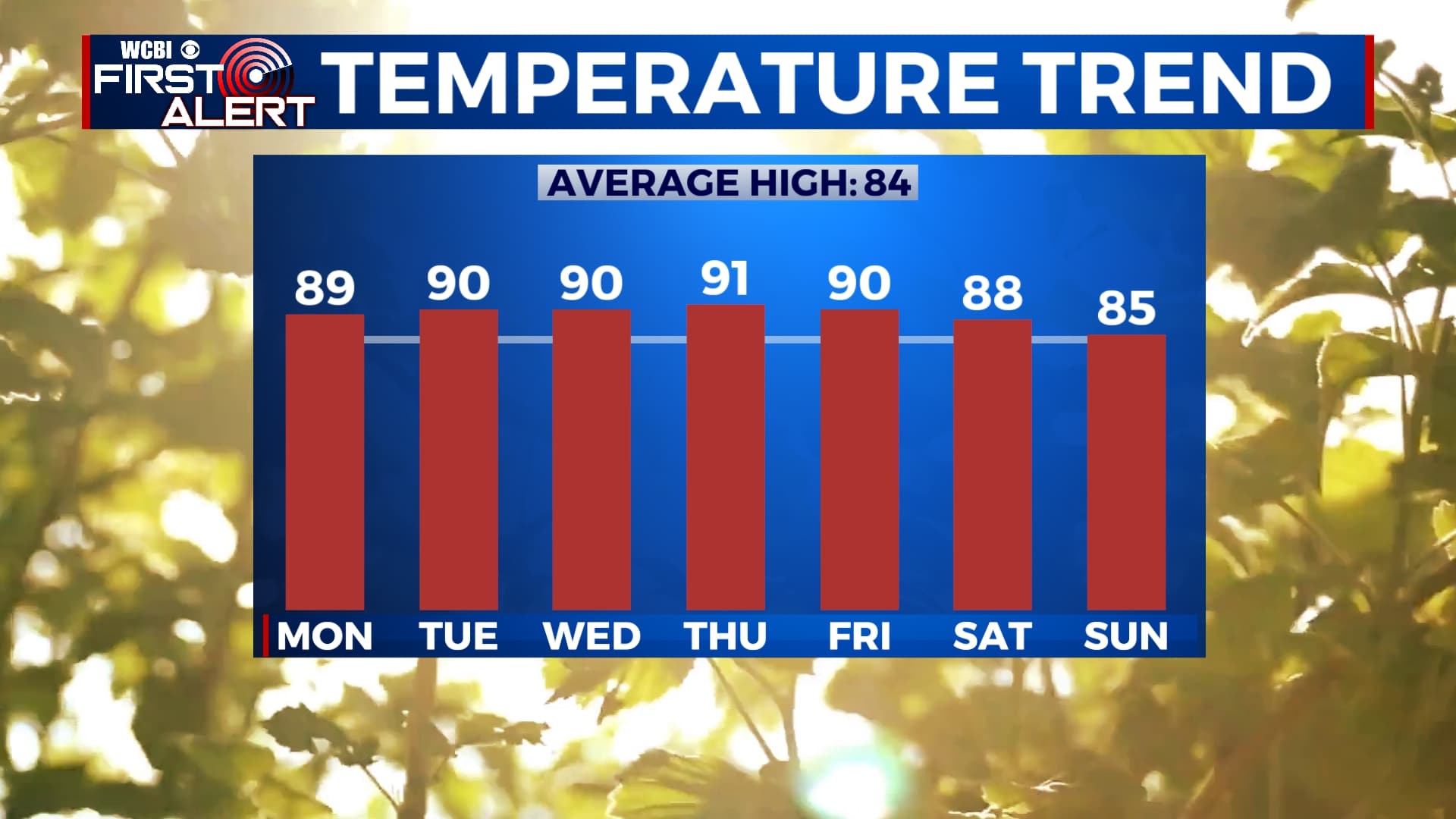
SUMMARY: Temperatures this week will continue to rise into the upper 80s and lower 90s. Some partly cloudy skies the first half of the workweek will make way for some slight chances for an isolated shower or thunderstorm Wednesday through Sunday. Southerly flow will allow moisture to increase across the area midweek into the weekend.
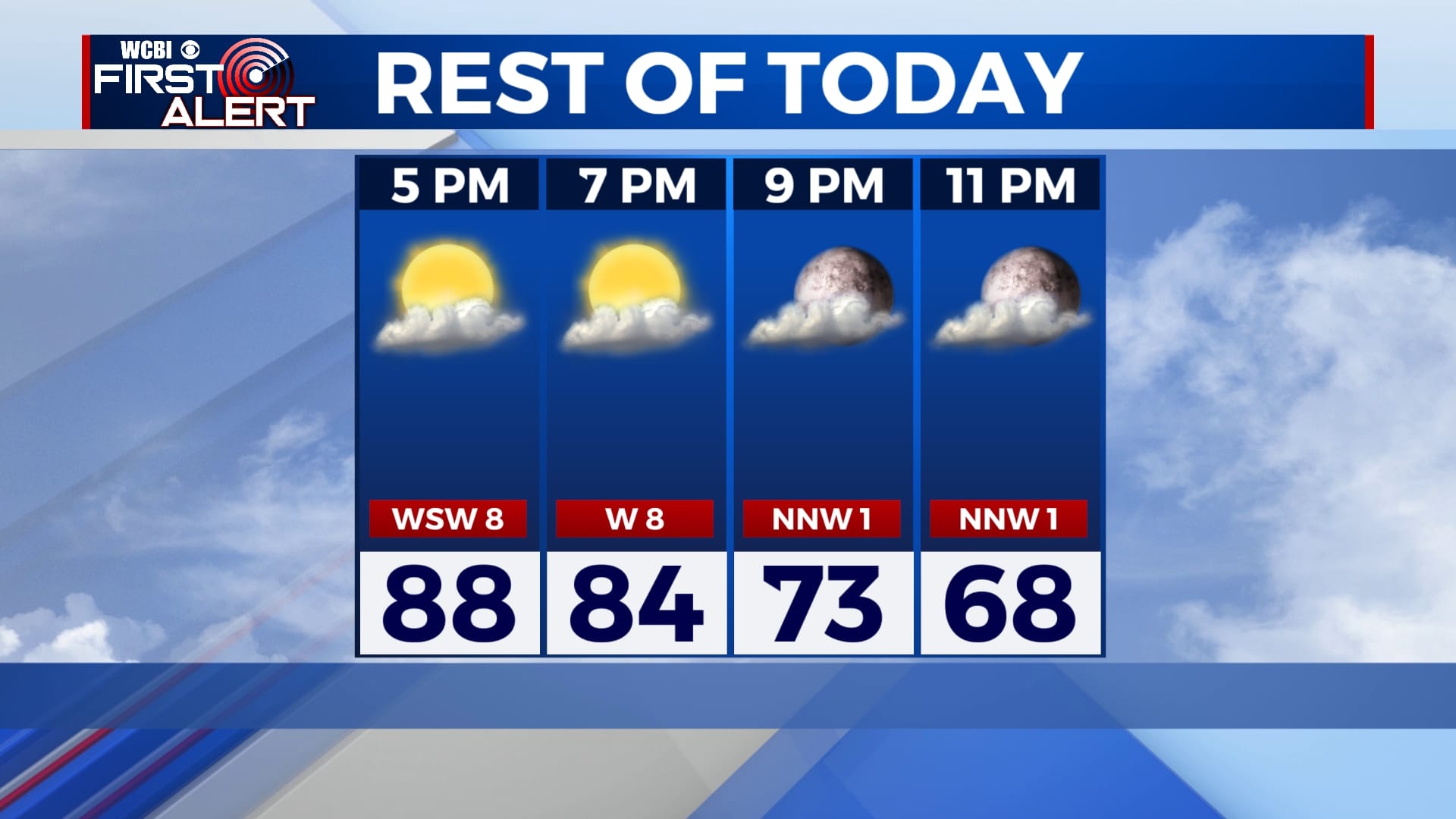
TONIGHT: Remaining dry with lows in the lower 60s. Slight humidity and light winds in the region will support a small chance for some patchy fog in our southern counties until early tomorrow morning. Winds tonight will be light out of the NNW around 3 MPH.
MONDAY: Some patchy fog may be the case in our southern counties for the early morning hours but once the sun rises and begins to warm the surrounding atmosphere, any fog leftover will dissipate immediately. Partly cloudy skies expected with temperatures in the upper 80s and lower 90s. Overnight lows in the mid-60s.

TUESDAY: Another warm day in the lower 90s with a mix of sun and clouds. Breezy at times with winds out of the SSW around 5-10 MPH. Overnight lows will be in the 60s.
WEDNESDAY: Partly cloudy skies in the morning with a bit humid conditions. The chance for an isolated storm or two is possible in the late afternoon and early evening. Highs will remain in the low 90s with overnight lows in 60s.
THURSDAY: We’ll see partly cloudy skies with the exception of a spot shower in the afternoon. Highs in the low 90s and overnight lows in the 60s.
FRIDAY-SUNDAY: On-and-off chances for an isolated shower can be expected for most of the weekend. Temperatures look to cool off into Saturday with persistent cloud cover over the area. Highs linger in the mid-to-upper 80s and low 90s.


Leave a Reply