Warming trend continues ahead of Thursday’s severe threat
COLUMBUS, Mississippi (WCBI) – SUMMARY: Afternoon highs were in the low-60s this afternoon. A Red Flag Warning goes into effect tomorrow due to low humidity and gusty winds which can promote rapid fire growth; therefore, outdoor burning is discouraged.

TONIGHT: Mostly clear with lows in the mid-30s. South wind around 5 mph.
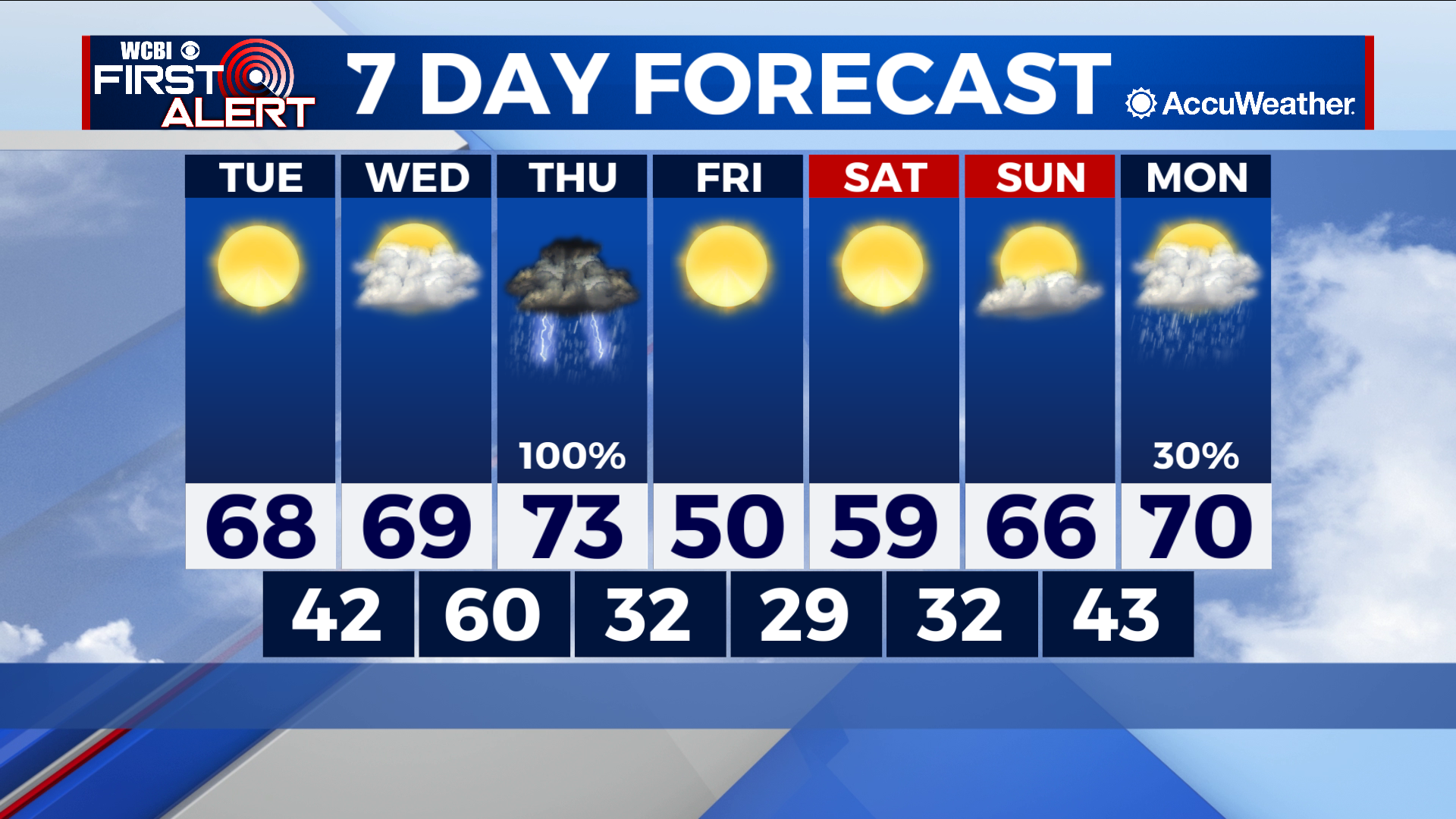
TUESDAY: Sunny and warmer with highs in the upper-60s. South winds 5-10 mph with gusts up to 20 mph.
TUESDAY NIGHT: Mostly clear with lows in the mid-40s. South wind around 5 mph.

EXTENDED FORECAST: Showers and thunderstorms are likely Thursday as a strong storm system makes its approach to the region. Some storms may be strong to severe with damaging winds and an isolated tornado or two across the region. Stay tuned for additional updates. Once this system moves through the area, we will clear out and cool down rather quickly. Friday will be mostly sunny with highs in the 40s once again.


Leave a Reply