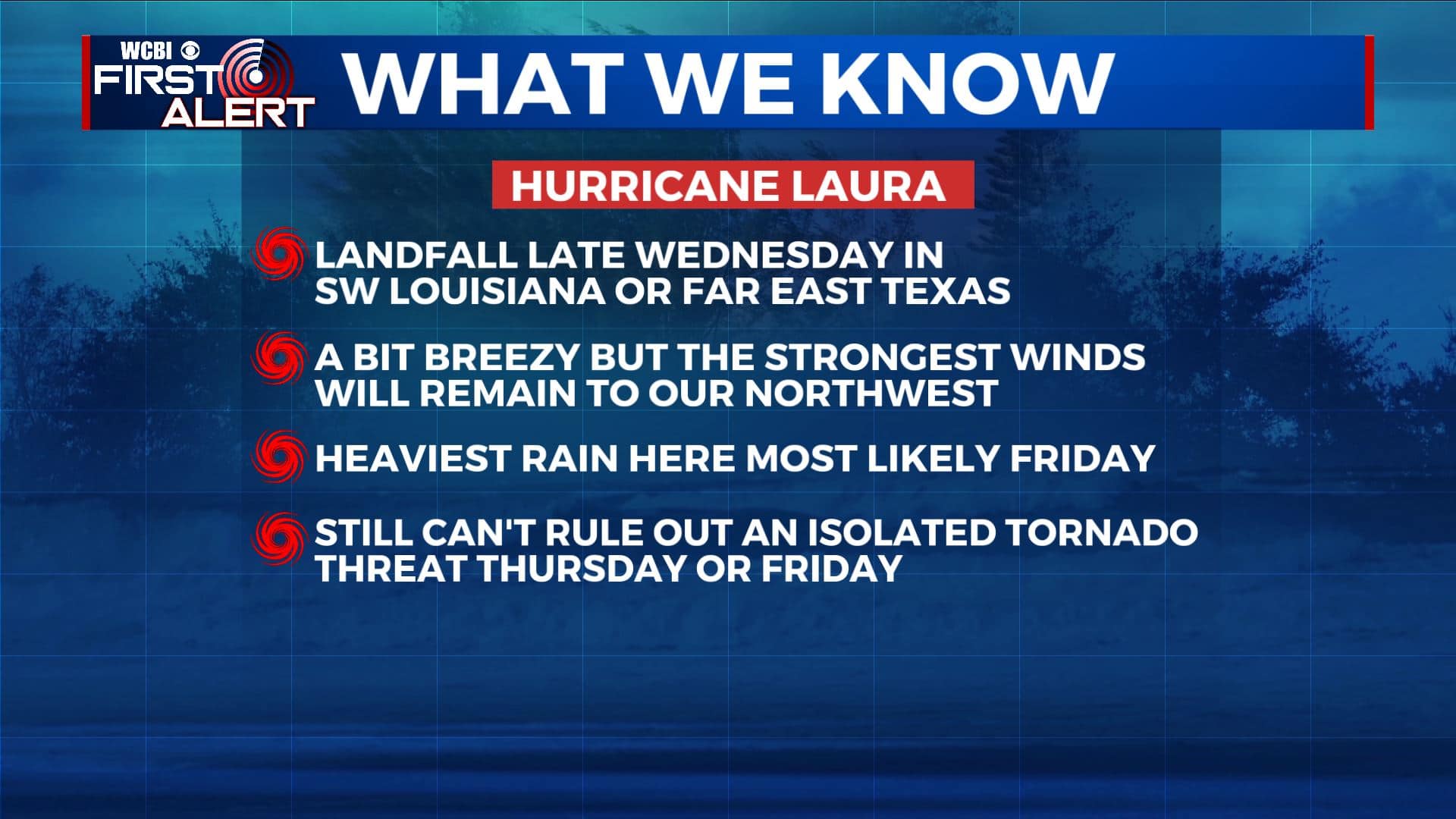
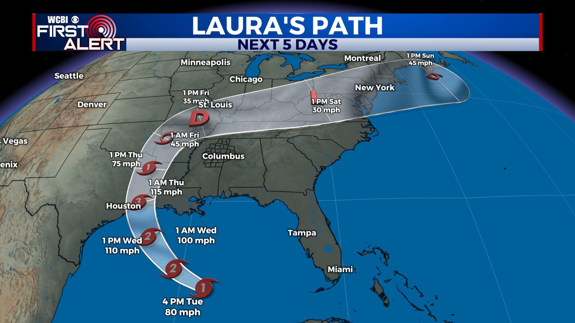
Watching Hurricane Laura
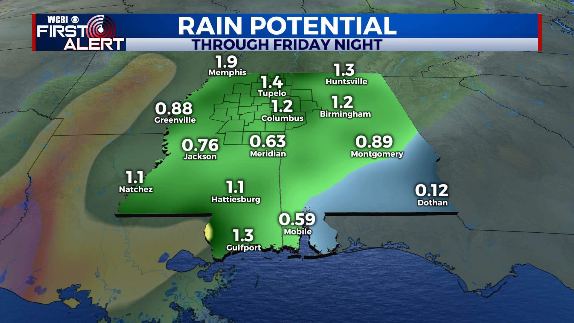
SUMMARY: Hurricane Laura may still give our area some issues Thursday into Friday in the form of some locally heavy rain and perhaps a small risk for an isolated tornado. Outside of Laura the next week will be warm and humid with daily chances of rain and storms.
Forecast as of 4 p.m. Tuesday 8/25
TUESDAY NIGHT: Scattered evening showers with more in the way of isolated activity overnight. Lows in the mid 70s. Winds ESE 5-10 mph.
WEDNESDAY: Mostly cloudy to start with an isolated shower possible. Look for more sun to develop as the day wears on but that could spark a few more spotty showers and storms. Highs in the lower 90s with heat indices in the low 100s. Winds SE 5-15 mph.
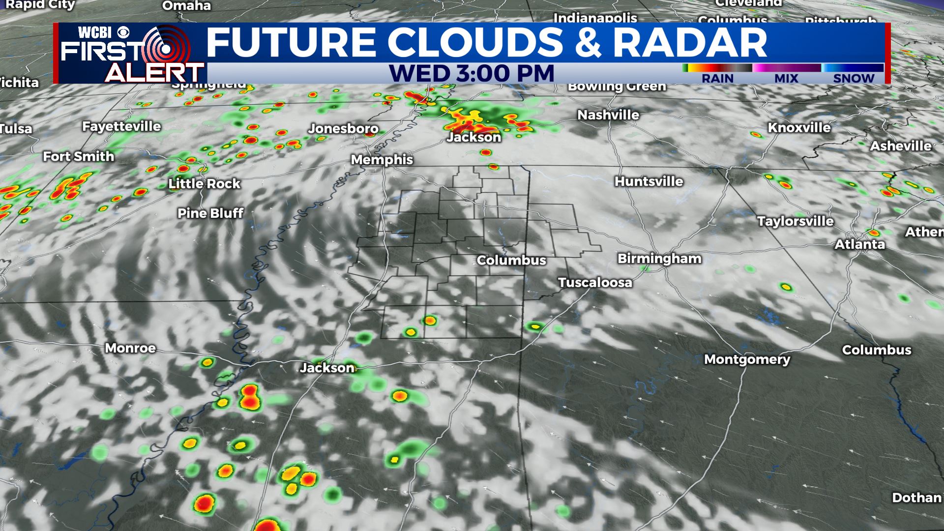
WEDNESDAY NIGHT: Variably cloudy, warm, and muggy. Lows in the mid 70s.
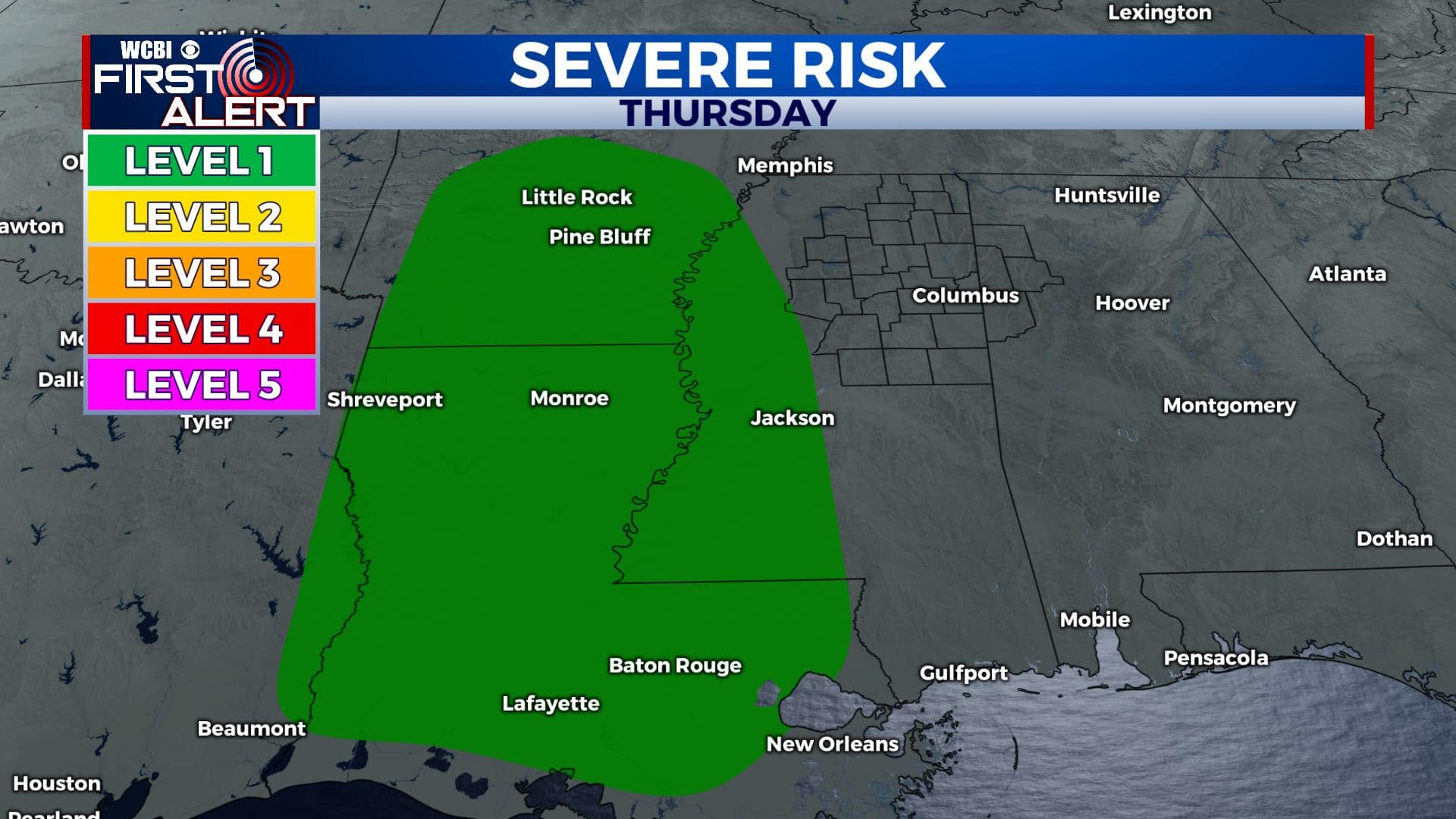
THURSDAY: Sun & clouds with a 40% chance of passing showers and storms. Highs around 90 with heat indices near 100°. Winds SE 10-20 mph. The highest odds of severe storms look to stay west of I-55 but any shower will have to be watched since there will be some extra wind in the atmosphere due to Laura.
FRIDAY: Areas of rain and storms. Some locally heavy rainfall and strong storms are possible depending on how the atmosphere sets up. Highs in the mid to upper 80s.
WEEKEND: Scattered rain and storms are possible both Saturday and Sunday. Look for highs in the mid to upper 80s with overnight lows in the 70s.
Follow @WCBIWEATHER on Facebook, Twitter, Instagram, and the WCBI News App


Leave a Reply