Wednesday cold front exacerbates nippy week.
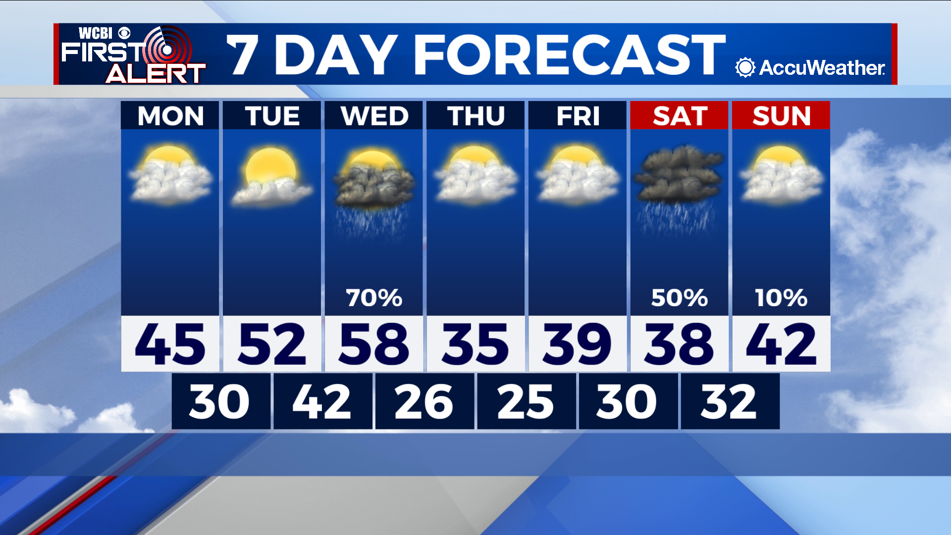
COLUMBUS – SUMMARY: A cold front Wednesday brings the next big rain chance to the area along with sub-freezing temperatures. Heavy cloud cover forms a mainstay of this week’s weather, although rain chances remain isolated to Wednesday and Saturday.
MONDAY: While just as cold as it has been over the past several weeks, Monday will provide a marked improvement in conditions compared to a rainy and snowy weekend. Highs touch the mid to high 40s but the biggest positive Monday is the lack of a rain chance. A high pressure system is set to move into the area Monday which will clear the skies just a tad and allow for some warming over the next day or so. Lows bottom out below freezing.
TUESDAY: Highs make further advances Tuesday as temperatures rise into the low 50s. Skies should clear up somewhat which will help with the temperature increase, and also bring the most sunshine that we may see all week. The day is once again dry and lows improve into the low 40s overnight.
REST OF THE WEEK: The only two rain chances of the week will be found on Wednesday with a cold front, and on Saturday. Wednesday’s cold front does not bring any winter precipitation threat but some healthy rain totals are a possibility. In addition to the rain, however, Wednesday’s front also brings frigid air into the area as lows plummet into the mid to high 20s through Friday night. The strong levels of cloud cover throughout the week will not help the situation, and highs will struggle to break out of the 30s once the front passes.