Wednesday evening rain and storms, then more bitter cold
COLUMBUS, Mississippi (WCBI) – An Arctic front brings rain and storms Wednesday evening followed by more major cold to end the week.
WEDNESDAY: Clouds thicken today as southerly breezes continue – expect highs to reach the mid 60s by afternoon. A few showers are possible through the day, but the bulk of the rain holds off until near/after sunset.
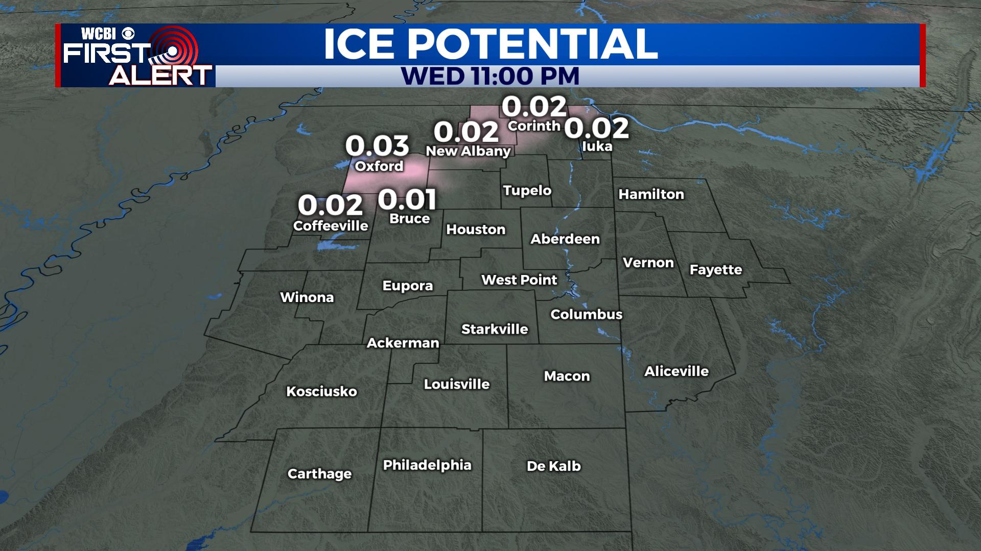
WEDNESDAY NIGHT: Showers and storms are likely, but the severe threat will lessen with eastward extent. The best chance at stronger activity will be near I-55; there, some storms could contain gusty winds or hail. Total rain amounts will range from a quarter inch up to an inch. Following the front’s passage, temperatures will crash into the upper 20s toward daybreak Thursday. While the opportunity for any freezing rain looks much lower, sub-freezing temperatures could still create a few slick spots on bridges and overpasses. Finally, gusty northerly winds will create wind chills in the 10s and 20s.
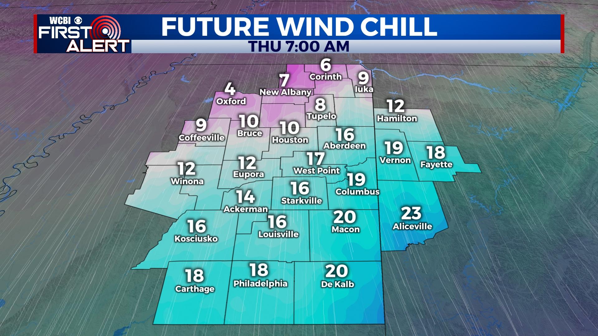
THURSDAY: Clouds hang on much of the day, and with strong northerly winds persisting, wind chills will easily stay in the 20s to near 30 all day. Actual air temperatures may only reach the mid to upper 30s.
FRIDAY: The sky stays mostly cloudy with cold air remaining in place. Expect lows in the 20s and highs to hold in the upper 30s. There remains a small chance of a few flurries Friday night, but our region remains in an unfavorable position to see anything significant at this point.
WEEKEND: The sunshine returns, finally! Mornings will be quite cold in the lower to middle 20s each day, but daytime highs will be back in the 50s Sunday.
NEXT WEEK: Clouds thicken up again by Tuesday, and rain chances could accordingly increase. Stay tuned for updates.


Leave a Reply