This Weekend Brings Rain, A Few Strong Storms Possible
TONIGHT: Look for a mostly cloudy sky with perhaps a few sprinkles somewhere. Lows fall into the middle 50s with light southeast winds under 5 mph.
FRIDAY: A few sprinkles remain possible at any point during the day. Look for a mostly cloudy sky with mild temperatures back into the middle 60s in the region. Winds remain out of the south and east 3-8 mph. Lows Friday Night fall into the mid to upper 50s under a mostly cloudy sky.
SATURDAY – SUNDAY: It’s possible we might deal with a few scattered showers during the daytime, but we won’t be worried about that. Daytime highs get into the mid to upper 60s with a few spots in the low 70s. Winds pick up out of the south and east 10-20 mph with higher gusts possible.
Heading into Saturday Night, there is the chance for a line of gusty showers/storms to push in from the west. While overall the threat is low, we can’t rule out a few strong storms with gusty winds and perhaps some heavy rain at spots. The tornado threat looks to be low as well, but we simply can’t rule it out this time of year. Most spots will not be affected by any strong to severe storms, but that doesn’t mean you shouldn’t be aware just in case.
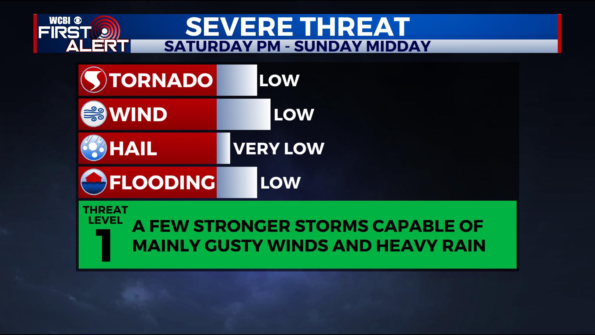
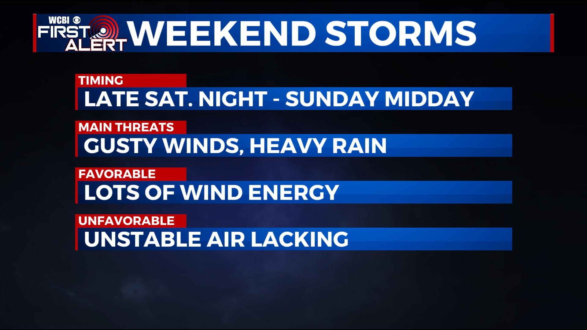 There still remains some uncertainty with the timing of the gusty line of showers and storms. In addition, we could get a narrow window of opportunity for some redevelopment heading into Sunday pending when the cold front pushes through. This could also pose a threat for a few stronger storms before by Sunday evening, the front clears for sure, and we see falling temperatures with north and west winds.
Overall the threat remains low, but we’ll continue to monitor as there will be a lot of wind energy in the atmosphere for storms to tap into, but not a lot of instability/thunderstorm energy at the surface. This is a classic wintertime set-up where while lots of things suggest a very low threat at best, we still have to be vigilant and monitor things moving forth.
MONDAY – TUESDAY: Look for lots of sunshine with highs more seasonal in the low to mid 50s. Lows at night are down into the 30s.
WEDNESDAY – FRIDAY: We’ll watch for another area of low pressure to move in from the south. This could be another heavy rain producer in the area, though timing and impacts still remain uncertain. In general, a storm track like what this one is having would suggest we would be on the cool side, and thus not have to worry about severe weather, but we’ll monitor with changes.
STAY WITH @WCBIWEATHER ON FACEBOOK, INSTAGRAM, TWITTER AND ON THE WCBI MOBILE APP.


Leave a Reply