Weekend Forecast
SUMMARY: Warm and steamy weather will be the norm as we go through the weekend. More storms are possible Saturday and some could be strong with gusty winds and more heavy rainfall. A few more storms could occur Sunday but overall coverage won’t be as high. Drier air looks to build into our area for most of next week but a tropical system could be an issue by next weekend.
FRIDAY NIGHT: Evening storms and showers should generally fade away after sunset but a few could linger. It’ll be warm and muggy with lows in the lower 70s.
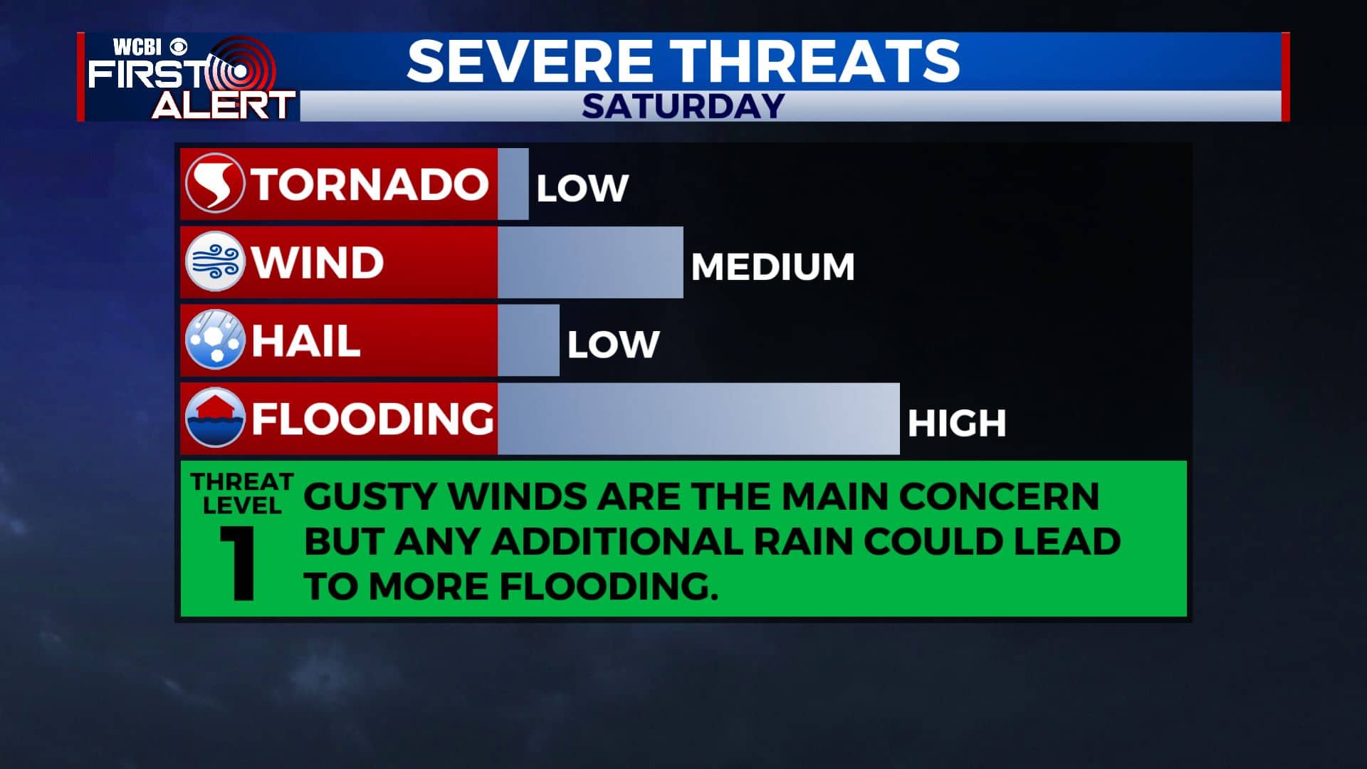
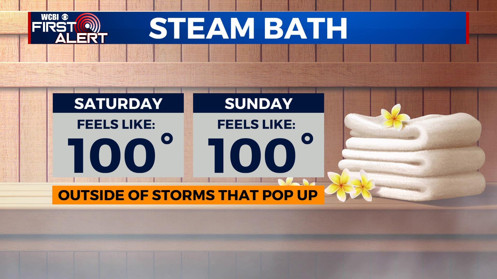
SATURDAY: Highs around 90° with heat indices near 100° outside of any shower or storm that happens to develop. There could be a batch of strong to severe storms sweep through the region with gusty winds and torrential rainfall. It’ll be something we’ll watch during the day.
SATURDAY NIGHT: Partly cloudy and quiet. Lows in the low 70s.
SUNDAY: Staying humid with highs in the lower 90s. Feels like temperatures should hover around 100° once again. Some spotty afternoon storms will remain possible.
MONDAY-THURSDAY: Generally partly cloudy and warm/hot. Highs in the lower 90s to start the week with perhaps some cooler upper 80s and slightly lower humidity by Wednesday & Thursday. Lows in the 60s.
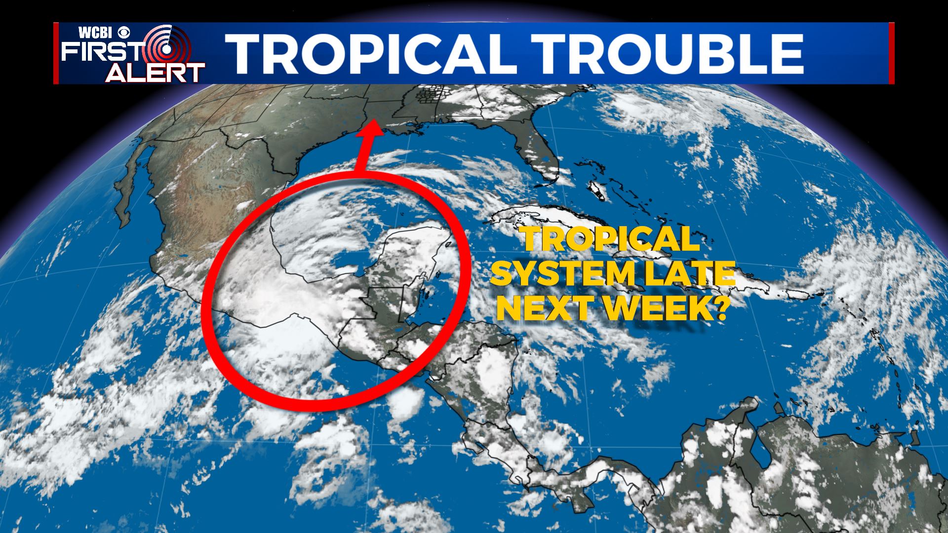
FRIDAY & BEYOND: We’ll be watching a potential tropical system. Some model data suggest something could develop in the Gulf and head to the north. Definitely nothing set in stone but it is for sure an item to watch since it is tropical storm and hurricane season now.
Follow @WCBIWEATHER on Facebook, Twitter, Instagram, and the WCBI News App


Leave a Reply