Some weekend wintry weather, ice storm on Monday
SATURDAY: Cloudy with some light drizzle or freezing drizzle. Highs in the low to possibly mid 30s. Keep watching for black ice and slippery spots, especially on bridge decks and other elevated surfaces.
SATURDAY NIGHT: Cloudy and chilly. Lows in the 20s to low 30s.
SUNDAY: Cloudy with light rain and freezing rain developing. Roads may become slick once again so keep an eye out for black ice. Highs in the low to possibly mid 30s. Winds N 10-15 mph.
SUNDAY NIGHT: Clouds with light rain or freezing rain possible. Lows in the low 30s or upper 20s.
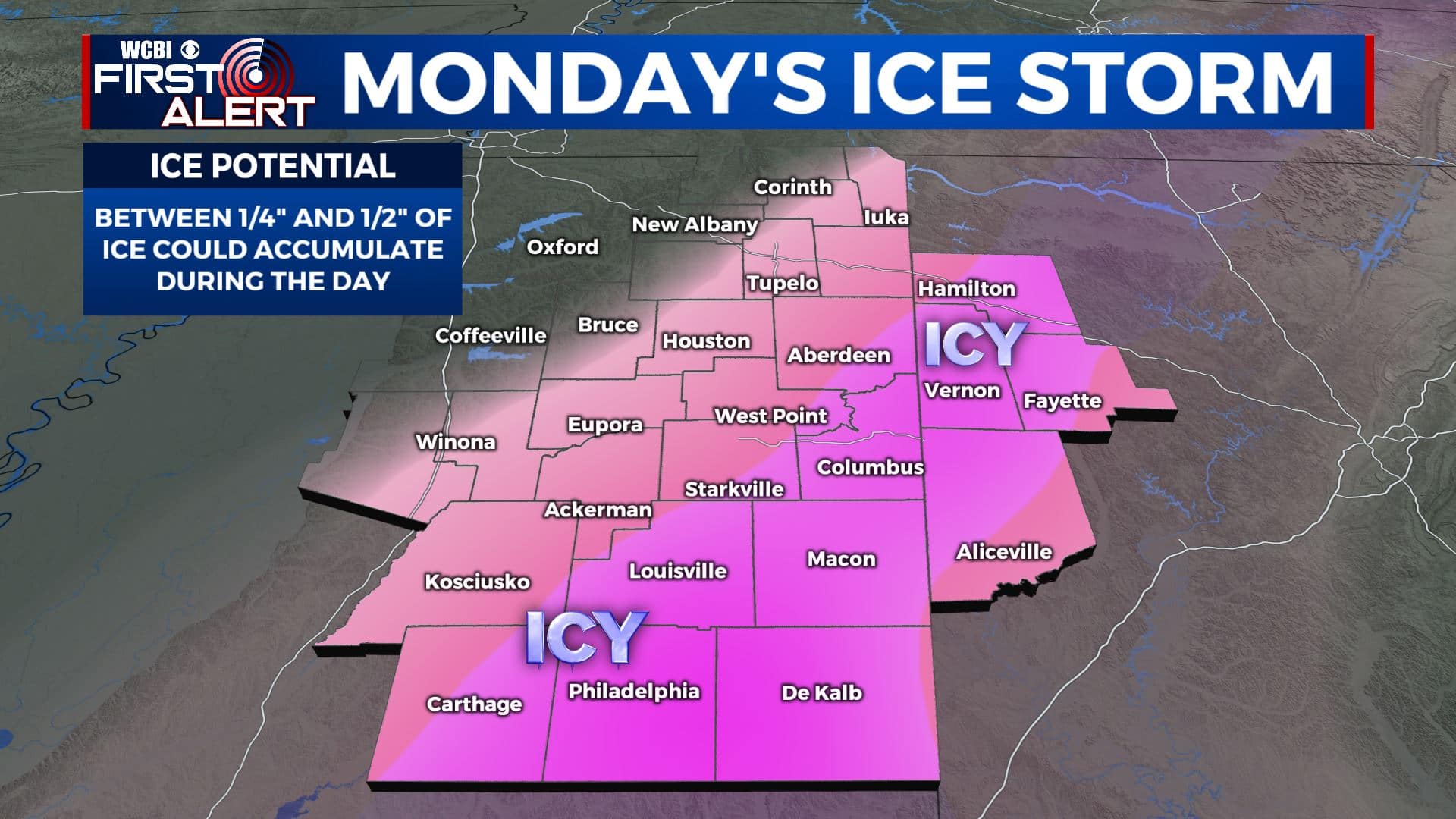
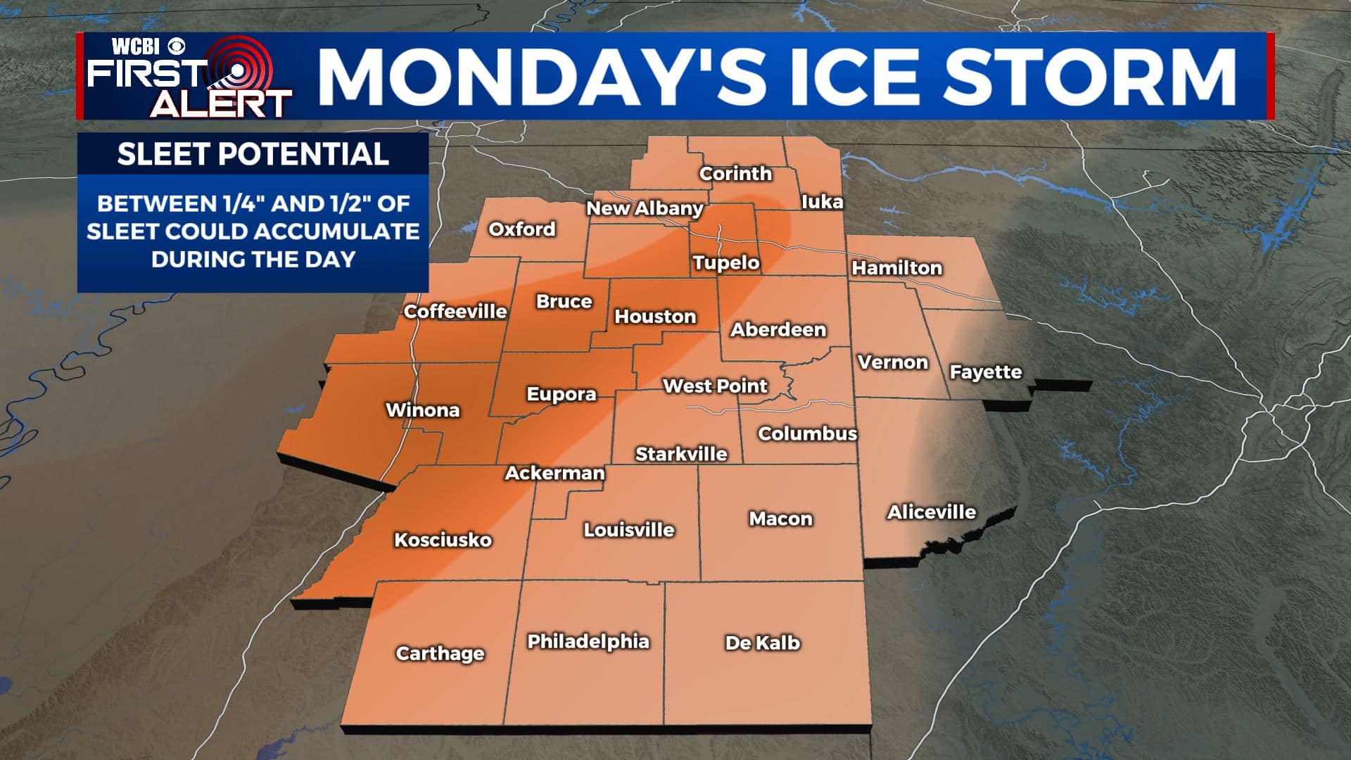
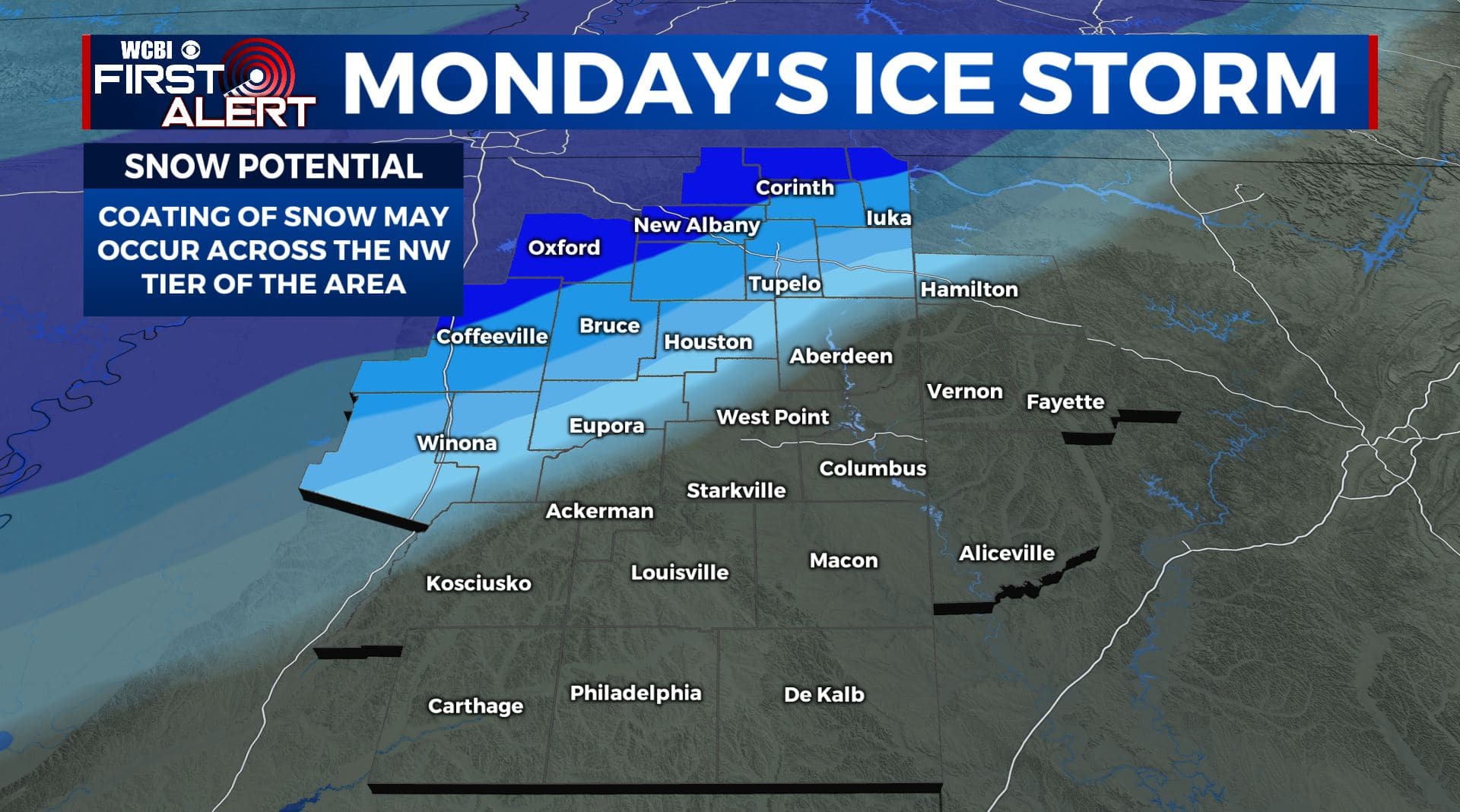
MONDAY: Confidence is increasing that widespread icing will occur with a storm system pushing across the region from mid morning through early/mid evening. Between 1/4″ and 1/2″ of ice (or more) could accumulate. Between 1/4″ to 1/2″ of sleet (or more) could also occur. Not much snow is expected with this system at this time but it can’t be ruled out across the northern tier of Mississippi. This looks like mainly a freezing rain event but some sleet and snow could also mix in. Significant travel issues and power disruptions could occur. Early highs in the low 30s with temperatures falling during the day.
MONDAY NIGHT: Cloudy and cold. Lows in the mid to upper 10s. Wind chills may be as cold as the single digits above and below zero. Any precipitation that has fallen is going to freeze. Travel may be adversely affected.
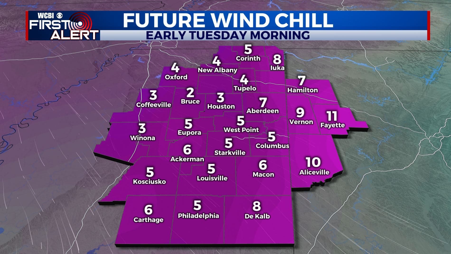
TUESDAY: Mostly cloudy. Highs look to struggle to get back to 32. Icy conditions could hang on during the day with the cold air mass in place.
TUESDAY NIGHT: Mostly cloudy. Lows in the mid to low 20s.
WEDNESDAY: Mostly cloudy. Highs in the upper 30s. Some rain or a wintry mix may move back in late in the day and into Wednesday night.
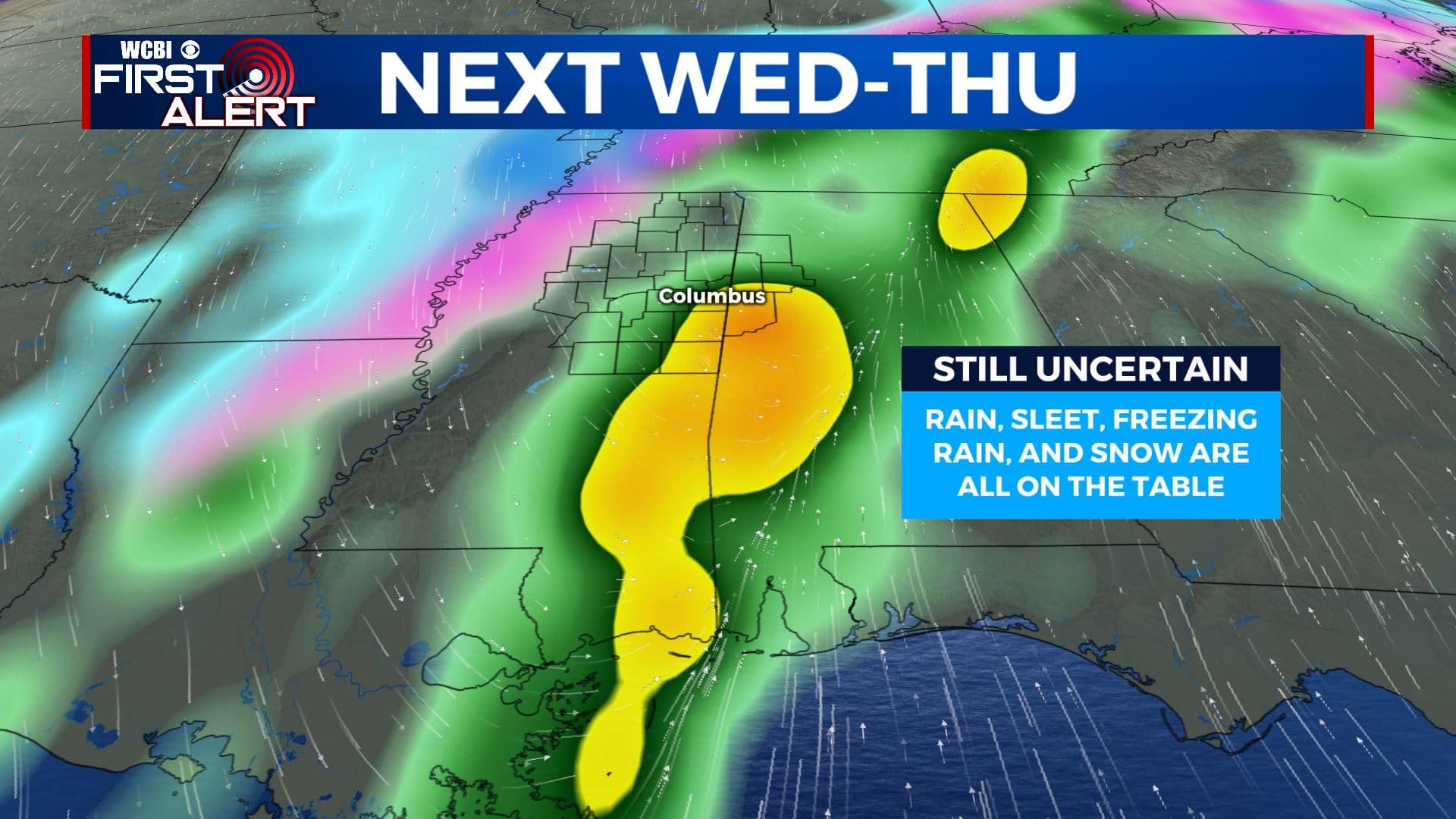
THURSDAY: Areas of wintry weather are possible. Highs in the mid 30s.
FRIDAY: Mostly cloudy. Highs around 40.
Follow @WCBIWEATHER on Facebook, Twitter, Instagram, and the WCBI News App


Leave a Reply