Wet & storms through Saturday morning
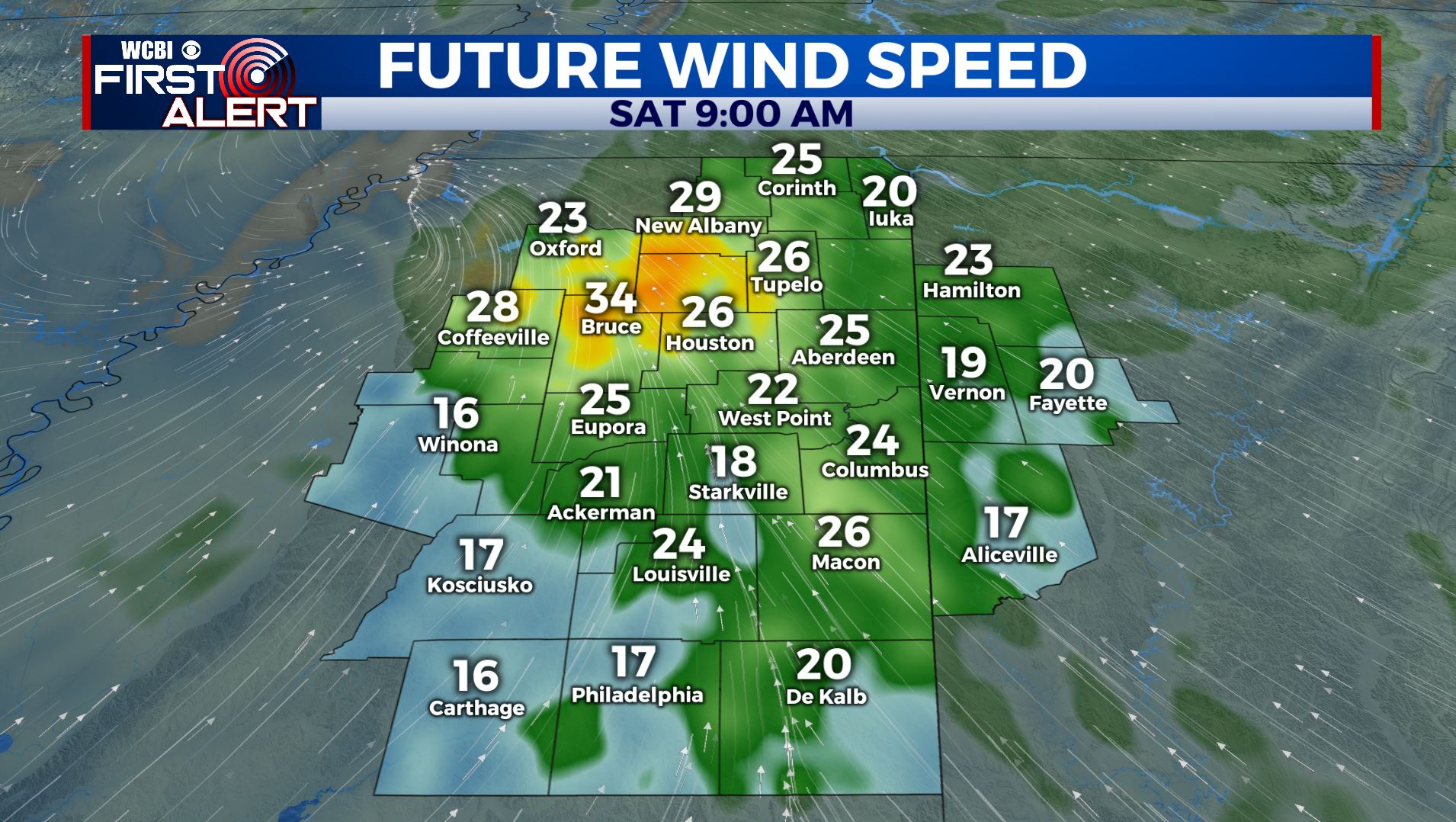
SUMMARY: Widespread rain will continue during the night and into Saturday morning. In addition, a low severe weather threat will exist through midday Saturday as warmer air briefly surges north from the Gulf Coast. The main concern overall with this event will be flooding with storm totals over 4 to 5 inches in places but an isolated tornado or two can’t be ruled out tonight and early Saturday. The remnants of Tropical Storm Olga could produce a spell of breezy winds with gusts over 30 mph. That combined with saturated soils may cause some tree and power line issues.
Remnants of Olga
FRIDAY NIGHT: Areas of rain with some embedded thunder late. Rising temperatures from the 60s into the 70s. Winds become southeasterly 10-20 mph.
SATURDAY: Rain and storms are likely with an ongoing low-end severe weather threat during the morning hours. By midday any threat of strong activity should be shifting to the east. Drier air will filter in during the afternoon and we may actually have a few breaks in the cloud deck. Look for highs in the low 70s. Winds will veer from the SE to the SW between 10 and 25 mph. Some gusts may be over 30 mph with the remnants of Tropical Storm Olga swirling through the region.
SATURDAY NIGHT: Areas of low clouds and fog are likely. Lows near 50.
SUNDAY: Clouds and fog should eventually thin out giving rise to a nice afternoon. Highs should be in the upper 60s to around 70.
NEXT WEEK: Pretty nice and seasonably mild weather is on track for Monday and Tuesday. We’re going to side with a warm, wet, and potentially stormy solution for Wednesday and Thursday. This could mean less than ideal conditions for Halloween but only time will tell. We can’t totally rule out some strong storms on Halloween either. It does appear that we’ll have cooler and drier air slide back in starting Friday as we start out November.
Follow @WCBIWEATHER on Facebook, Twitter, and Instagram. Download the WCBI News app as well.


Leave a Reply