Wet, Warm, & Unsettled Weather Continues
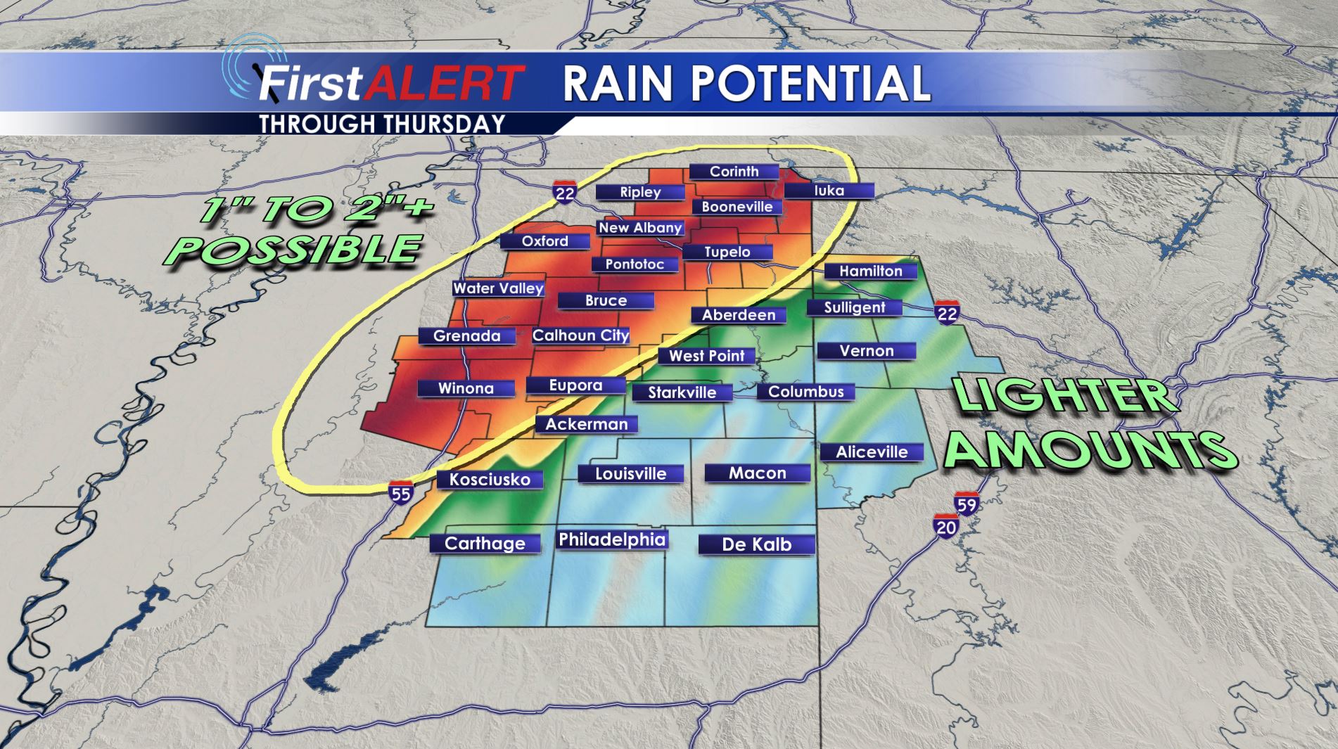
Rain Potential Through Thursday
TONIGHT: Rain and storms will be ongoing across the region tonight. The highest rain totals will be north and west of the Golden Triangle. While we can’t rule out a stray gusty storm the odds of severe weather is low. Lows will be mainly in the 60s but some 50s are likely near Oxford.
THURSDAY: Unseasonably warm and humid air is going to remain in place. Highs should be well into the 70s if not lower 80s. The warmest air is going to be found near the Golden Triangle. Rain chances will continue but they’ll be highest across the northern and western part of the area.
FRIDAY: Additional showers are possible but the big story overall will be the continuation of warmth and humidity. Highs are expected to be in the upper 70s to around 80.
SATURDAY: Plan on highs in the upper 70s to lower 80s. A few passing showers are possible during the day. There is a chance of strong to severe storms Saturday evening and Saturday night.
SUNDAY: Lingering showers are possible during the morning and some additional showers may redevelop during the afternoon. Highs will only be in the 60s.
Follow @WCBIWEATHER on Facebook, Twitter, Instagram, and Snapchat


Leave a Reply