Wetter weather and fall temperatures for the week ahead
SUMMARY: a complex and tricky forecast is in store for us over the next week. After a warm and dry weekend, a weak front moves through Monday, bringing scattered showers and cooler air for Tuesday. Wednesday, it’s now looking like any severe weather threat will stay well to our south. We now are looking at much cooler temps with widespread rain for Wednesday. We’ll cool down even more later on in the week with scattered showers possible Thursday through Saturday.
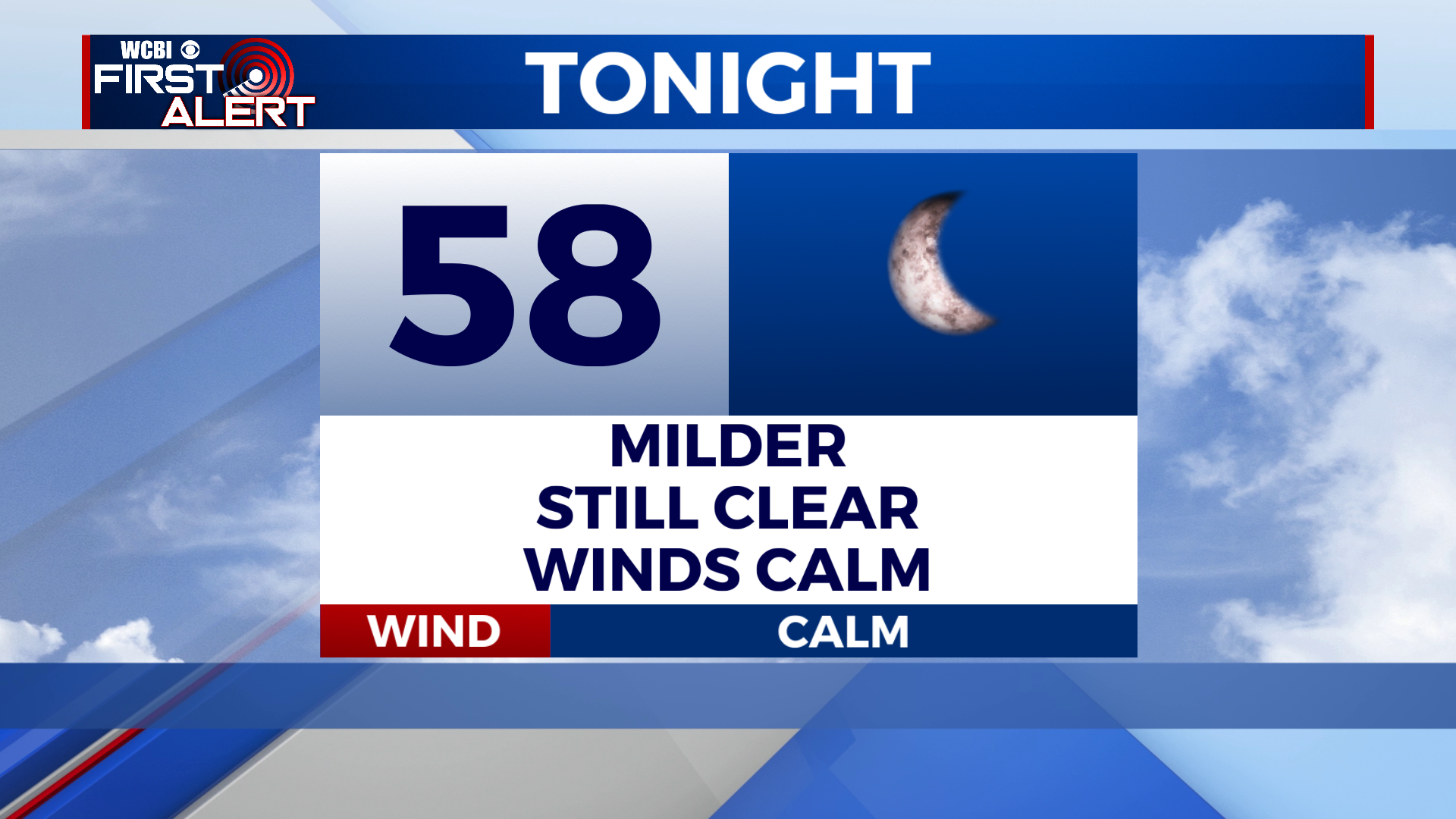
SATURDAY NIGHT: A much milder night for Saturday night, with lows in the mid to upper 50s. Skies should stay fairly clear.
SUNDAY: Much warmer for Sunday, with a high near 80 degrees and mostly sunny skies. Clouds will begin to move in during the afternoon hours.
SUNDAY NIGHT: A few showers and storms will move in overnight Sunday night, but many of us look to stay dry until Monday. Warm and muggy, with a low in the mid 60s under mostly cloudy skies.
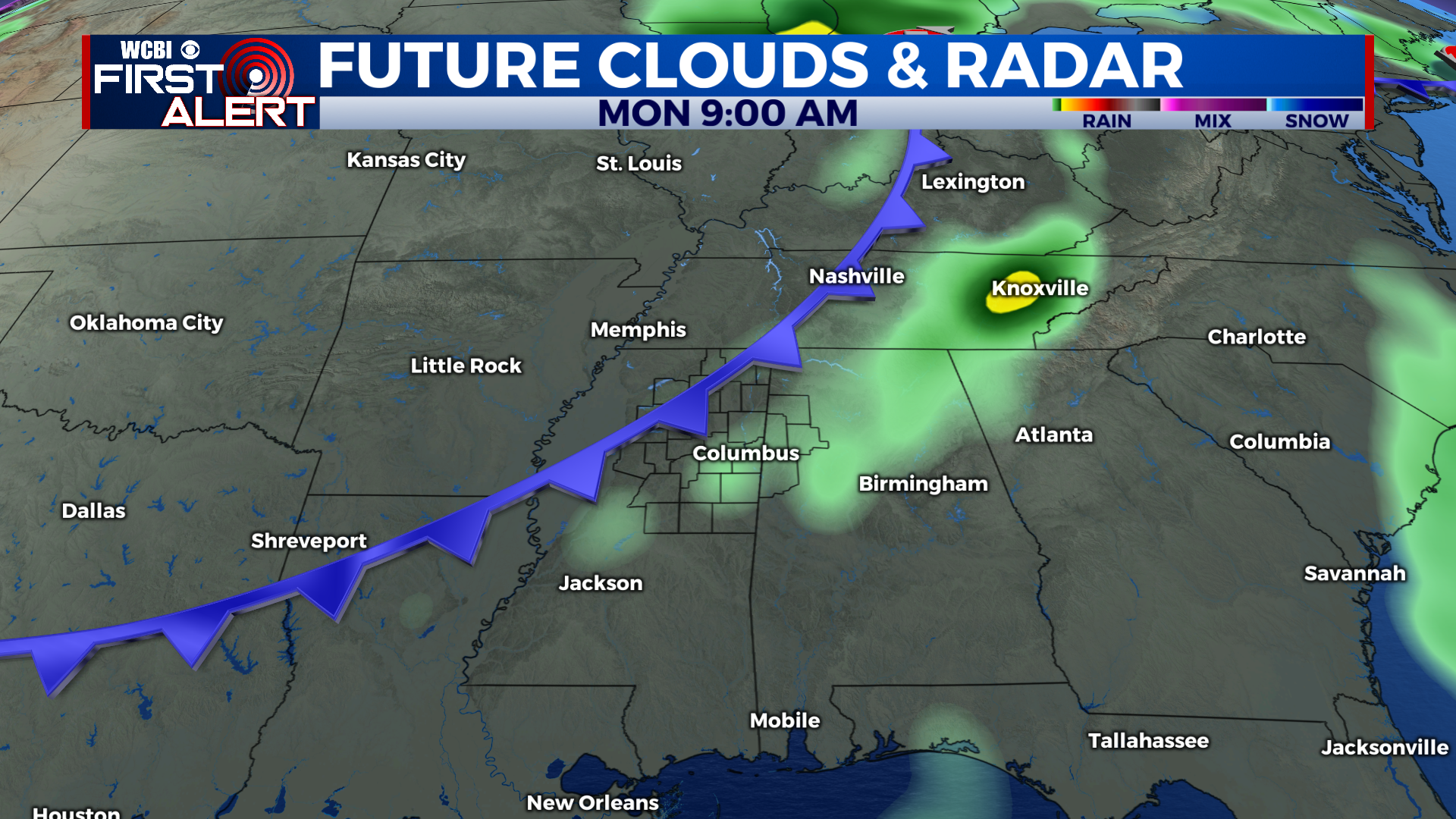
MONDAY: A cold front will move through the area on Monday, bringing with it a few scattered showers and storms. Warm and humid with a high near 80 degrees.
TUESDAY TO FRIDAY: A cold front moving through Monday afternoon will bring in much cooler and drier air for Tuesday, with sunny skies and highs in the upper 60s to near 70. Wednesday, another, much stronger cold front will move through the area, with widespread rain and storms throughout the day. Highs will stay in the 60s. Rain begins to taper off for Thursday, but some scattered showers are possible. Highs remain cool in the 60s. Rain showers look to stick around for Friday and Saturday, with mostly cloudy skies and very cool conditions. Highs Friday will be in the upper 50s to low 60s, with low to mid 60s for Saturday. Lows will be in the upper 40s or 50s from Tuesday onward.
CONNECT WITH @WCBIWEATHER ON TWITTER, FACEBOOK AND INSTAGRAM