Windy with severe storms likely Wednesday PM
COLUMBUS, Mississippi (WCBI) – Warm and windy conditions today lead to severe weather chances Wednesday afternoon and early evening. Clearing and cooling conditions move in for the later portion of the week.
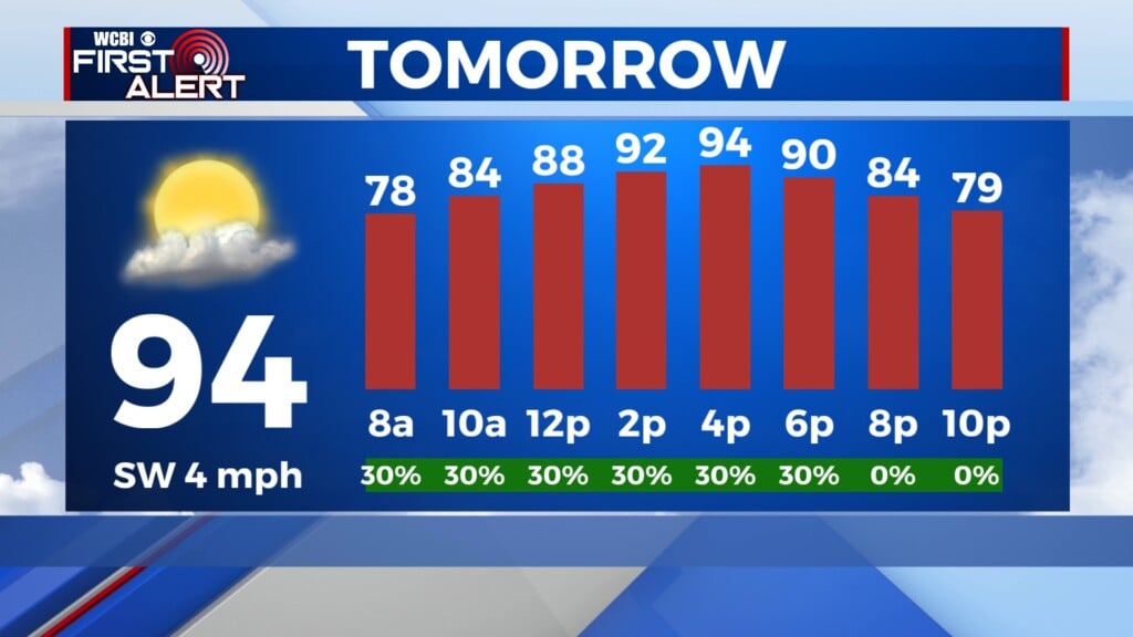
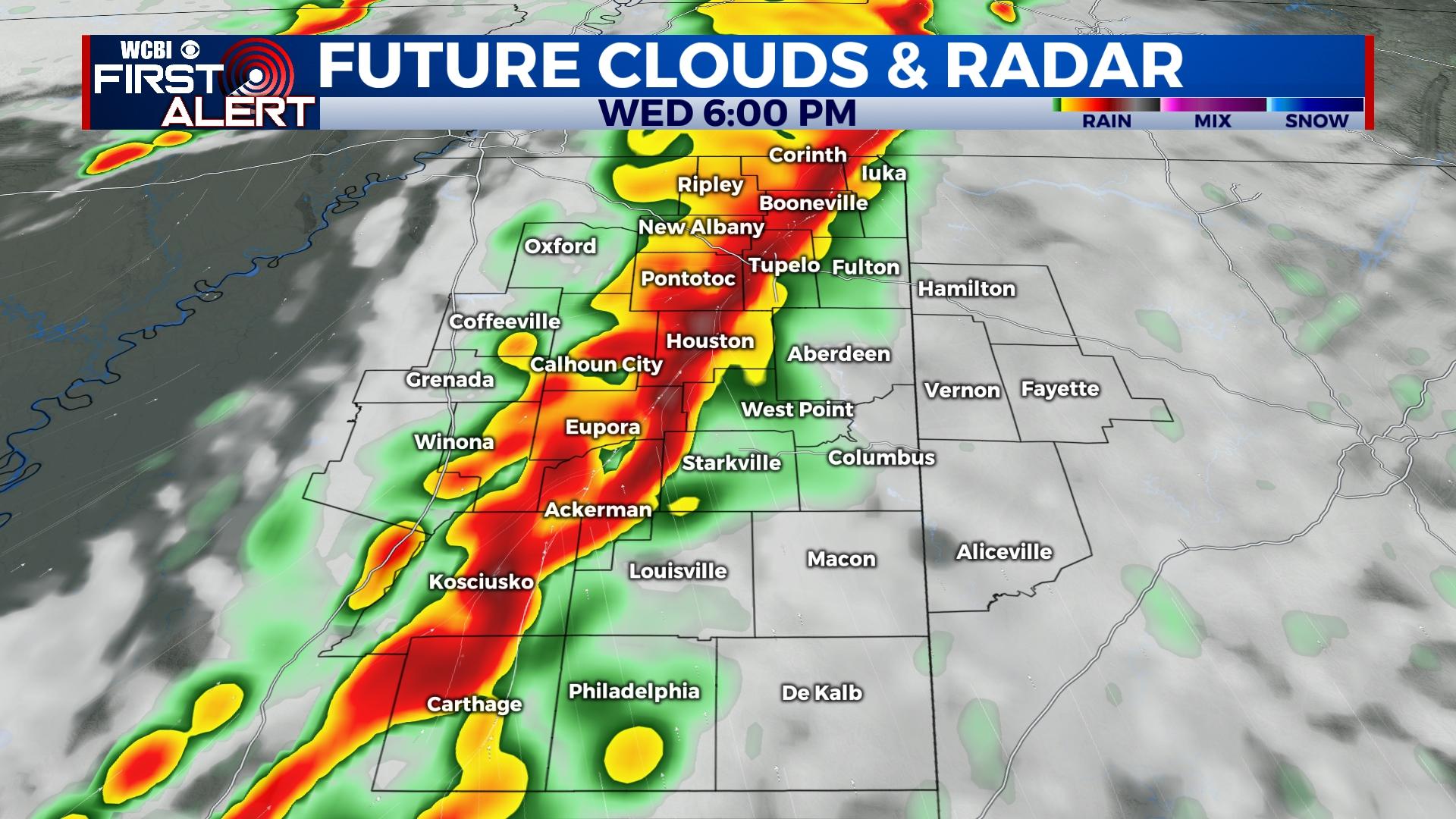
WEDNESDAY: Variably cloudy, warm, and quite windy today with highs in the lower 80s. Preceding any storms, non-thunderstorm wind gusts could approach 45-55 mph for many hours today. Concerning the severe weather threat, a significant severe event remains in the cards later in the afternoon and early evening hours. A line of storms is expected to sweep across the state and bring potential for hurricane force (74+ mph) wind gusts and embedded tornadoes. There is some indication the southern extent of the line could break apart into more cellular-type storms, and should this occur, the tornado threat could increase. This would be most likely to happen from the Golden Triangle southward. Regardless, everyone in north Mississippi and west Alabama has heightened potential to see severe wind gusts and a few embedded tornadoes from around 1-9p.
REST OF WEEK: Gradual clearing and cooler weather is on tap for Thursday and Friday with both days seeing highs back in the 60s and morning lows in the 40s to upper 30s.
WEEKEND: A brief increase in cloud cover could occur Saturday, but at this point no rain is expected. Sunday looks great with plenty of sunshine and seasonable early April temperatures.
NEXT WEEK: Monday starts dry, but yet another round of locally strong storms could develop into the region by Tuesday. This is still many days away, so stay tuned for updates!