The Latest on Accumulating Snow Monday Night
CHECK WCBI.COM/WEATHER FOR THE LATEST UPDATES
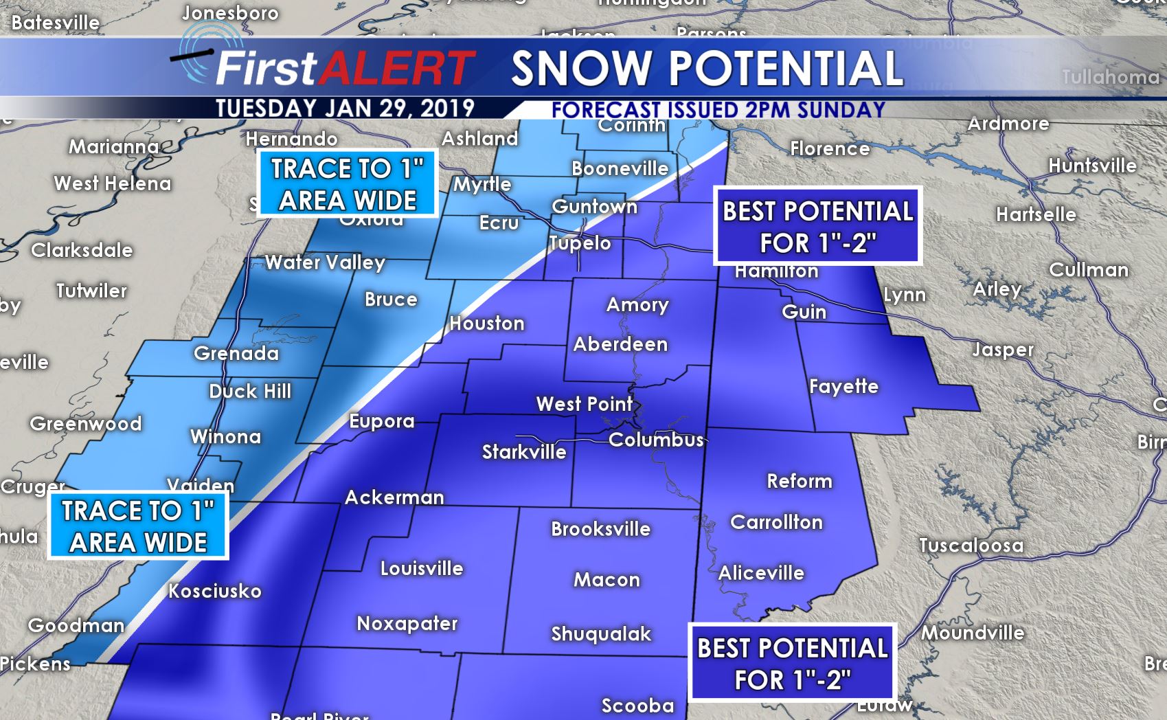
Updated 4:30 P.M. Sunday, January 27th – We have high confidence as of Sunday Afternoon for accumulating snow to impact our region on Monday Night into Tuesday Morning. Right now, all of us will see up to an inch of snow, with some areas having the potential to see 1-2″ of snow with locally higher amounts. The prime-time opportunity looks to be 11PM to 6AM across our area, with snow lasting a few hours for most.
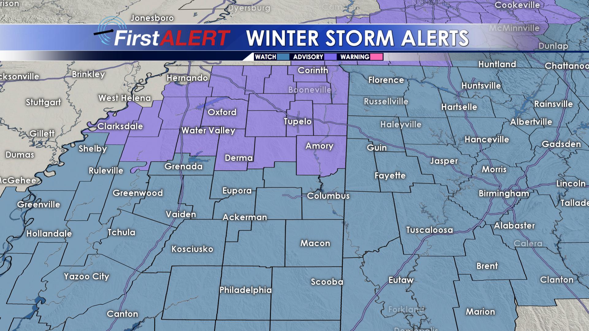
WINTER STORM WATCH IN EFFECT FOR WEST ALABAMA AND AREAS ALONG AND SOUTH OF US 82.
WINTER WEATHER ADVISORY IN EFFECT FOR TUPELO AND SURROUNDING AREAS ALONG THE US 278 CORRIDOR.
Showers will move in Monday after supper time along and behind a strong cold front. No severe weather will occur. After the front passes, temperatures will quickly drop and a transition to snow will occur, some areas before midnight. Snow will continue through Tuesday morning, with all of the snow out of here by 9AM, if not before then.
Given moisture present Tuesday morning and freezing temperatures expected to last much of the day, even with only a light dusting of snow, roads have the potential to become slick, especially on bridges. Black ice is a big concern Tuesday during the day. Daytime temperatures may not get above freezing in some locations. The good news is that sunshine through much of the day Tuesday will help to evaporate some of the ice off the roads, but perhaps not all of it. Side streets and rural, less traveled roads may remain icy heading into Tuesday night. Dangerous wind chill values and black ice will also be a concern going into Wednesday. By Wednesday Afternoon, temperatures in the upper 30s and low 40s coupled with lots of sunshine will help to take care of most, if not all issues in our area.
We fully expect many schools to close Tuesday due to travel concerns, and we anticipate this to be a fairly high impact event as far as the Tuesday Morning commute goes, even in areas that only see a dusting of snow. Impacts will be significantly lower by Tuesday Evening, but some slicks spots will remain into Wednesday Morning. We’ll continue to monitor.
Catch the full 7 Day Forecast Discussion on WCBI.com/weather.
Be sure to check back with us here by Sunday Night. Follow @WCBIWEATHER on Facebook, Twitter, and Instagram for updates as well.


Leave a Reply