Wintry weather tonight & Monday morning
SUMMARY: An area of low pressure moving across the northern Gulf of Mexico will give our local area a mixed bag of rain, sleet, and snow from late Sunday evening through Monday afternoon. The best potential for wintry accumulations will be tonight through Monday morning.
LATEST CLOSING LIST
TRAVEL INFO FROM MDOT
TRAVEL INFO FROM ALDOT
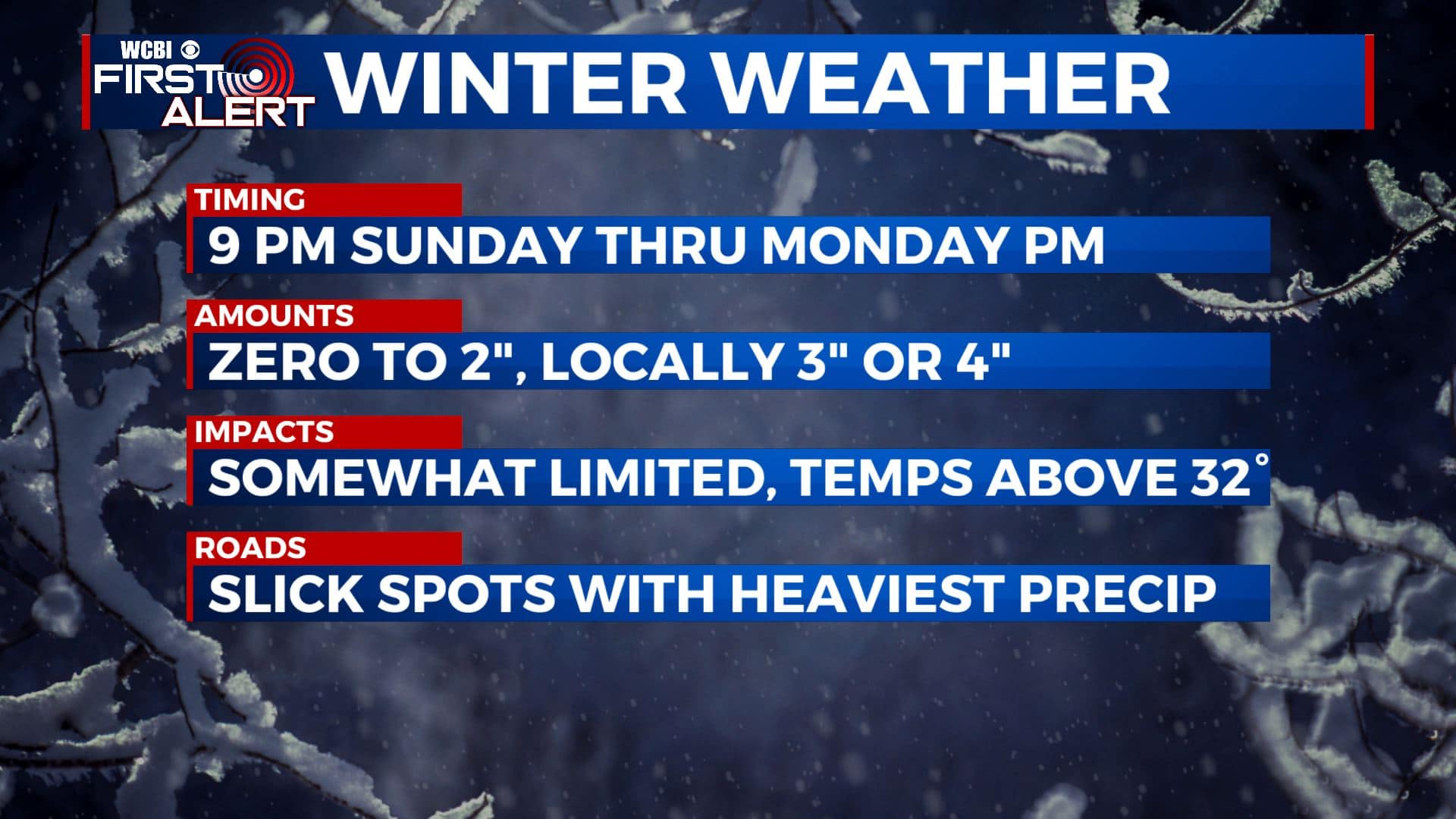
TIMING: From about 9 PM tonight through early Monday PM
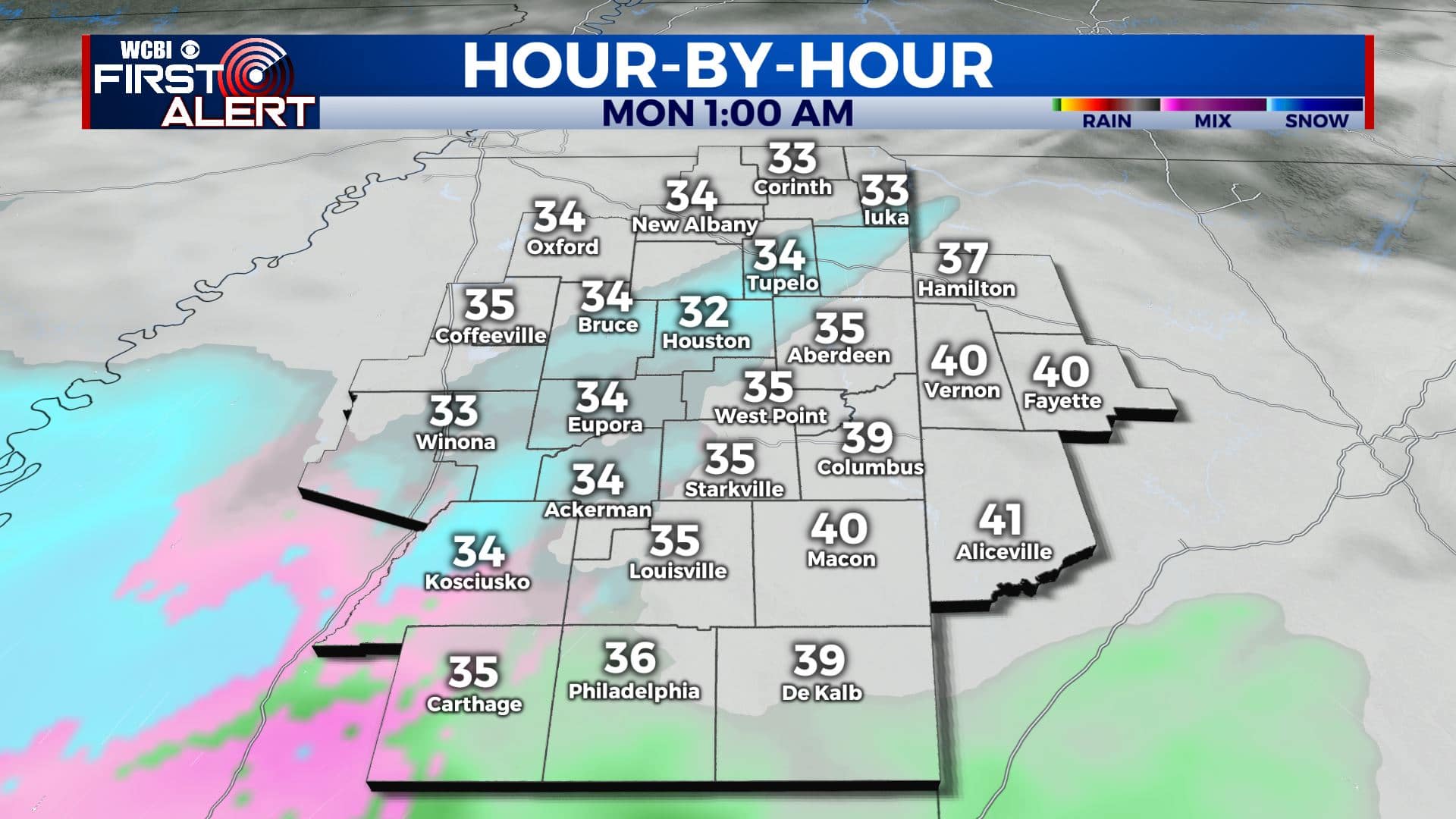
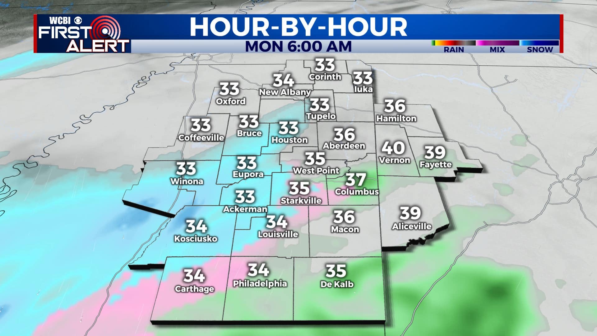
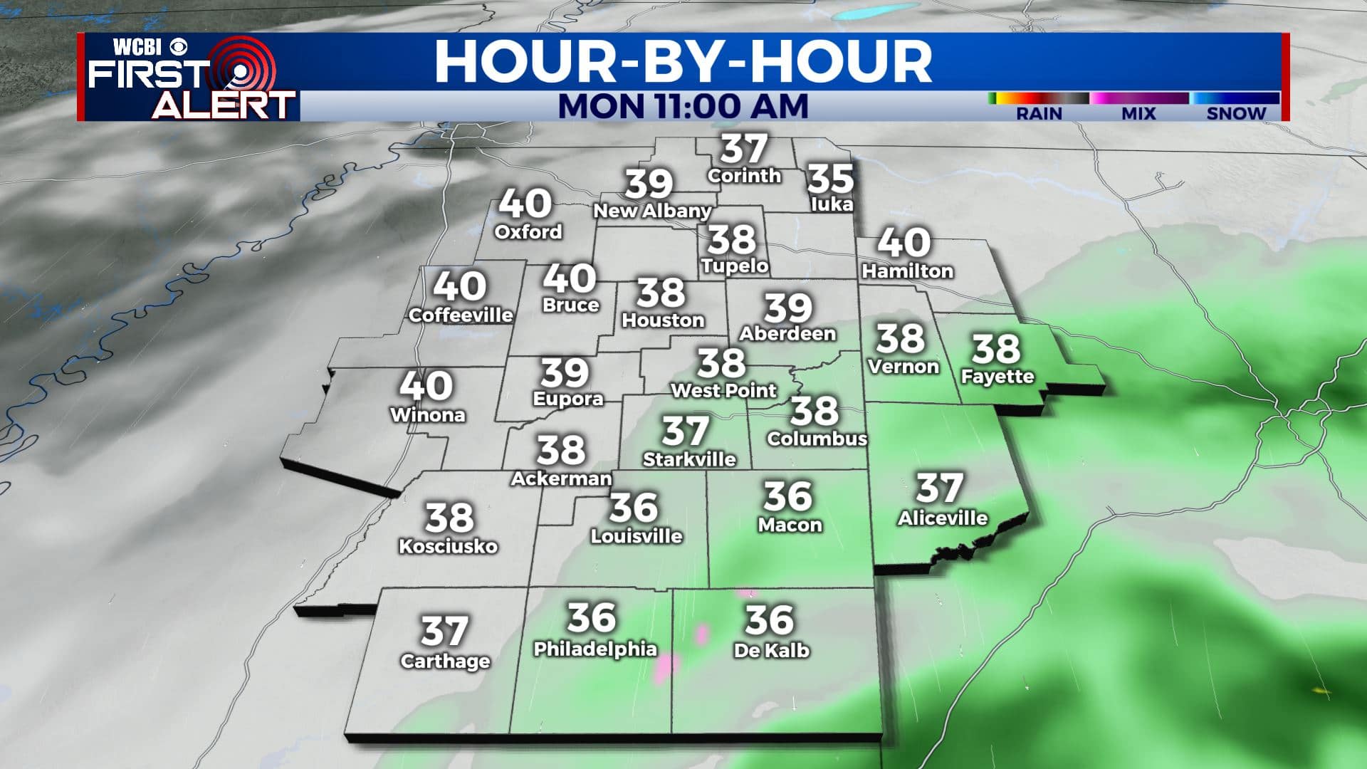
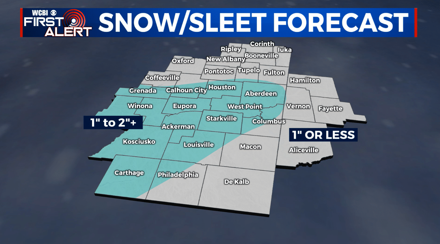
AMOUNTS: Anywhere from zero to 2″ of sleet and snow are possible. Some locations could get locally higher amounts in the 3″ to 4″ range if a heavy band of snow can setup somewhere.
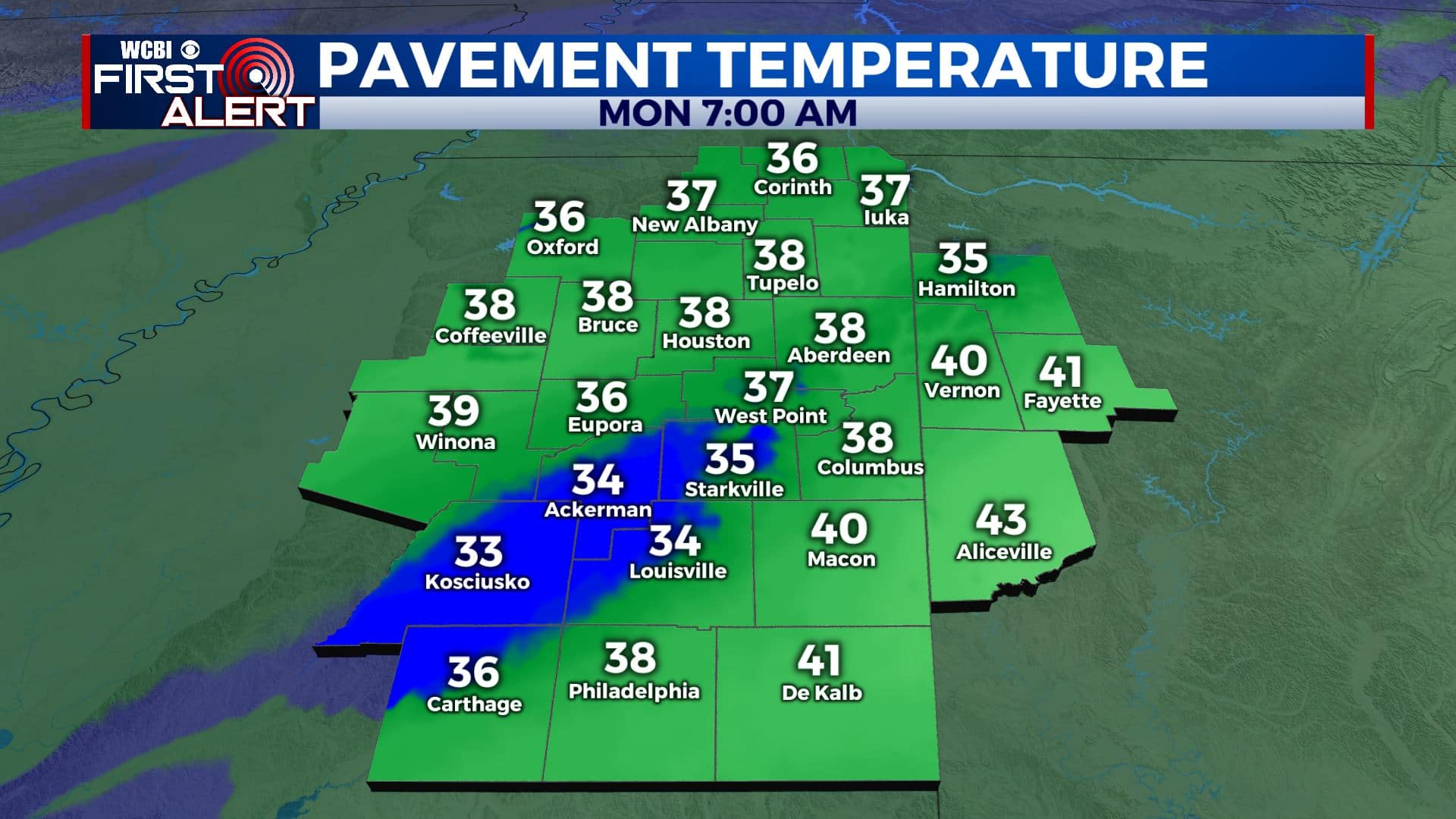
ROADS: In general, road surface temperatures will remain above freezing during this event and that will mitigate widespread travel issues we think. Things could become slick if a heavy band of precipitation happens to setup over any one spot for a bit. Also keep in mind bridges can become slick faster than regular road surfaces. When it doubt, slow down! Some additional slippery spots could redevelop Monday night when air temperatures dip back below freezing.


Leave a Reply