Zeta to bring us rain and some wind
SUMMARY: Rain develops tonight and continues into Thursday as the remnants of Zeta and a cold front push across the Twin States. Some wind gusts could be over 30 mph at times Wednesday night into Thursday but no widespread issues are expected in our area at this time. Drier weather builds back in by Friday afternoon and it will continue through most of next week.
TUESDAY NIGHT: Cloudy with areas of rain developing. Some thunder is also possible. Steady to slowly rising temperatures in the 60s. Winds NE 5-10 mph.
WEDNESDAY: Cloudy with areas of rain and storms. Some rain may be locally heavy at times. Highs in the 70s. Winds SE 5-15 mph with some higher gusts.
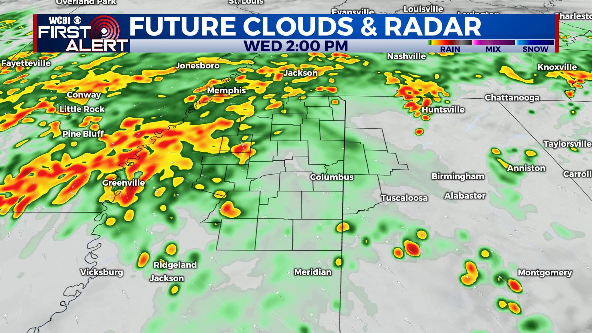
Wednesday afternoon forecast
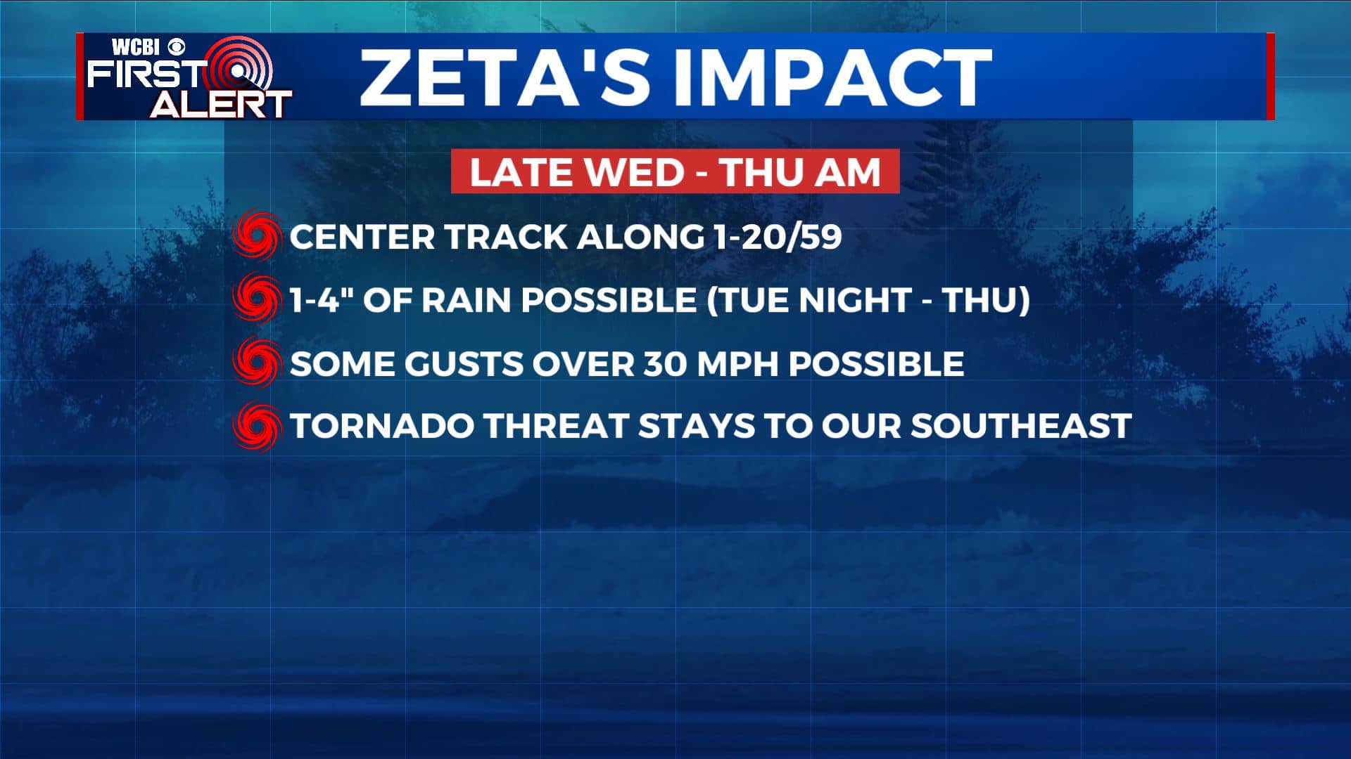
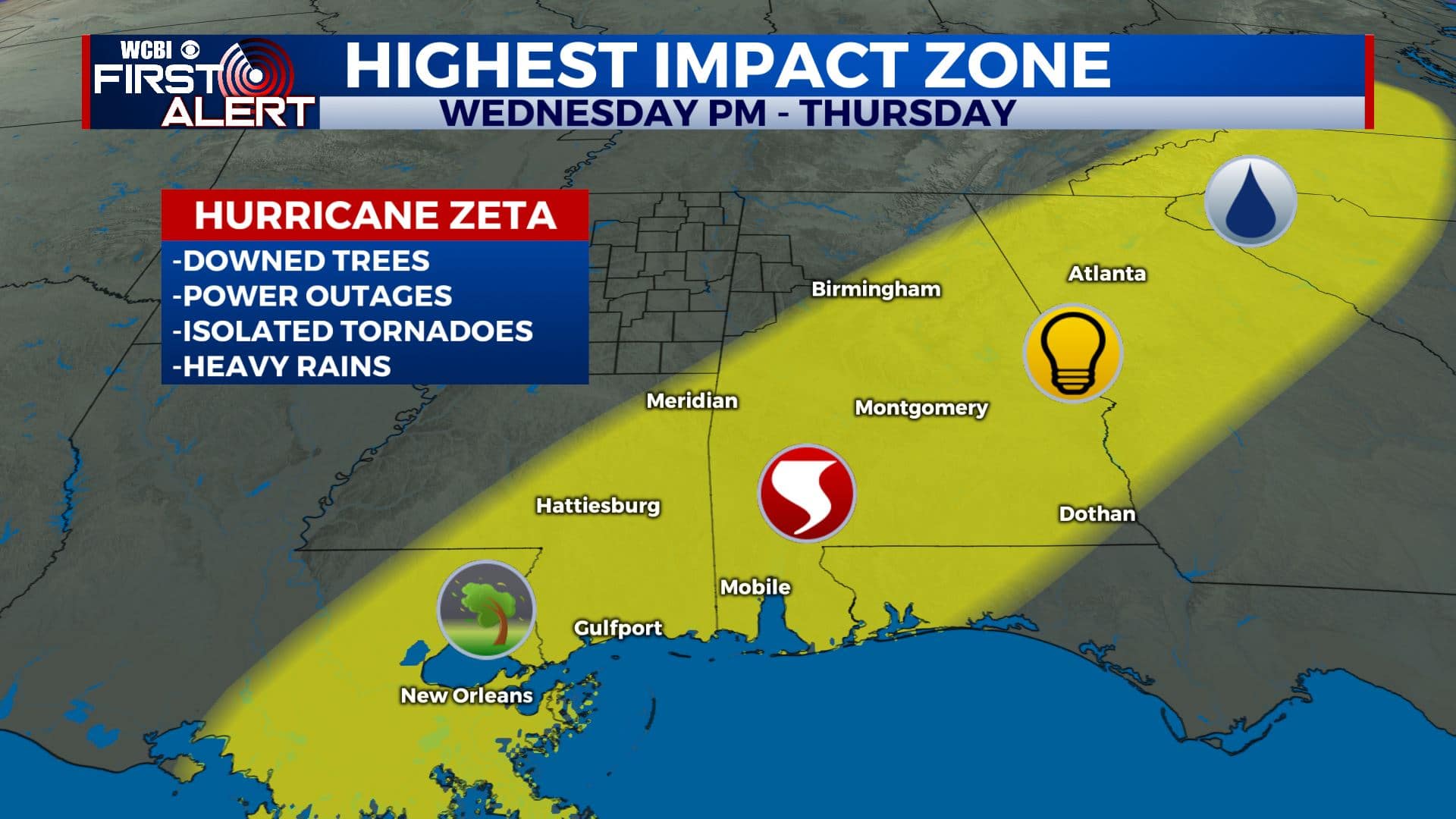
WEDNESDAY NIGHT: Breezy with areas of rain. Wind gusts could be over 30 mph as the remnants of Zeta swirl through along the I-20/59 corridor.
Wednesday night forecast
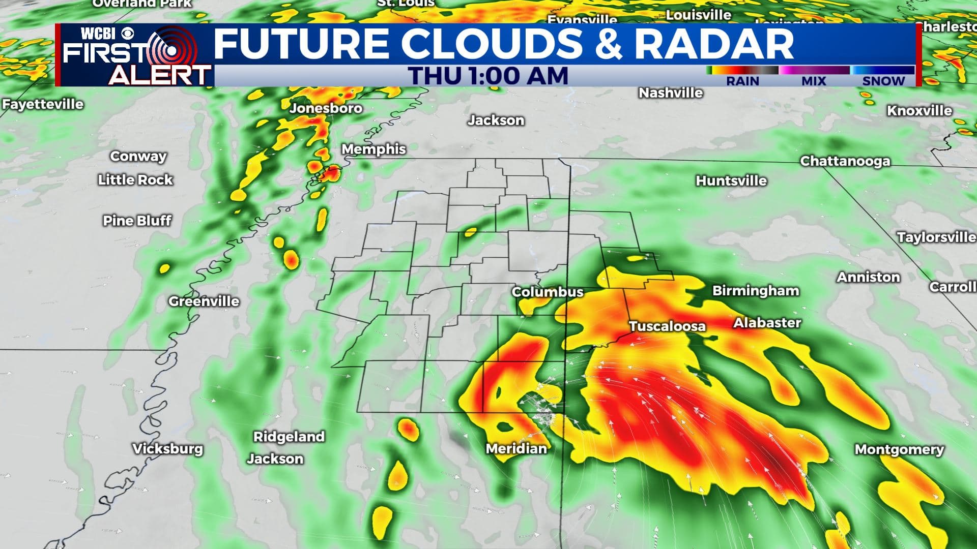
THURSDAY: Morning clouds and showers give way to some afternoon clearing behind a cold front. Breezy SW winds 10-25 mph develop with some gusts over 30 mph. Highs in the low 70s.
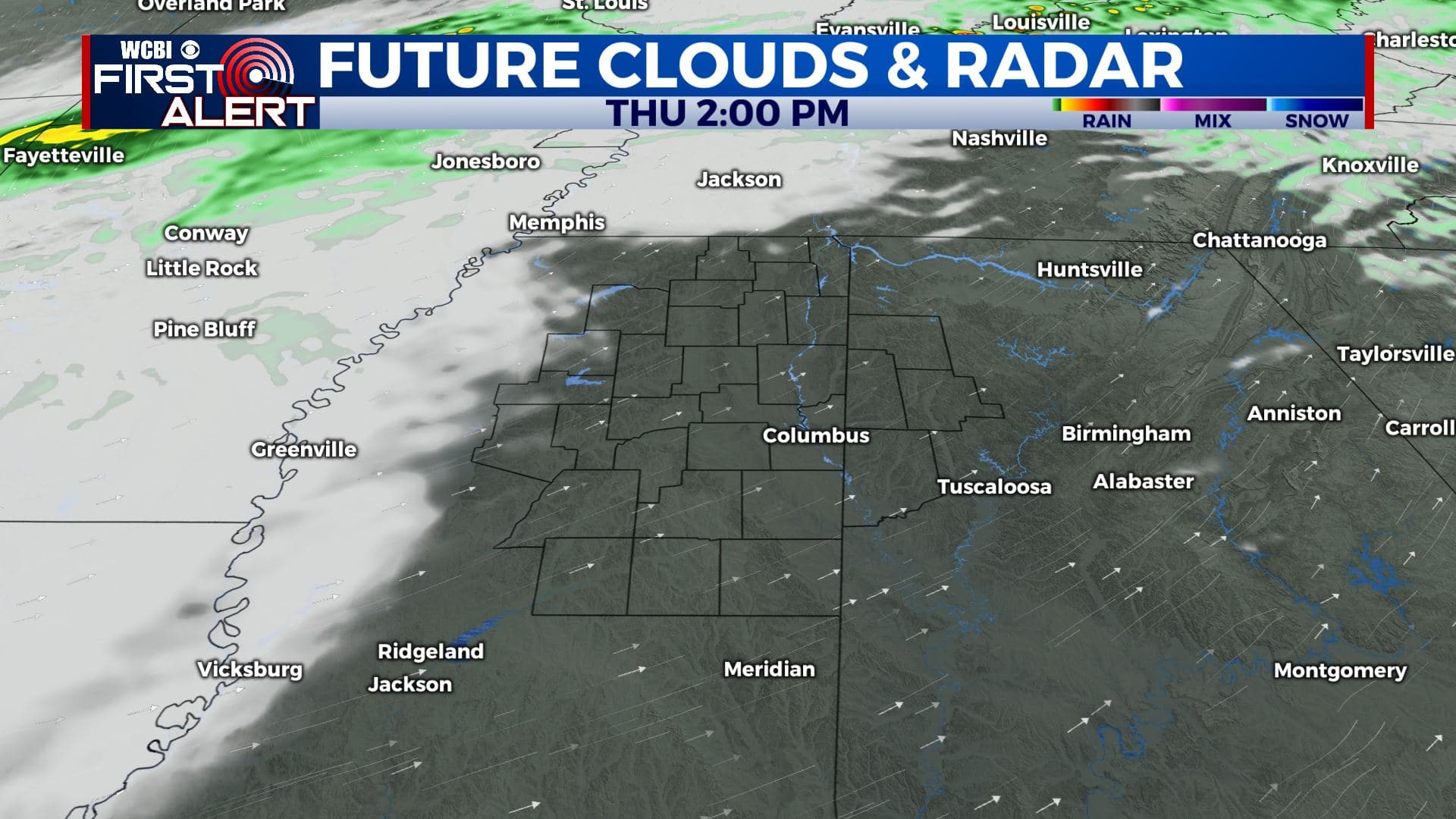
Thursday afternoon forecast
THURSDAY NIGHT: Mostly cloudy with a few isolated showers possible. Lows in the upper 40s to lower 50s.
FRIDAY: Morning clouds with widespread sun taking over during the afternoon. Cooler highs in the low 60s. No issues expected for high school football this week.
WEEKEND: Mostly sunny. Highs around 70 Saturday (Halloween) with 60s on tap for Sunday. Lows in the 40s and 50s.
NEXT WEEK: Bright sunshine should be the norm. Expect highs in the 60s with lows in the 30s and 40s. There won’t be any weather worries for Election Day on Tuesday.
Follow @WCBIWEATHER on Facebook, Twitter, Instagram, and the WCBI News App


Leave a Reply