Strong Storms Saturday Morning, Bitter Cold Air Saturday Night
Strong Storms Expected Late Tonight into Tomorrow Morning: A slight risk for severe weather is forecast for strong to severe storms Saturday. Main risk is damaging winds, but an isolated tornado cannot be ruled out before 12 PM.
TONIGHT: Scattered showers and storms are possible after 7PM, but the best chance looks to hold off for most of us until after midnight. A few storms could be on the stronger side, although as of now we aren’t anticipating any organized severe weather until early Saturday morning. Temperatures will climb from the mid 50s Friday Evening into the low 60s by Saturday morning. Look for southeast winds to pick up through the night, becoming southeast at 10-20 mph by Saturday morning.
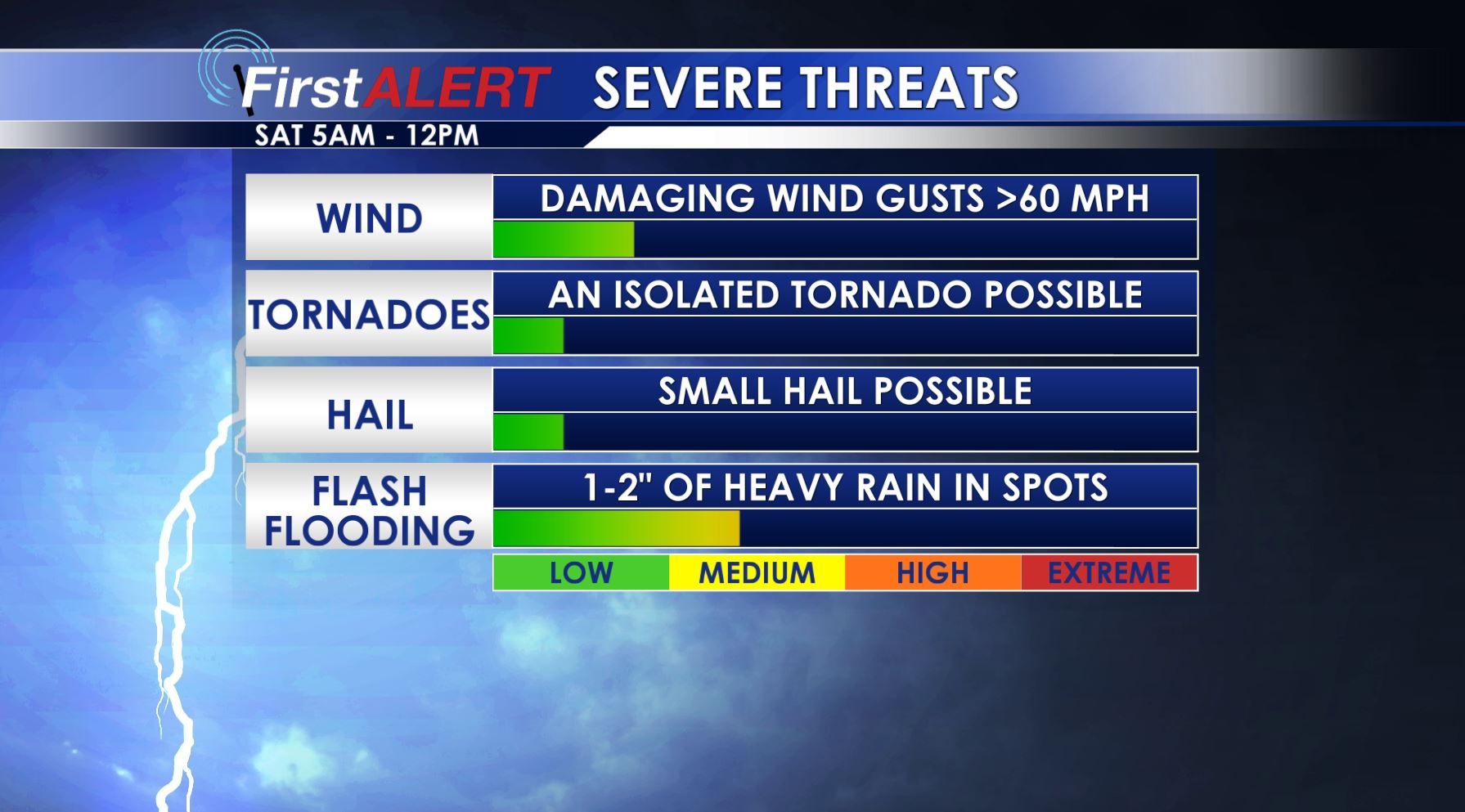
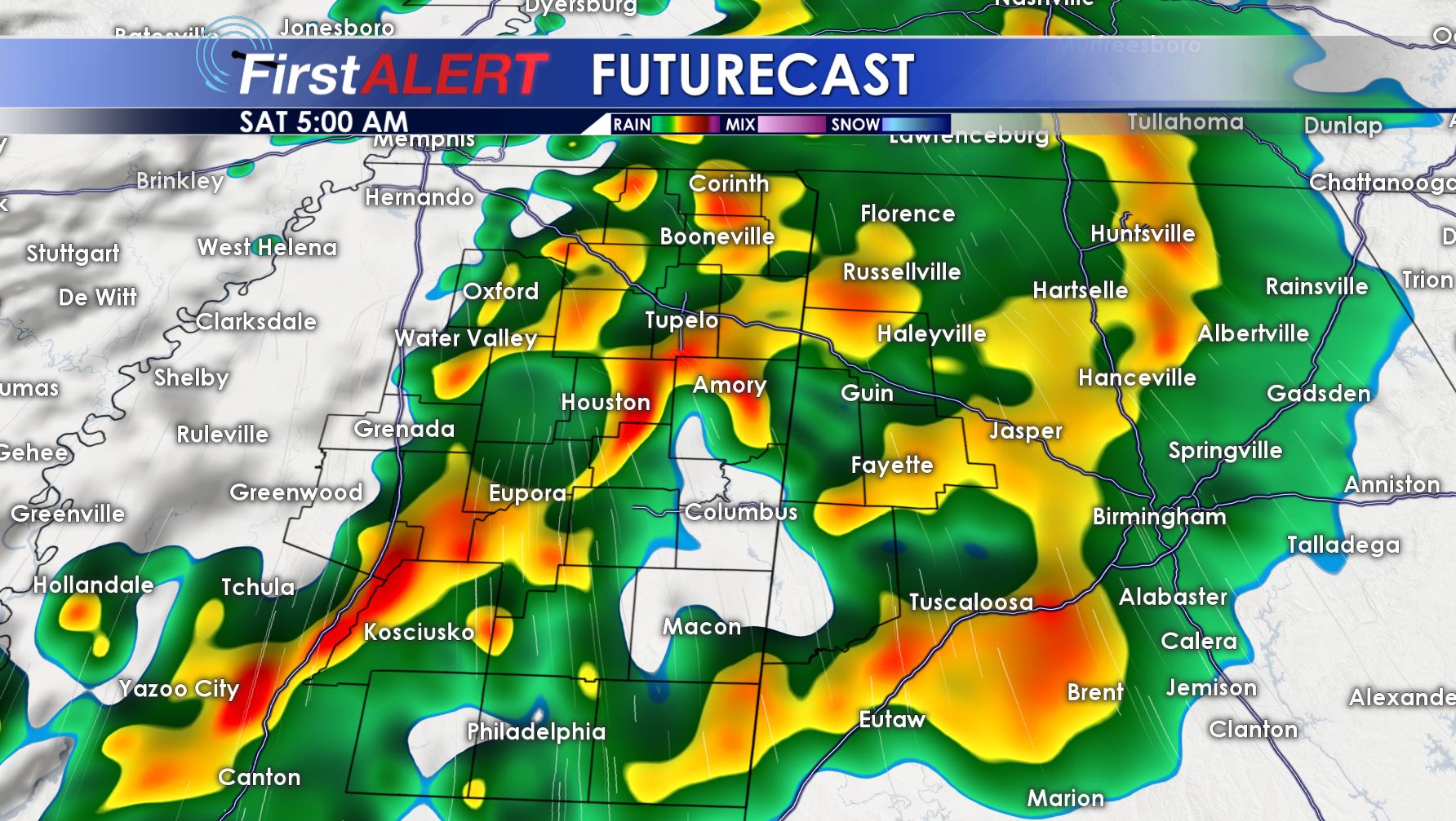
SATURDAY: Saturday Morning starts with breezy southeast winds and showers and thunderstorms. Some storms will be strong to severe with damaging winds the main threat. An isolated tornado cannot be ruled out. The best chance for strong to severe storms looks to be between 5AM and 12PM. Temperatures will be in the 50s and 60s during the morning hours.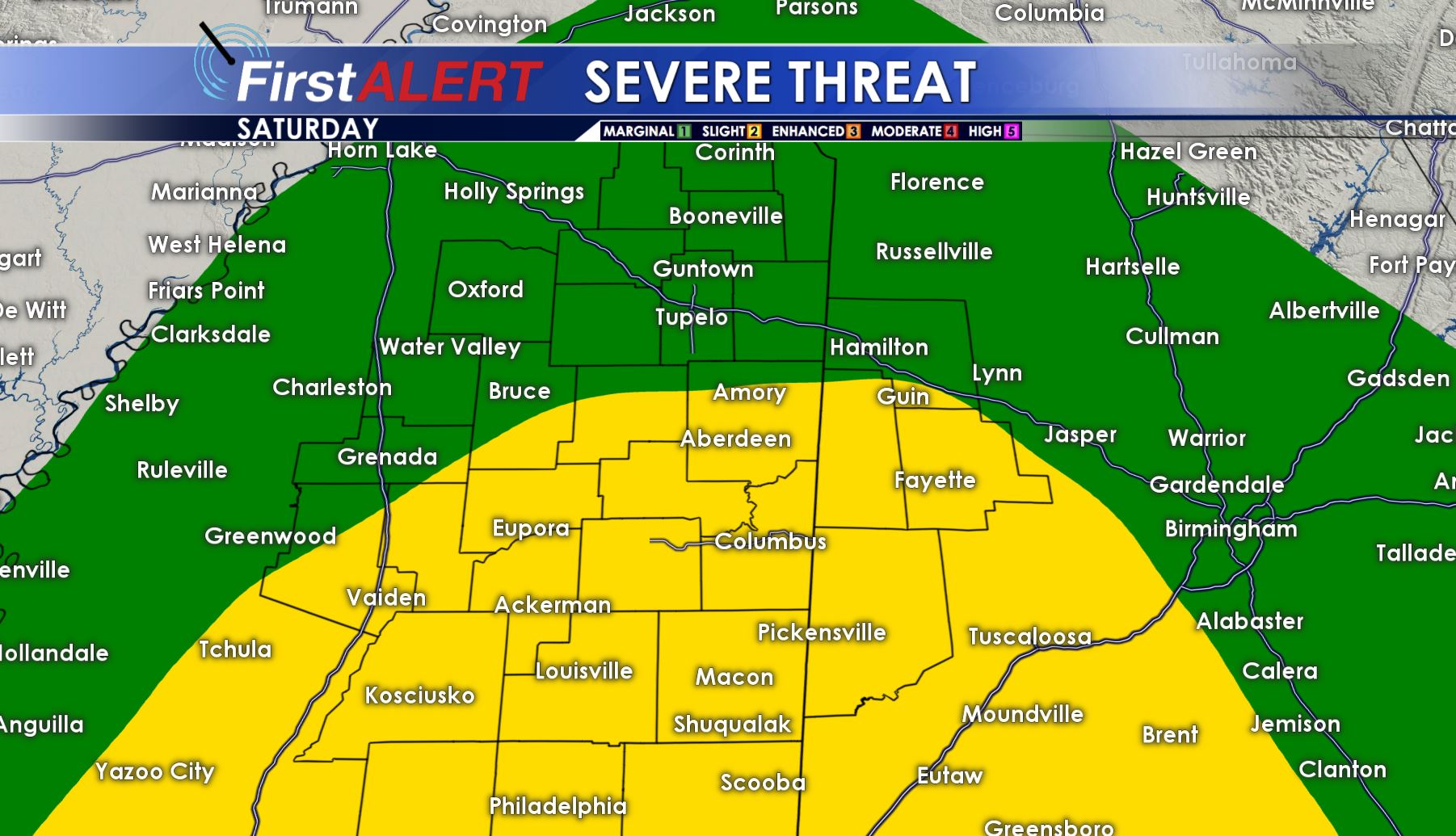 By Saturday Afternoon, storms push to the east and we’re left mostly cloudy with gusty winds from the northwest. This will help to usher in arctic cold air into our region. Look for afternoon temperatures falling into the 50s and 40s.
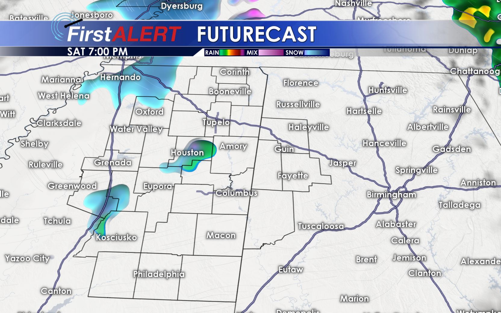
Saturday Evening into the overnight, bitter cold air and the presence of a bit of leftover moisture may in fact allow for some very light wintry mix to fall, including snow flurries. No impacts will occur, and we do not expect any accumulation. In fact, most of us will be left high and dry. Temperatures will fall into the 30s and even 20s in a few spots Saturday Night.
SUNDAY: Decreasing clouds and cold through the day with highs in the mid to upper 30s. Northwest winds at 10-20 mph with gusts as high as 30 mph will keep wind chills in the teens and 20s through the day. Winds calm somewhat overnight under clear skies, allowing temperatures to drop into the teens and 20s.
MLK DAY: Sunny and a bit warmer than Sunday with highs in the mid to upper 40s. Overnight lows in the low to mid 30s.
MID NEXT WEEK: High temperatures into the 40s and 50s Tuesday and Wednesday with another front approaching. Isolated showers possible Tuesday, with more widespread precipitation Wednesday. Temperatures will likely drop through the day Wednesday, with the high temperature coming in the morning hours. Thursday, look for another round of arctic air to come into the region.
FOLLOW @WCBIWEATHER ON FACEBOOK, TWITTER AND INSTAGRAM.


Leave a Reply