60s return as we begin a new week; Big cool down by Christmas
SUMMARY: Winter began Monday morning but it sure won’t feel like it as the sunshine and the 60s return as we kick off Christmas Week. A BIG cool down is still on the way as we near Christmas Day thanks to a strong cold front that will push through late Wednesday into Christmas Eve early Thursday, along with some rain chances.
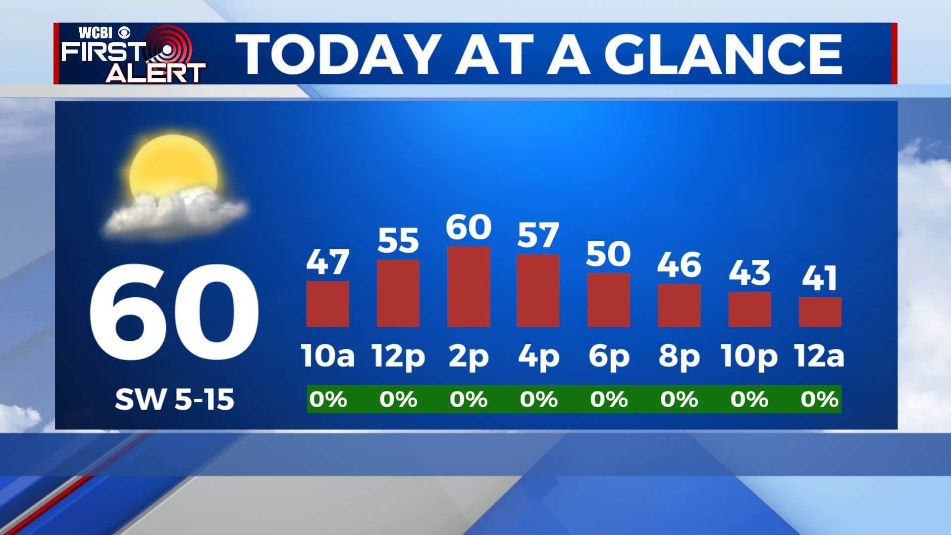
MONDAY: After the morning fog burns off, we’ll see the return of the sunshine and the 60 degree weather for your Monday afternoon. SW winds 5-15 mph.
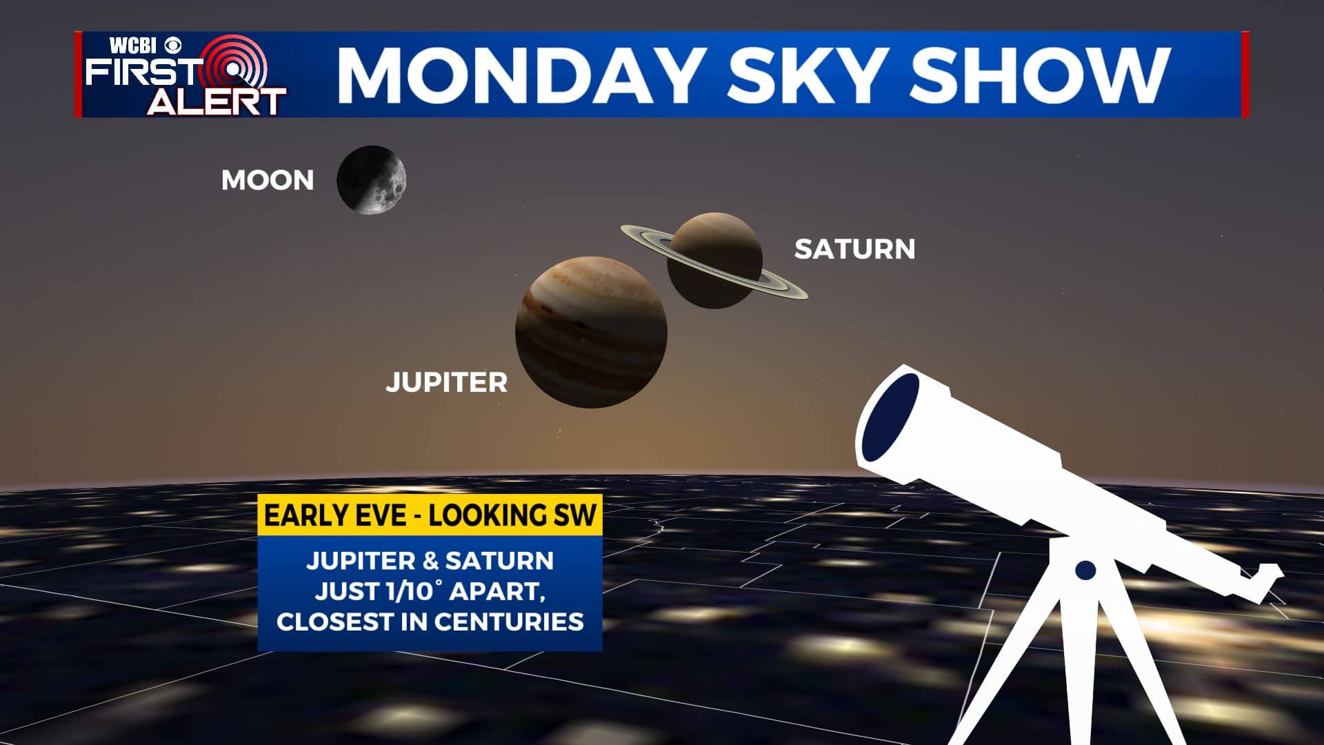
MONDAY NIGHT: Even though tonight is going to be the longest night of the year, it’s going to be a mostly clear night to watch The Great Conjunction in which Jupiter and Saturn will be close enough to one another that it will look like one big bright star. Just look to the SW. Still a bit chilly with overnight lows in the mid 30s.
TUESDAY: Mostly sunny skies. Temperatures remain above average with highs in the lower 60s. Temperatures will dip again into the mid 30s overnight.
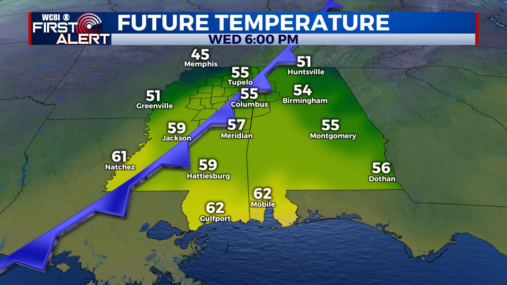
WEDNESDAY-CHRISTMAS EVE THURSDAY: Clouds will be increasing throughout the day on Wednesday ahead of our next cold front. Rain chances will also increase Wednesday evening into the overnight hours. We could have a bit of thunder, but no severe weather is expected. The colder air will begin to filter in Christmas Eve morning as the rain exits. Depending on how fast the cold air moves in, we “could” see a flurry or two early Thursday morning but not expecting much. Highs will be in the lower 60s on Wednesday, but will only be in the 40s for highs on Thursday. Get ready for that cool down!
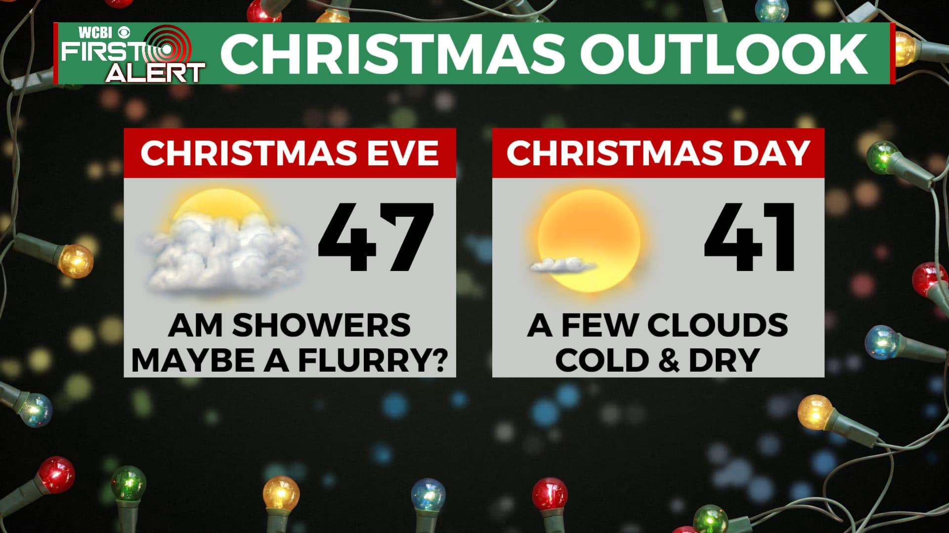
CHRISTMAS DAY FRIDAY-WEEKEND: It will be sunny but cold for Christmas Day. BRRRRRR!!! Highs in the 40s and morning lows in the 20s. A few clouds will move in by Saturday and Sunday with highs back up to the upper 40s to lower 50s. Some isolated showers are possible on Sunday.


Leave a Reply