A Great Weekend Ahead, Summer Comes Back in Time for the Start of Fall
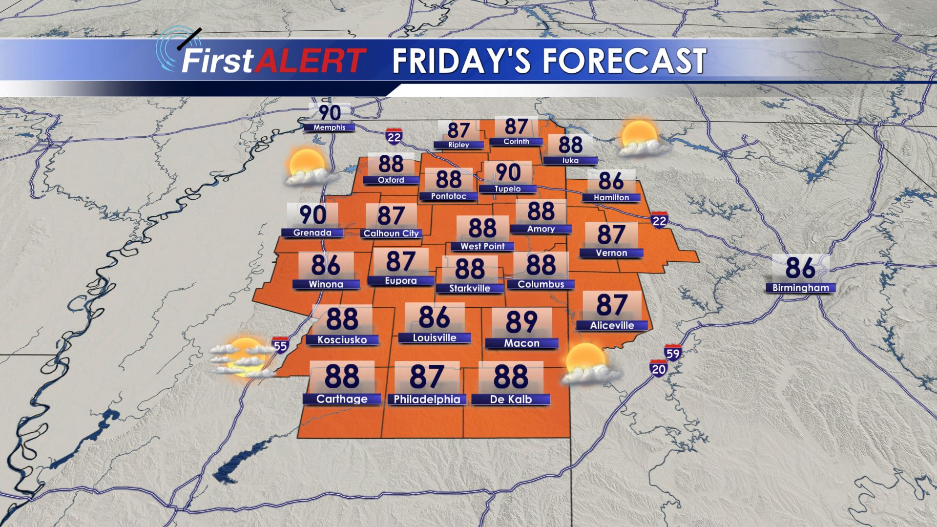
Friday’s Forecast
TODAY: Mostly sunny to partly cloudy with temperatures in the upper 80s to near 90. Look for southeast winds 5-10 mph, perhaps a little higher at times. It will be perfect for Friday Night football with temperatures cooling into the 70s.
TONIGHT: Mostly clear and cool with lows down into the low 60s. Look for light southeast winds 3-7 mph.
THIS WEEKEND: Abundant sunshine with a few clouds are expected. Look for highs in the upper 80s to low 90s for the last week of summer. Lows at night fall into the 60s. College football will remain dry, but it will be warm and sunny during the afternoon games.
MONDAY – TUESDAY: We’re watching for another frontal boundary to fall in from the north. It would likely stall out over parts of our area, but it may be starved of moisture, meaning that for now we’ll mark it with isolated showers. The best odds for any showers would be north of US 278. Highs are back in the upper 80s and low 90s. Fall begins Monday morning at 2:50 a.m. CDT.
WEDNESDAY – NEXT WEEKEND: Longer term trends continue to point to drier and warmer weather sticking around, likely carrying into October. This time of year is our driest time of the year,
TROPICS: Humberto has successfully undergone post-tropical transition. It’s remnants continue to race to the north and east. Jerry is now a category 2 hurricane and will carry itself to the north and east soon, turning away from the mainland coast. Imelda is no longer with us, its remnants left a big mess across parts of Southeast Texas. And then 3 other areas in the Atlantic must be monitored for development. No impacts to the lower 48 are expected over at least the next 5 days.
Stay connected with @WCBIWEATHER on Facebook, Twitter, and Instagram


Leave a Reply