Rain Later Today, Bitter Cold Air May Bring A Light Wintry Mix Tonight
WATCH THE LATEST WEBCAST VIDEO HERE.
TODAY: We’ll start mostly clear to partly cloudy, but clouds increase during the day. Look for south winds 5-10 mph with temperatures climbing into the 60s by the late morning and early afternoon hours.
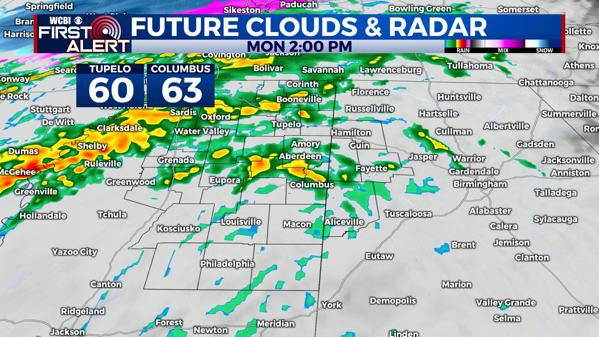
Showers start by the afternoon and build into the evening hours along a strong arctic cold front. As the front passes, you’ll notice a quick drop between 10-20° in temperatures with strong north winds 10-25 mph with gusts even higher. Temperatures will plummet quickly, falling into the 20s and 30s by the evening hours.
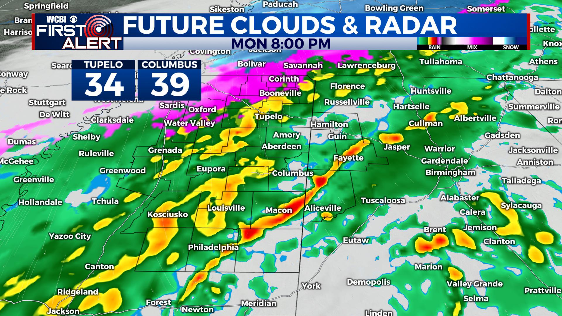
TONIGHT: Temperatures will continue to plummet with showers around. We’ll keep strong north winds 10-25 mph with higher gusts. Look for a quick changeover in a few spots to see some ice pellets or even a few flakes. With strong winds and a warm ground, no sticking will occur at the surface, though a few elevated places towards the Tennessee State Line could see some sticking, such as on cars and roofs. NO IMPACTS WILL OCCUR IN OUR REGION. WE DO NOT ANTICIPATE ANY ACCUMULATION BASED ON A WARM SURFACE AND GUSTY WINDS DRYING ANY MOISTURE OUT.
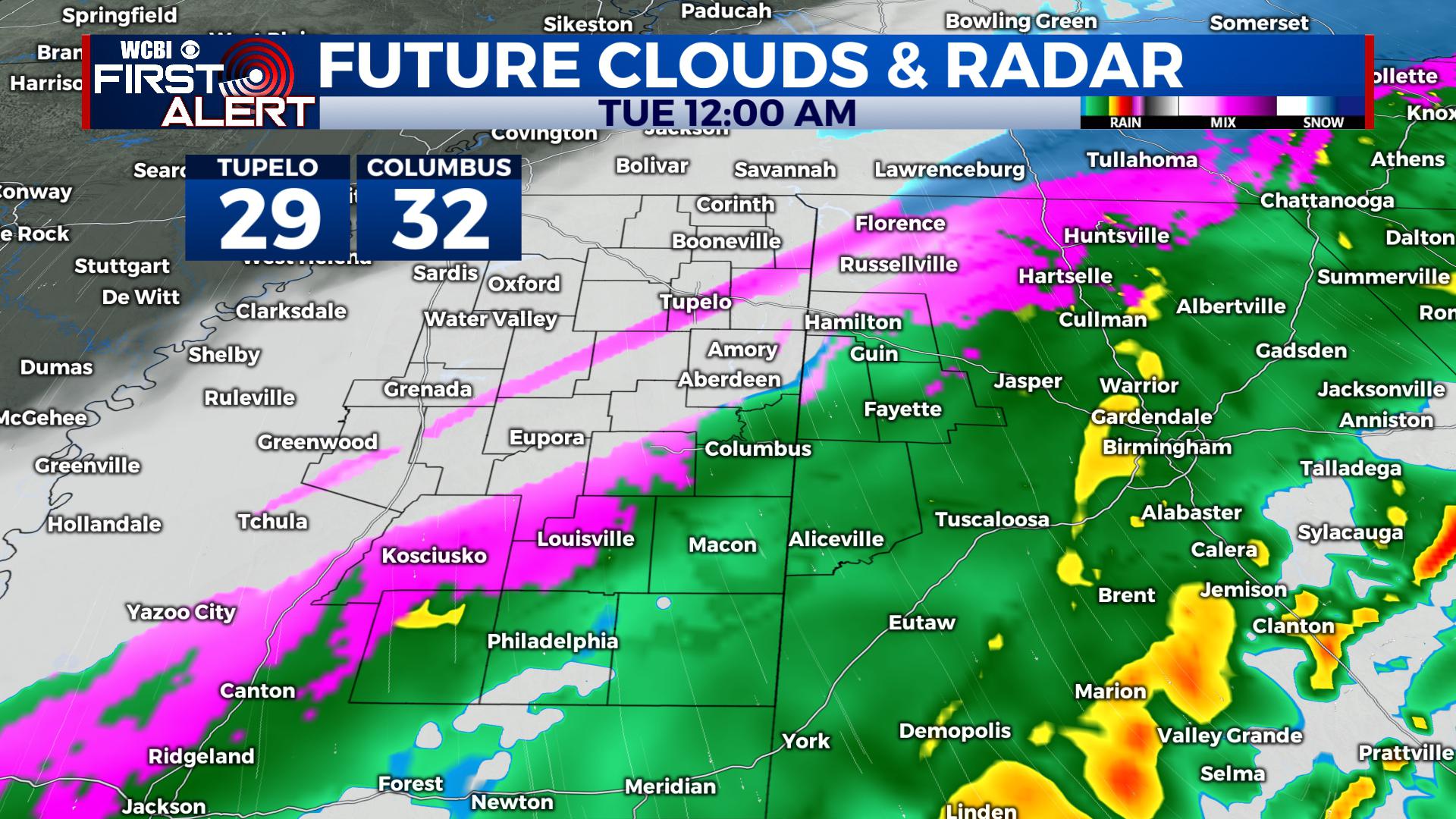
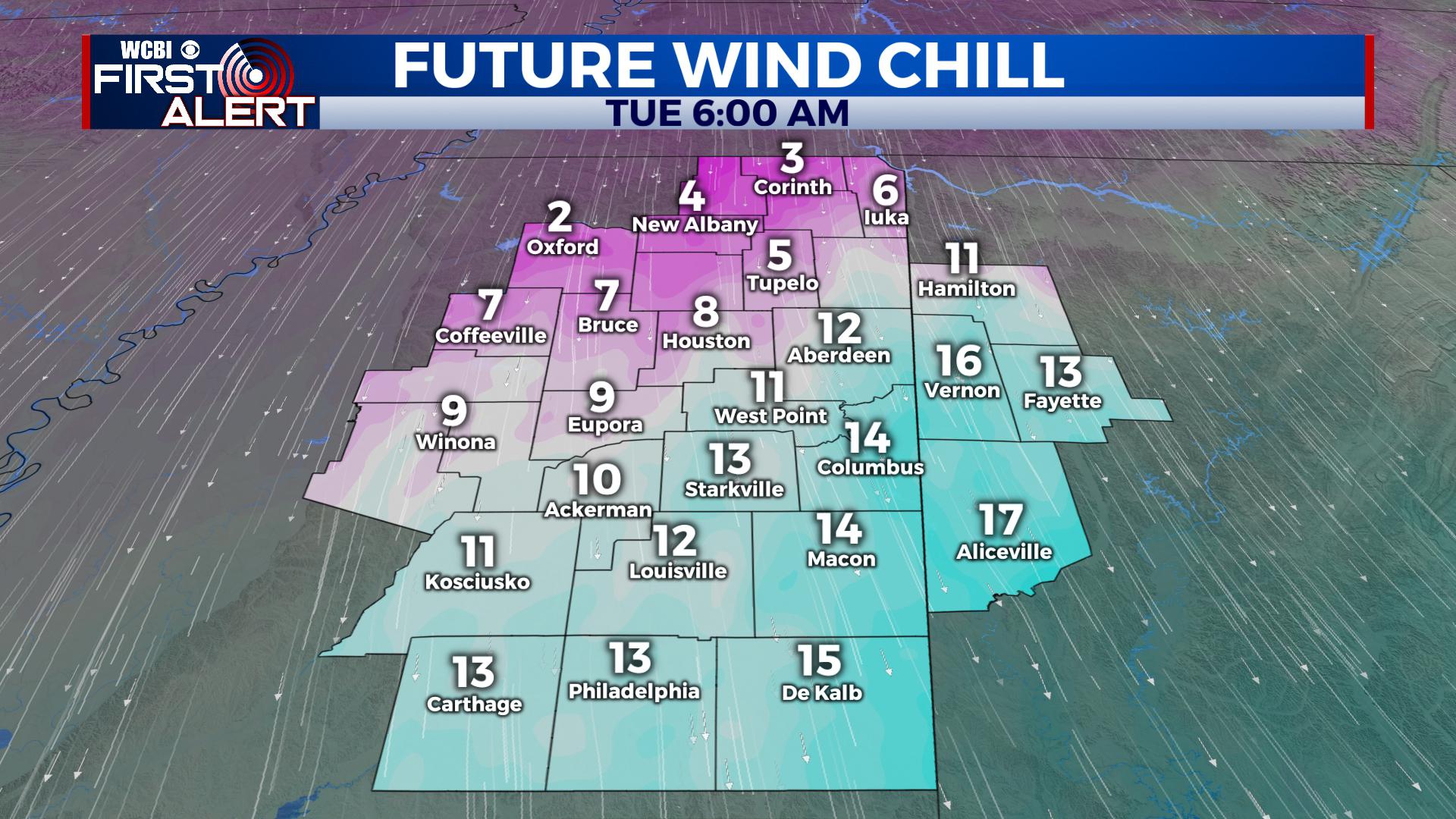
TOMORROW: Look for a bitter cold start to the day. We’ll start in the 20s and low 30s with wind chill values in the single digits and teens out the door Tuesday Morning. Any moisture will move out by the morning hours with the sunshine returning. Winds remain out of the north 10-25 mph, keeping it feeling bitter cold. Highs are expected to only be in the 30s in the region. Roads will be just fine and school will be in session. Lows Tuesday Night fall into the low 20s and upper teens.
WEDNESDAY: We’ll likely start the day with some broken record low temperatures. By the afternoon, winds should start to relax and highs climb into the upper 40s with a few possibly hitting 50. Look for lots of sunshine during the day. Lows are back into the 20s and 30s Wednesday Night.
THURSDAY – WEEKEND: We’ll slowly warm up into the 50s and 60s by the weekend with a mostly sunny sky. Overall, it will still be cooler than average, but fairly pleasant by Saturday and Sunday.
Follow WCBI Weather on Facebook, Twitter, and Instagram and download the WCBI Mobile App for the First Alert Forecast at your fingertips 24/7.


Leave a Reply