Rain Showers Arrive Today, Some Snow Flurries by Tomorrow Afternoon
WATCH THE LATEST WEBCAST DISCUSSION UPDATE HERE.
MONDAY: Look for a mostly cloudy to overcast sky. Temperatures will rise into the mid to upper 60s with breezy south winds 10-20 mph. There will be a few sprinkles in the morning, with the chance for more showers into the afternoon and especially evening in the region.
MONDAY NIGHT: Areas of rain will continue to develop as the cold front passes through. Temperatures will hold in the 60s until the front passes. Once it does, we’ll see a shift in winds to the north and west 5-15 mph, with falling temperatures the rest of the night. Look for an overcast sky.
TUESDAY: Temperatures will fall through the day with north and west winds 5-15 mph. Look for areas of rain to continue. Some snow flurries will mix in by Tuesday Afternoon from north to south, with rain and snow ending by Tuesday Night.
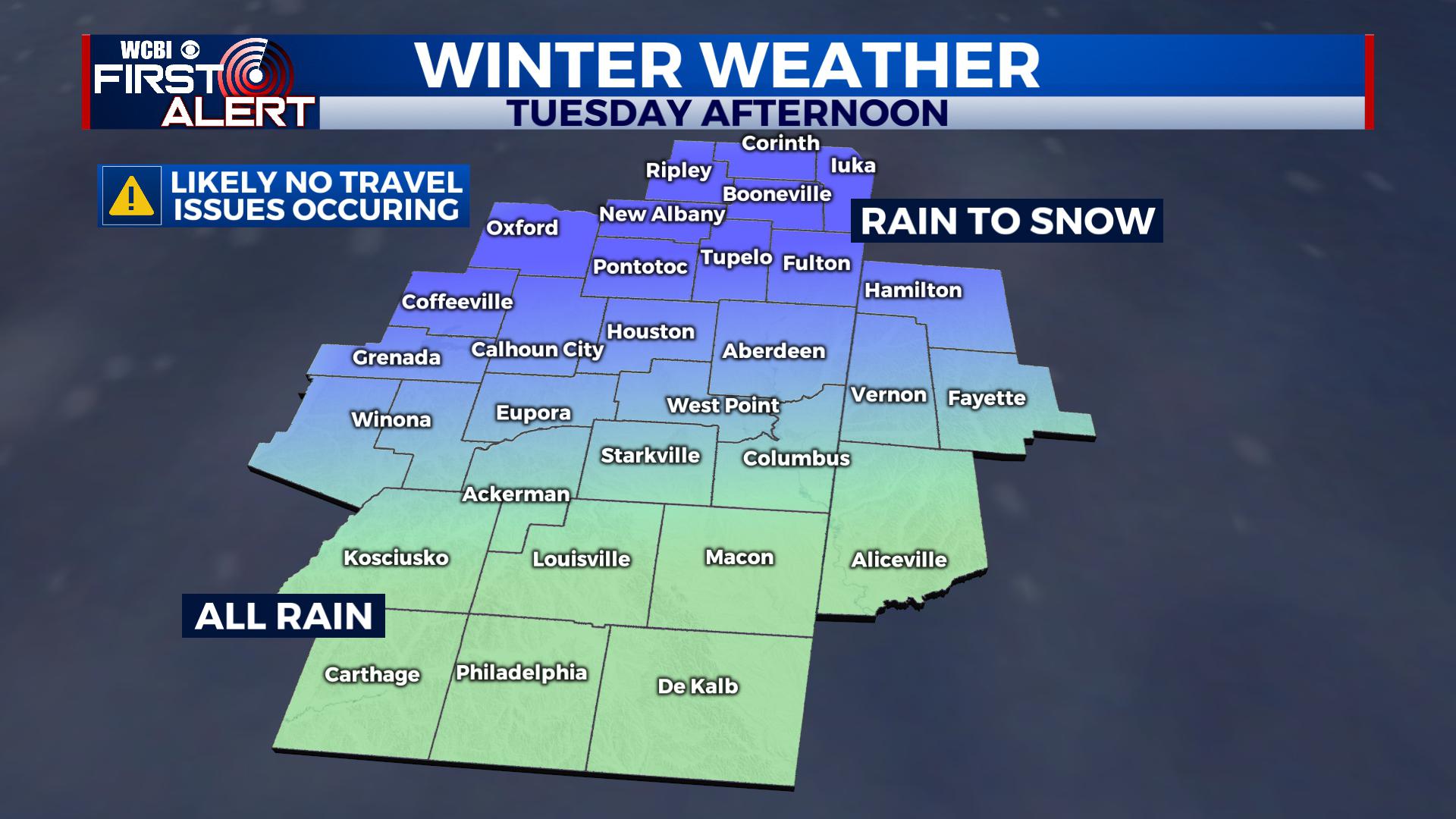
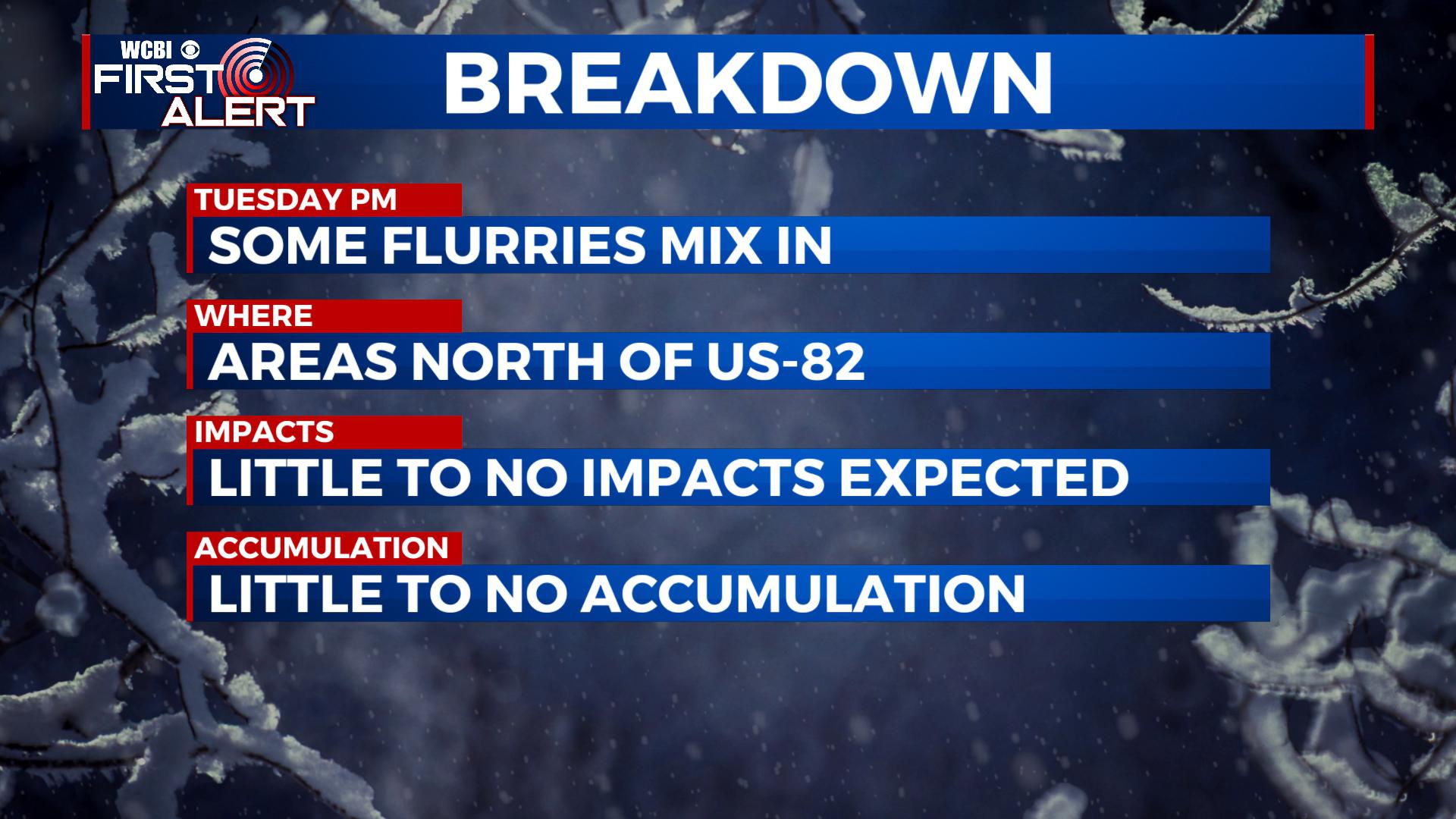
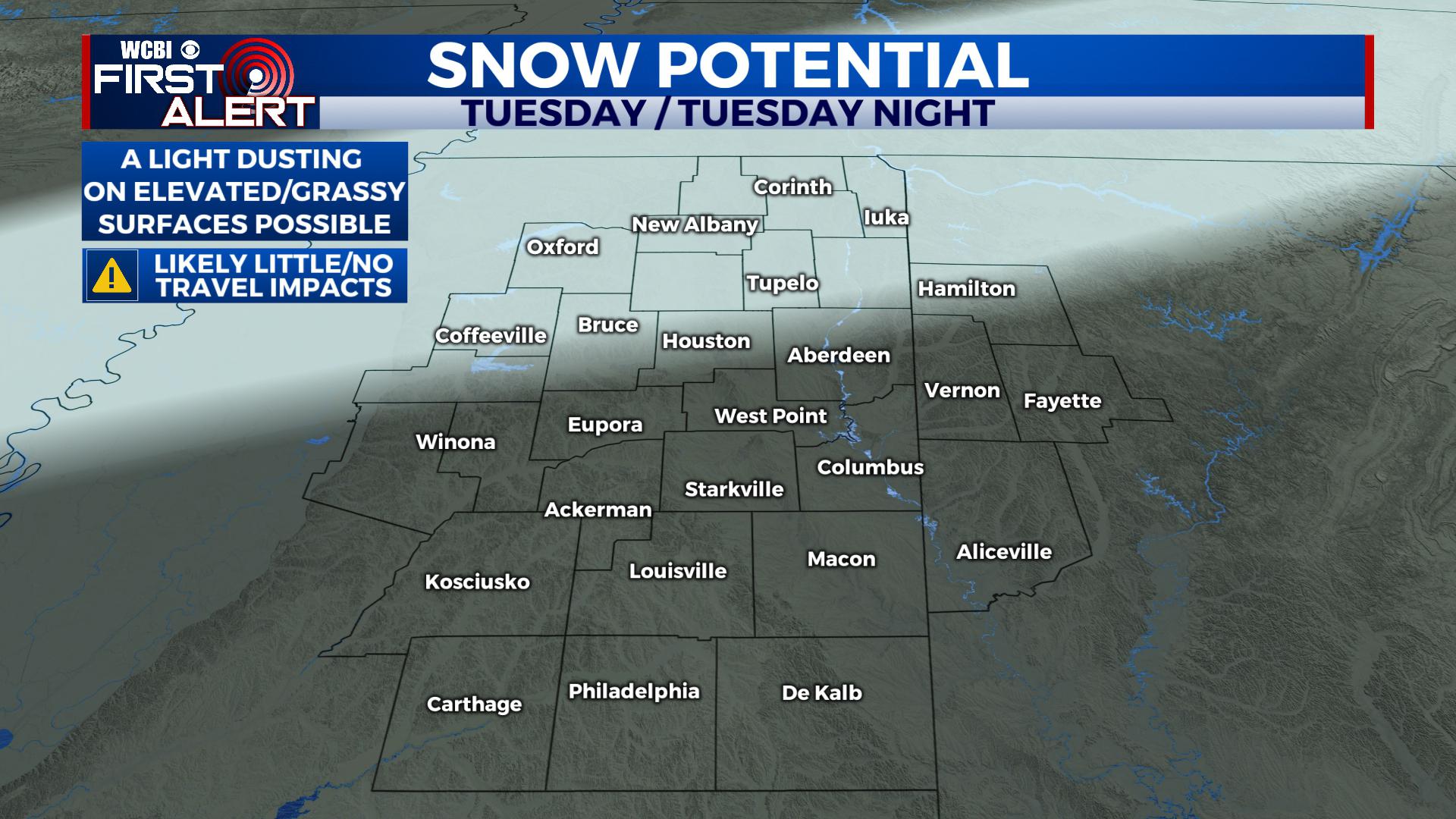
No major travel impacts will occur, and little to no accumulation is expected. Road temperatures will stay warm enough and breezy north winds will help dry off surfaces to keep snow from sticking and causing problems, but some light accumulation can’t be ruled out on elevated surfaces like outbuildings, on top of cars and on grassy surfaces. We’ll keep our eyes on bridges and some rural roads, particularly close to the Tennessee State line to see what happens, but we still think they should overall be fine. Major roads won’t have any issues from this. Along and south of US-82 will likely miss out on any flurries in the area.
TUESDAY NIGHT: Rain/Snow will taper off into the night with north and west winds continuing. Look for lows down in the upper 20s and low 30s, though at this time there really are no major concerns for travel issues on Wednesday morning for work/school.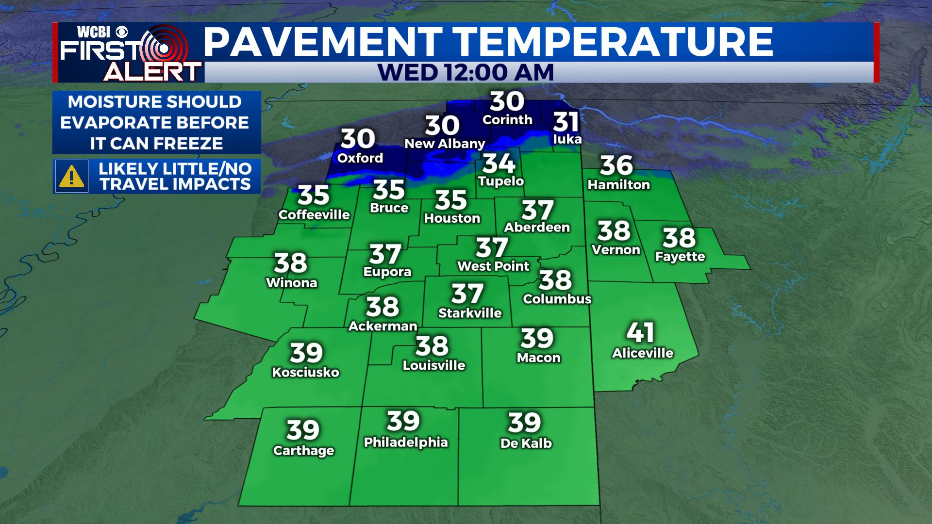
WEDNESDAY: Any sticking of snow that is left will quickly disappear as highs climb back into the mid to upper 40s with some sunshine mixing back in. Lows fall into the low to mid 30s Wednesday Night.
THURSDAY: With a mix of sun and clouds, highs climb back into the upper 40s and low 50s. Lows fall into the mid to upper 30s.
FRIDAY / SATURDAY: Highs will be back into the middle 50s with the chance for some showers rolling on in. Look for a mix of sun and clouds during the period. Lows at night are in the upper 30s to mid 40s.
SUNDAY / EARLY NEXT WEEK: We’d anticipate a few dry days with a mix of sun and clouds as temperatures climb into the upper 50s and low 60s.
STAY WITH @WCBIWEATHER ON FACEBOOK, TWITTER, INSTAGRAM AND ON THE WCBI MOBILE APP.


Leave a Reply