Severe Storms Expected Later This Afternoon
WATCH THE LATEST WEBCAST DISCUSSION HERE
BUILD A SAFETY PLAN AND FIND LOCAL COMMUNITY SHELTERS HERE
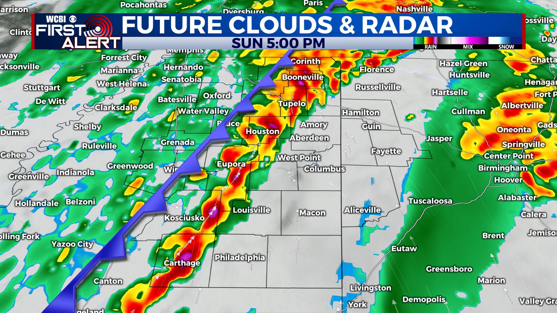
THIS AFTERNOON: A cold front looks to slide across the area starting Sunday morning into the afternoon and evening Along the front, showers and thunderstorms are anticipated, approaching I-55 around lunchtime and pushing to the east through the afternoon and evening. A few of these storms will have the potential for damaging winds and a couple of tornadoes today. Timing remains until 8PM, but could be extended just a touch depending on how quickly the front moves through.
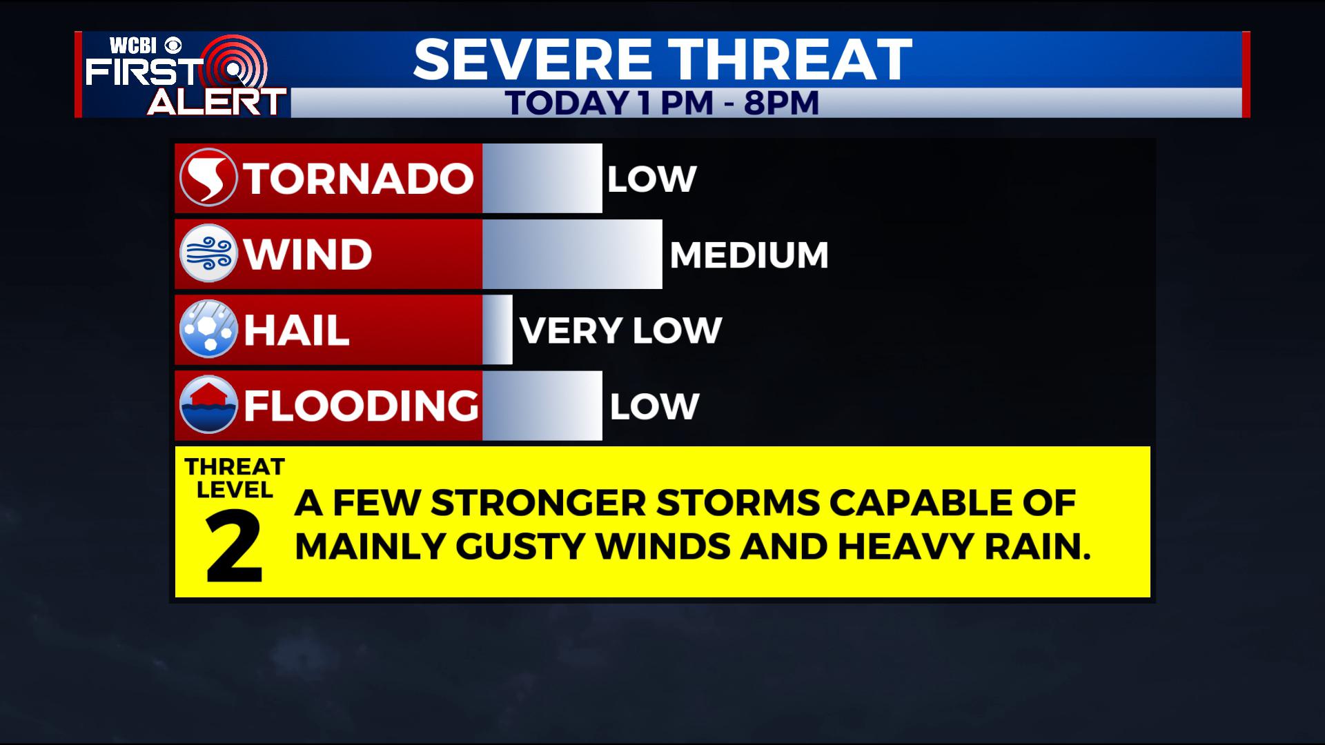
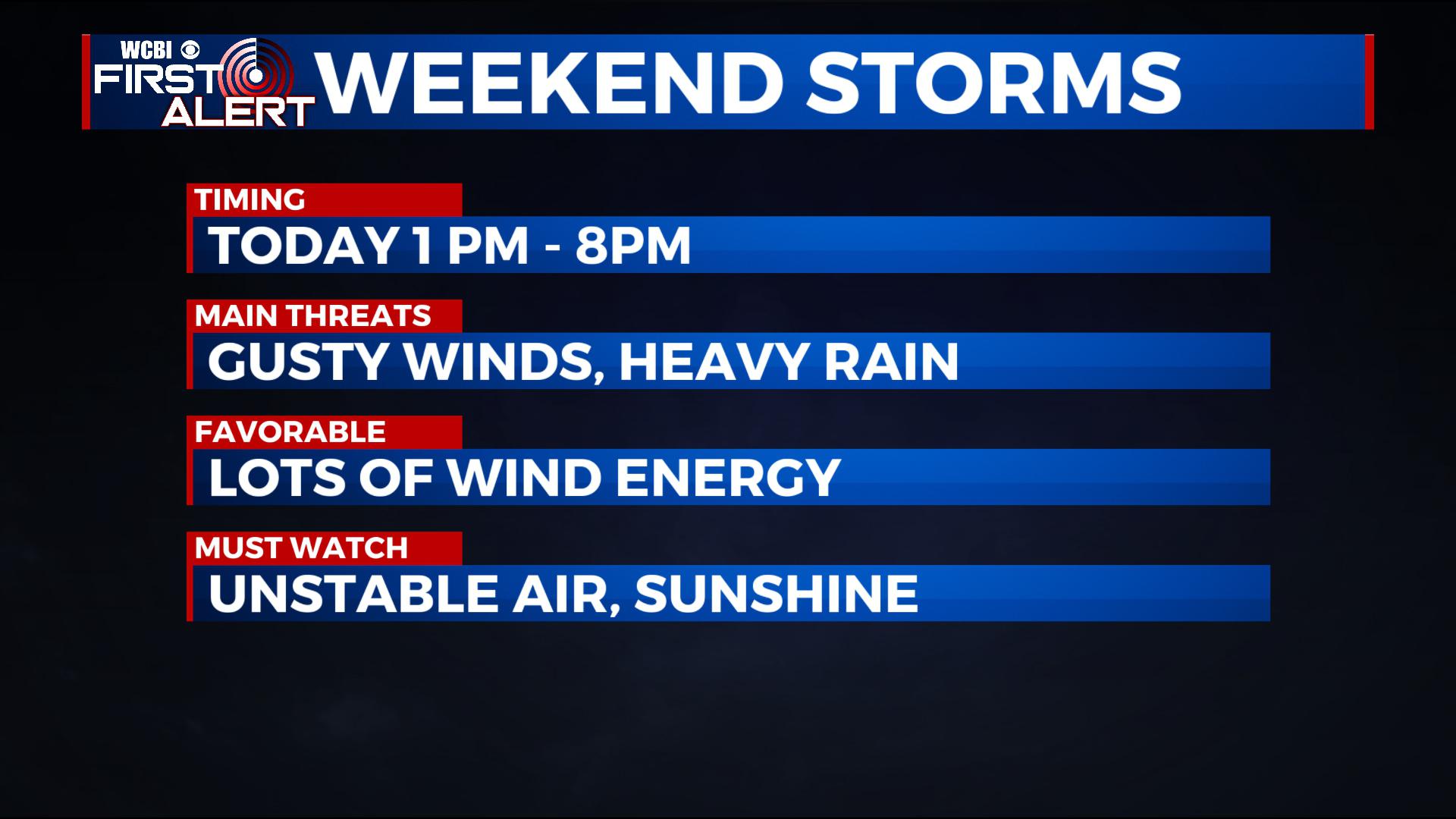
With a later trend recently into the afternoon and evening, we anticipate better instability which brings up our threat a bit, particularly east of the Natchez Trace during the afternoon and evening hours. That instability would couple with lots of wind energy will be monitored closely, as confidence is increasing of this occurring.
TONIGHT: Once the front passes, temperatures start dropping with lingering showers. Sunday Night, lows fall into the mid to upper 30s, with a few remaining in the low 40s. We’ll likely be under a mostly clear sky by morning with breezy west winds 10-25 mph.
MONDAY – WEDNESDAY: Look for lots of sunshine with highs more seasonal in the low to mid 50s. Lows at night are down into the 30s. Monday will be a bit breezy with west and northwest winds, but things trend calmer by Monday Night. By Wednesday, clouds will build back in the region, but rain would hold off until after sunset.
THURSDAY – FRIDAY: We’ll watch for another area of low pressure to move in from the south. This could be another heavy rain and strong storm producer in the area, though timing and impacts still remain uncertain. Right now, the best chance for rain and storms would be on Thursday, with some lingering areas of rain into Friday.
NEXT WEEKEND: We’d anticipate things to remain quiet and mild, but a burst of arctic air looks to swing our way by early next week. We’ll monitor.
STAY WITH @WCBIWEATHER ON FACEBOOK, INSTAGRAM, TWITTER AND ON THE WCBI MOBILE APP.


Leave a Reply