Lingering showers Friday followed by a nice weekend
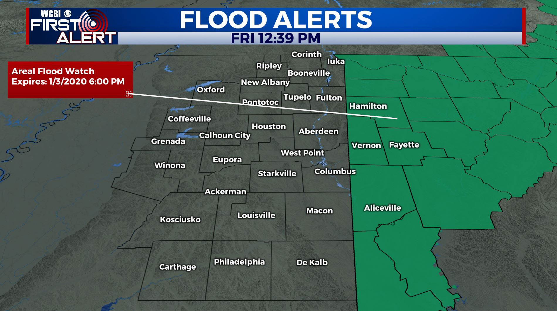
SUMMARY: An Areal Flood Watch remains in effect for our western Alabama counties through 6 pm Friday. Lingering rain showers will continue through the day on Friday before rain exits by the evening. Many spots will see nearly 3-4 inches of rainfall by the time this is over. The first weekend of 2020 is looking sunny and cooler. Some rain chances are in the forecast next week.
FRIDAY: Cloudy skies with lingering showers as cold front pushes through, cooling us down for the weekend. Mild with highs in the low 60s. SW winds 5-10 mph.
FRIDAY NIGHT: Mostly cloudy skies. Lows near 40. Winds will switch up to the NW 5-10 mph.
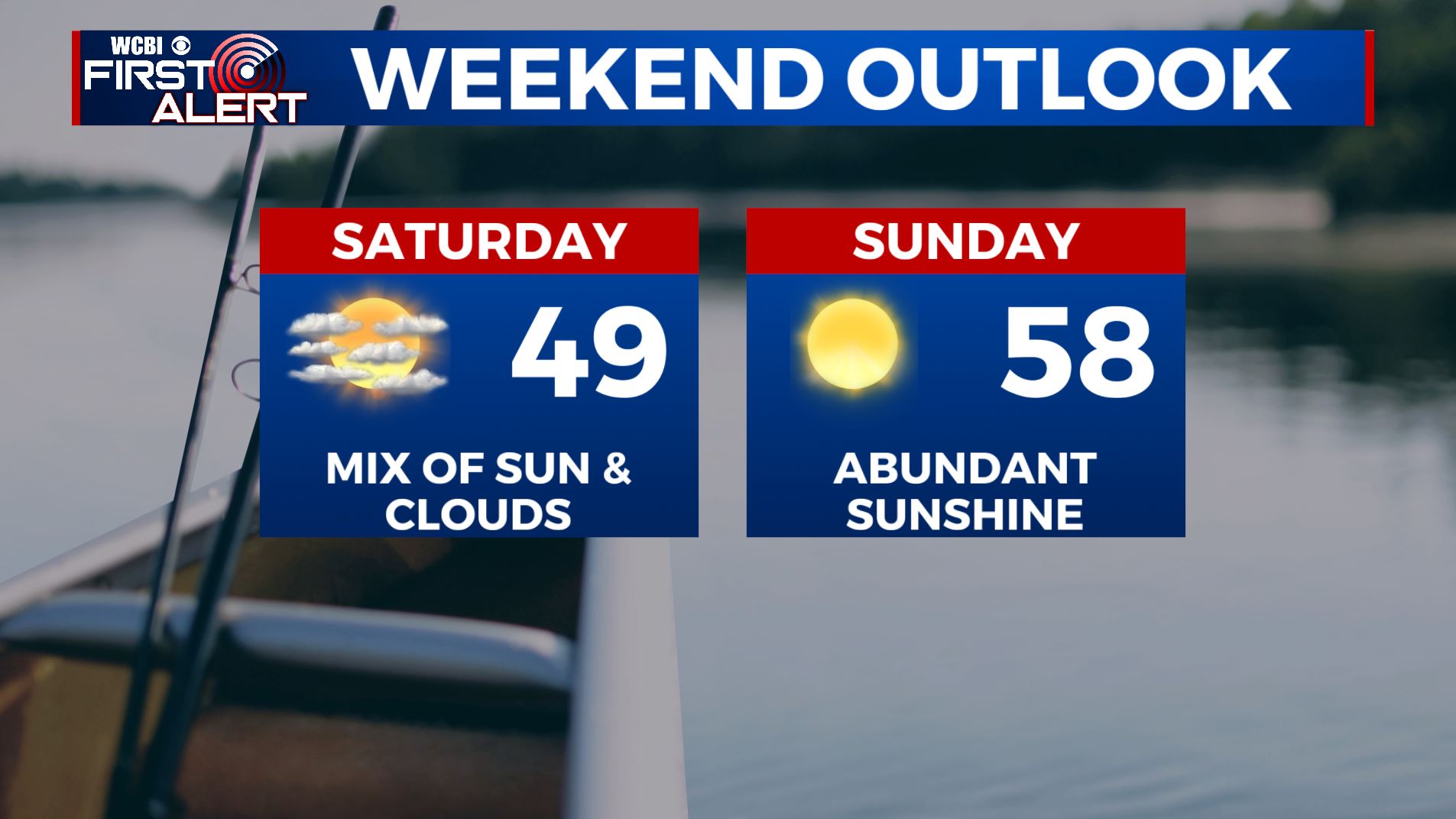
SATURDAY: Clouds will start to break up on Saturday and we’ll see more sunshine by the afternoon. Highs will be a few degrees below average Saturday in the upper 40s with a brisk NW wind 10-20 mph. Overnight lows chilly in the lower 30s.
SUNDAY: We’ll have a lot of sunshine. Highs back up into the mid to upper 50s. Overnight lows in the mid 30s.
MONDAY: A mostly sunny start to the new work week as many of us return back to work & school from holiday break. Highs in the upper 50s.
TUESDAY: A mix of sun and clouds with possible rain chance. Highs in the mid 50s.
WEDNESDAY: Mostly sunny skies. Highs in the mid 50s.
THURSDAY: Increasing clouds with a slight chance of rain. Highs in the mid 50s.
STAY WITH @WCBIWEATHER ON FACEBOOK, INSTAGRAM, TWITTER AND ON THE WCBI MOBILE APP.


Leave a Reply