Rain Showers as Early As Tomorrow Night, Severe Weather on Saturday Morning
TONIGHT: Look for a mostly clear sky to start with south and east winds 3-8 mph. By the morning, we’ll see some cloud cover work its way in. Lows fall into the upper 30s and low 40s.
THURSDAY: Look for a mostly cloudy sky and temperatures rising into the low 60s. Winds will be out of the south, perhaps a bit breezy at times. Showers work in after sunset Thursday into Thursday Night, but the bulk of the rain holds off until later.
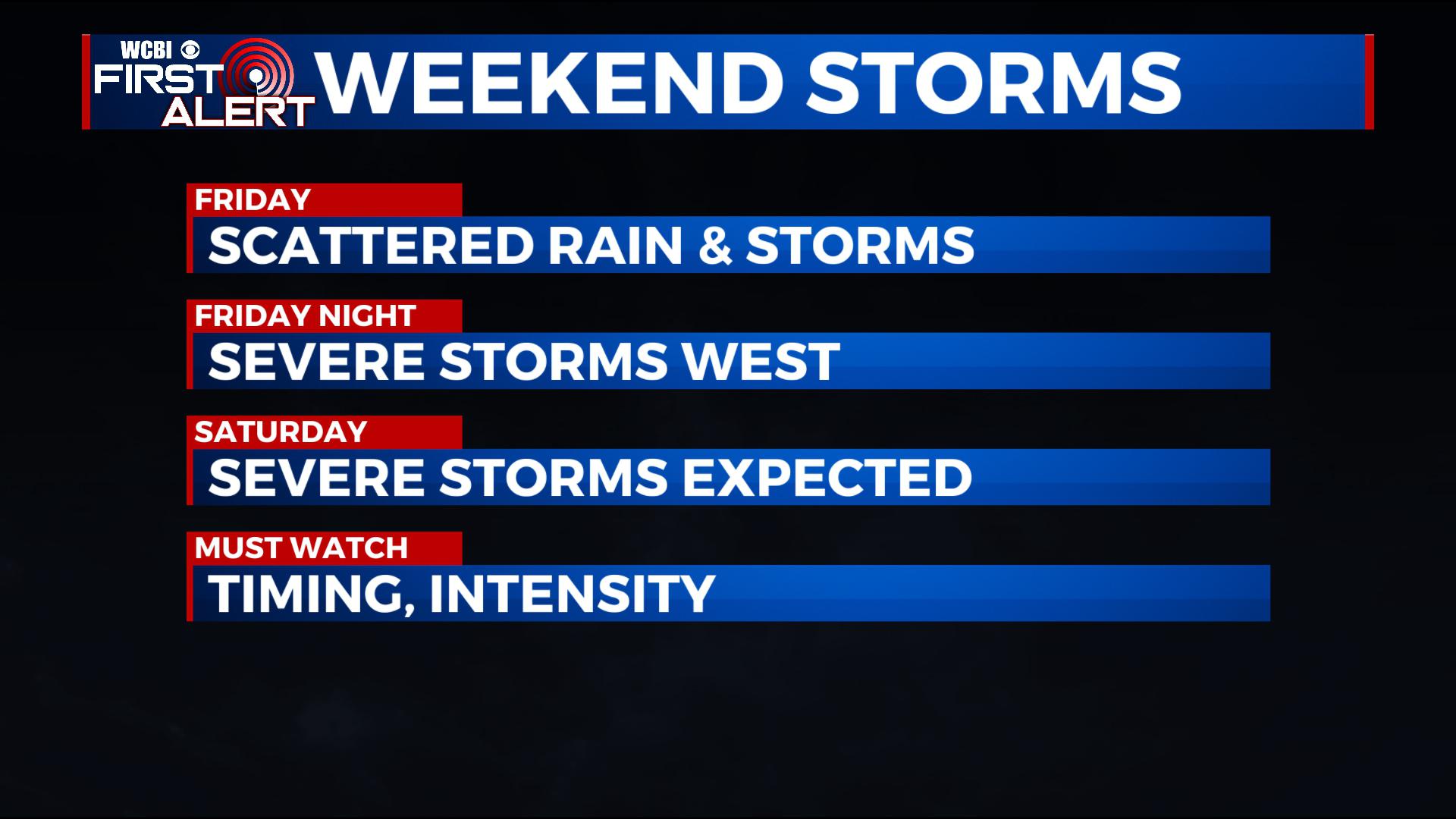
FRIDAY: We’ll see temperatures rising into the upper 60s and low 70s with breezy south and east winds likely. Look for a mostly cloudy day with some scattered showers and storms, though it looks like we’ll hold off on strong storms in the area during the day. Aline of storms will build out to our west and approach us and bring us the chance for storms as early as late Friday Night, but more than likely into the daytime hours on Saturday.
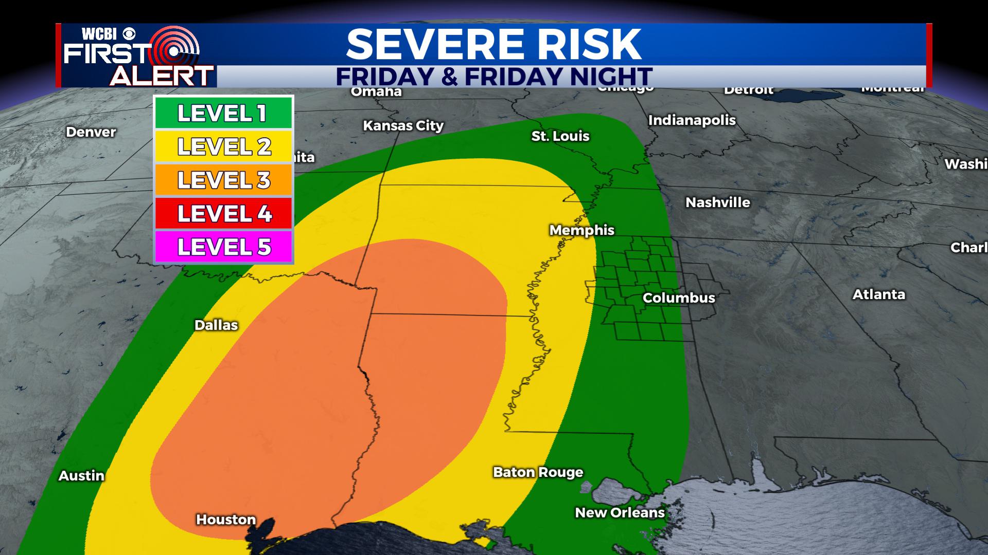 A level 3 risk covers areas to our west. We’ll stay quiet during the daytime but could see storms approach as early as late Friday Night.
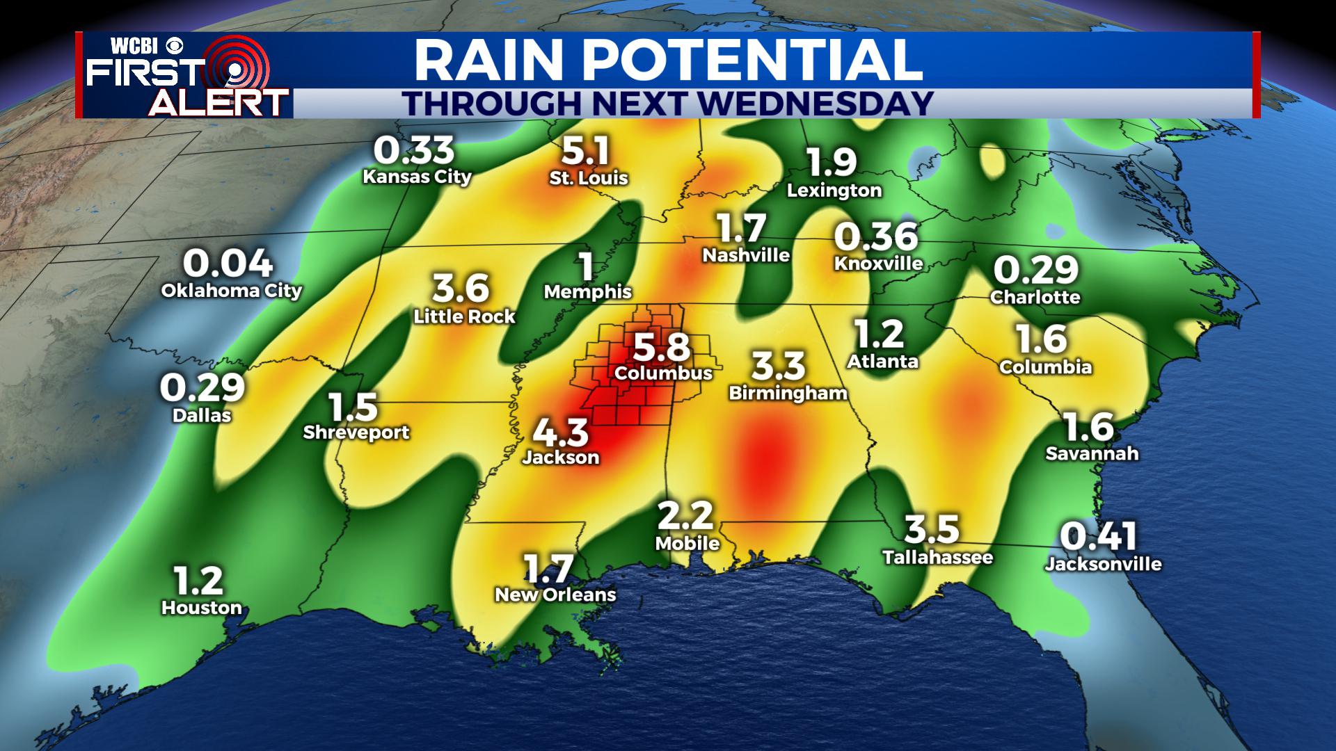
SATURDAY: A line of strong to severe storms approaches the area early Saturday Morning. Everyone is expected to see rain and storms, with the potential there for severe weather across the weekend. As of now, we still have a level 3 risk for the area. The main threats will be damaging winds as high as 70 mph and flooding rains, though a few tornadoes look probable embedded in a line of storms. We’ll have to watch and see if any isolated storms form ahead of the line, something that would enhance the severe potential even higher. Timing looks to be from 3AM to 3PM, with prime-time from 6AM to 12PM.
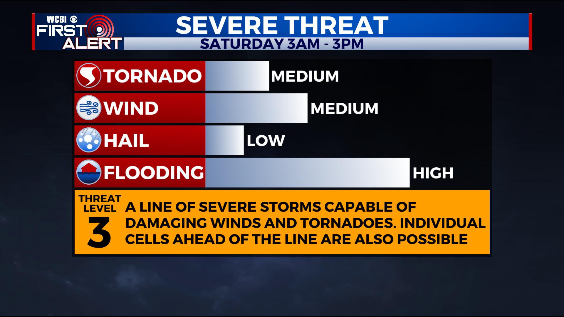
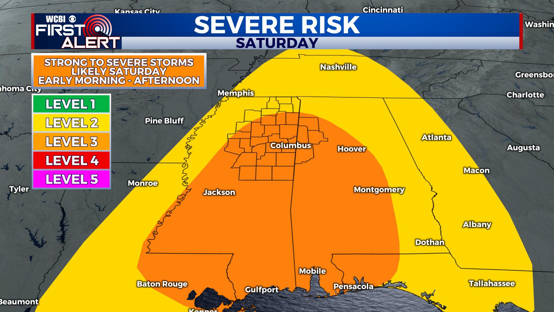
Our area is under a level 3 risk for severe storms on Saturday. All modes of severe weather are possible.
SUNDAY: Right now we anticipate storms to roll out of the area by Saturday Night meaning we’ll trend dry with a mix of sun and clouds on Sunday. A few showers can’t be ruled out before sunrise with highs in the upper 50s and low 60s. Some more showers are expected heading into late Sunday night.
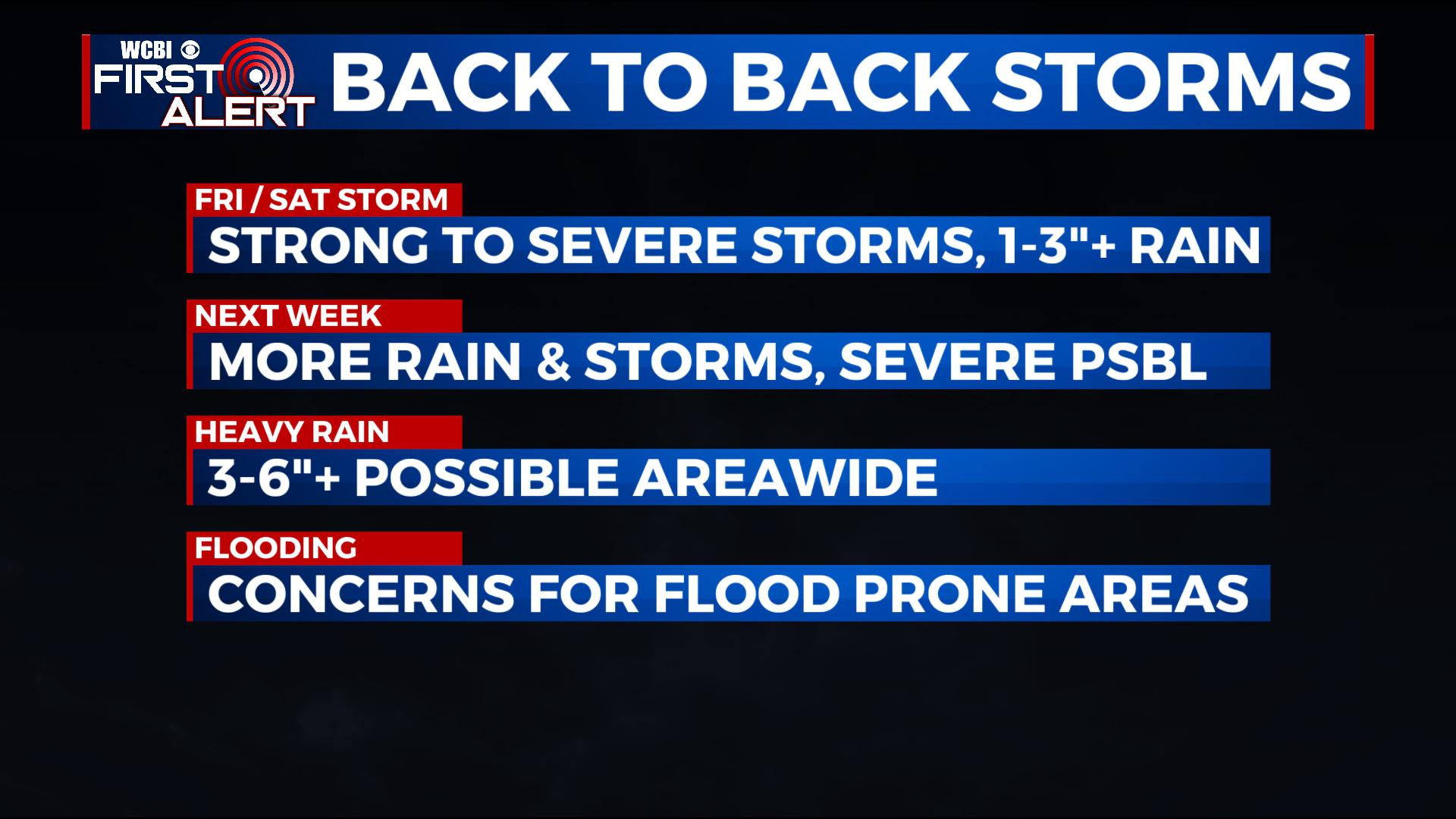
MONDAY – WEDNESDAY: Another system looks to follow closely behind, bringing the chance for batches of storms to pass through the area, adding on to already high rainfall totals. Flooding will be a concern moving forth, and we can’t rule out severe weather at some point heading into next week.
STAY WITH @WCBIWEATHER FOR THE LATEST ON FACEBOOK, INSTAGRAM, TWITTER AND ON THE WCBI MOBILE APP.


Leave a Reply