A Warm and Soggy Week Ahead
MONDAY: Clouds build in through the day from south to north. Look for an overall mostly cloudy sky with showers and a few thunderstorms. Some storms could have some small hail, but the severe threat is low. Look for variable winds around 5 mph through the day. Temperatures remain in the 60s.
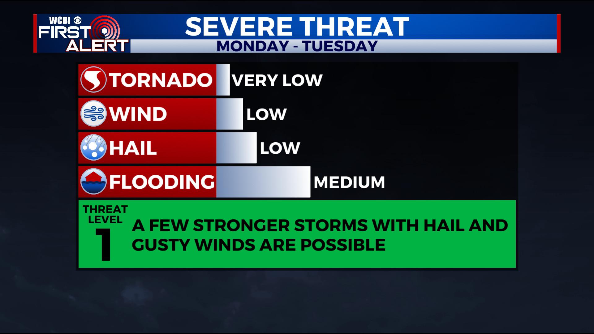
MONDAY NIGHT: Showers with a few storms continue. Hail remains possible with any stronger storm, but the severe threat is low. Winds remain light and variable under a mostly cloudy sky.
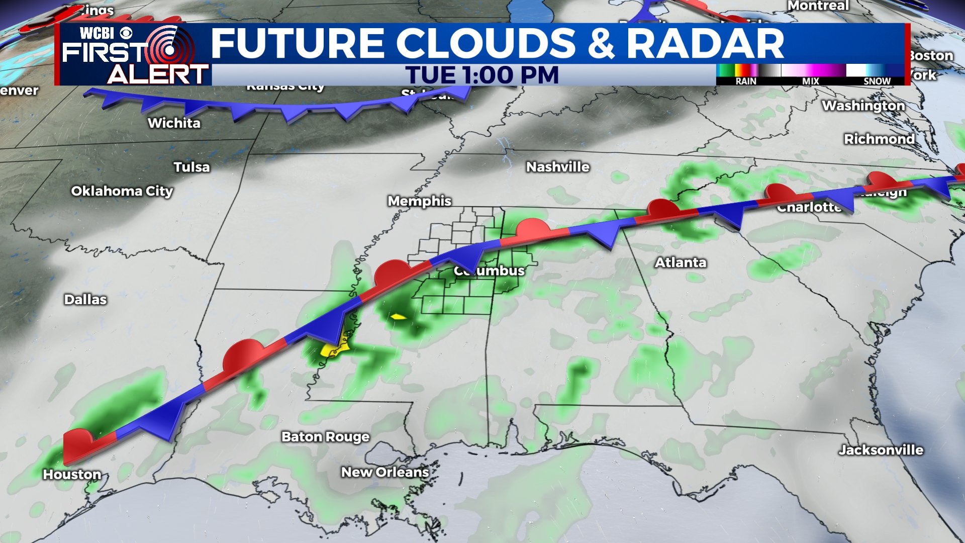
TUESDAY – WEDNESDAY: Several rounds of rain and storms continue Tuesday and Wednesday. While this won’t be a steady all-day rain, we think everyone will see at least some rain each day. There’s a small window of opportunity for some storms to have some hail and perhaps some breezy winds, but the overall severe threat is low. Highs will be in the low 70s with morning lows in the 60s.
THURSDAY – FRIDAY: Chances for rain continue through the end of the week with highs in the mid to upper 60s. Again, this won’t be an all-day rain situation, but more off-and-on.
SATURDAY: More chances for showers and storms return to the area with highs in the low 60s. It’s too early to pin down specifics, but we’ll continue to fine-tune the forecast. For now, plan for rain and storms through the day.
SUNDAY: We’ll finally dry out for Sunday as we see a mix of sun and clouds. Temperatures will be much cooler with morning lows in the 30s and highs only in the upper 40s and low 50s.
EXTENDED OUTLOOK: Next week brings us a much needed pattern flip back to winter! This change looks to deliver cooler than average air, meaning highs some days may only be in the 40s and 50s, with lows in the 20s and 30s! Stay tuned, we’ll keep you updated!


Leave a Reply