Heavy Rain Continues in the Region
FLASH FLOOD WATCH UNTIL WEDNESDAY NIGHT. RIVER FLOOD WARNINGS CONTINUE. Get the latest alerts on your WCBI Mobile App.
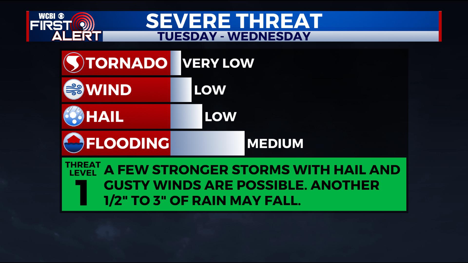
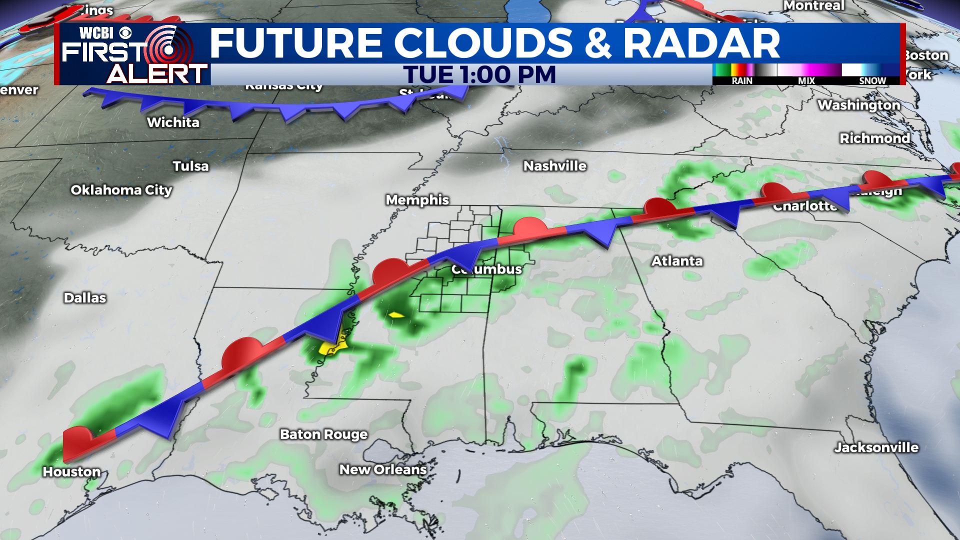
TUESDAY: Rain and storms continue through the region. Some storms may be strong with hail up to the size of quarters and heavy downpours, but that’s it. Look for 1-2″ of rain in the region with locally higher amounts likely. Highs climb into the upper 60s and low 70s with a mostly cloudy sky. Look for some areas of patchy fog.
 TUESDAY NIGHT: More scattered showers and thunderstorms are anticipated, adding to already high rainfall totals. Lows fall only into the 60s. Look for areas of fog and a mostly cloudy sky. A stronger storm with some hail and heavy downpours can’t be ruled out.
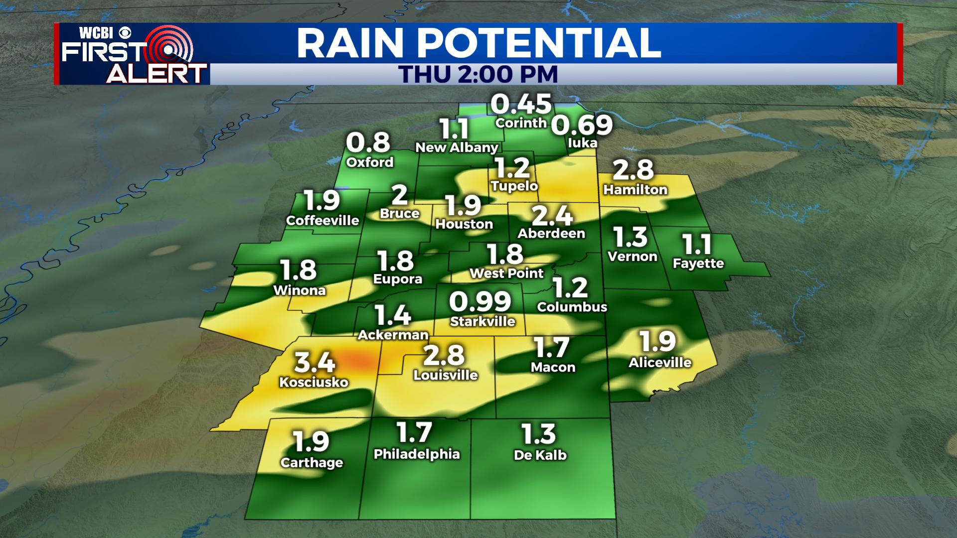
WEDNESDAY: More batches of rain and storms push through the region. Look for highs to climb into the 70s in the region with a mostly cloudy sky. Areas of fog are also expected. A stronger storm with hail and heavy downpours can’t be ruled out. Another 1-2″ of rain are expected.
THURSDAY – FRIDAY: A few scattered showers are possible, but we think a cold front may clear through the area, bringing a reprieve from the rounds of heavy rain and storms. Highs are a bit cooler in the upper 50s to mid 60s with a mostly cloudy sky.
SATURDAY: More chances for showers and storms return to the area with highs in the upper 60s to near 70. Some strong storms are possible, but that is still a bit uncertain this far out. Regardless, a strong cold front will push through by Saturday Night bringing an end to the rainy and warm pattern. Lows Saturday Night fall into the low 30s with a clearing sky.
SUNDAY – MONDAY: We’ll finally dry out for Sunday as we see a mix of sun and clouds. Temperatures will be much cooler with morning lows in the upper 20s and low 30s and highs only in the mid 40s to low 50s.
EXTENDED OUTLOOK: Next week continues to show us having a much needed pattern flip back to winter! This change looks to deliver cooler than average air, meaning highs some days may only be in the 40s and 50s, with lows in the 20s and 30s for an extended period of time. This pattern would also bring some sunshine back into the region! Stay tuned, we’ll keep you updated!


Leave a Reply