Widespread rain chances for Thursday
SUMMARY: A quick moving storm system will produce areas of rain in our region for our Thursday. Anywhere from a quarter of an inch to near one inch of rainfall is possible. The heaviest activity is more likely during the afternoon and evening. A weak system is expected pass through the Deep South on Sunday and there is an outside chance for a few showers on Sunday but we think the better rain chance will remain across southern Mississippi. Better rain chances move in midweek next week.
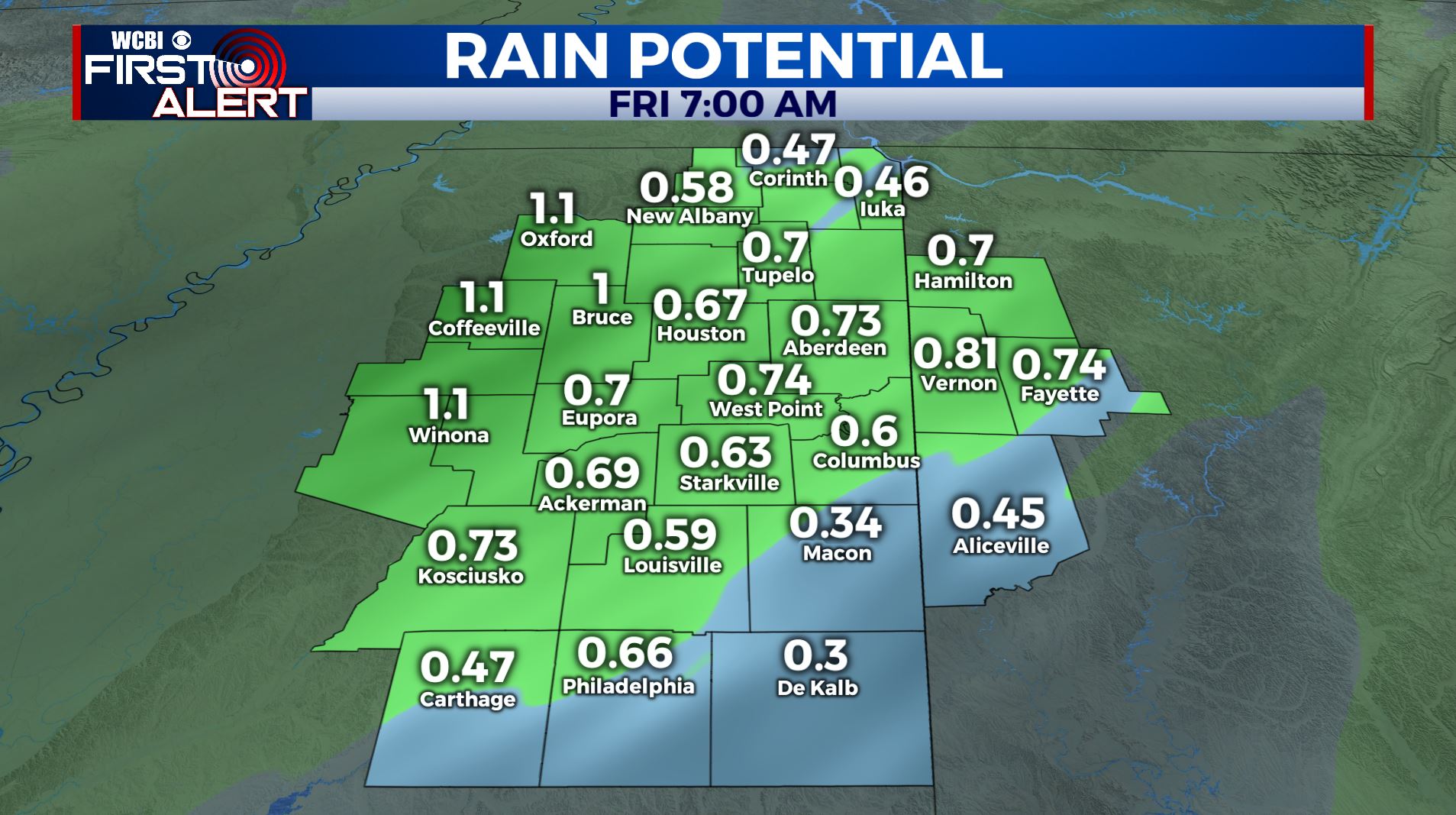
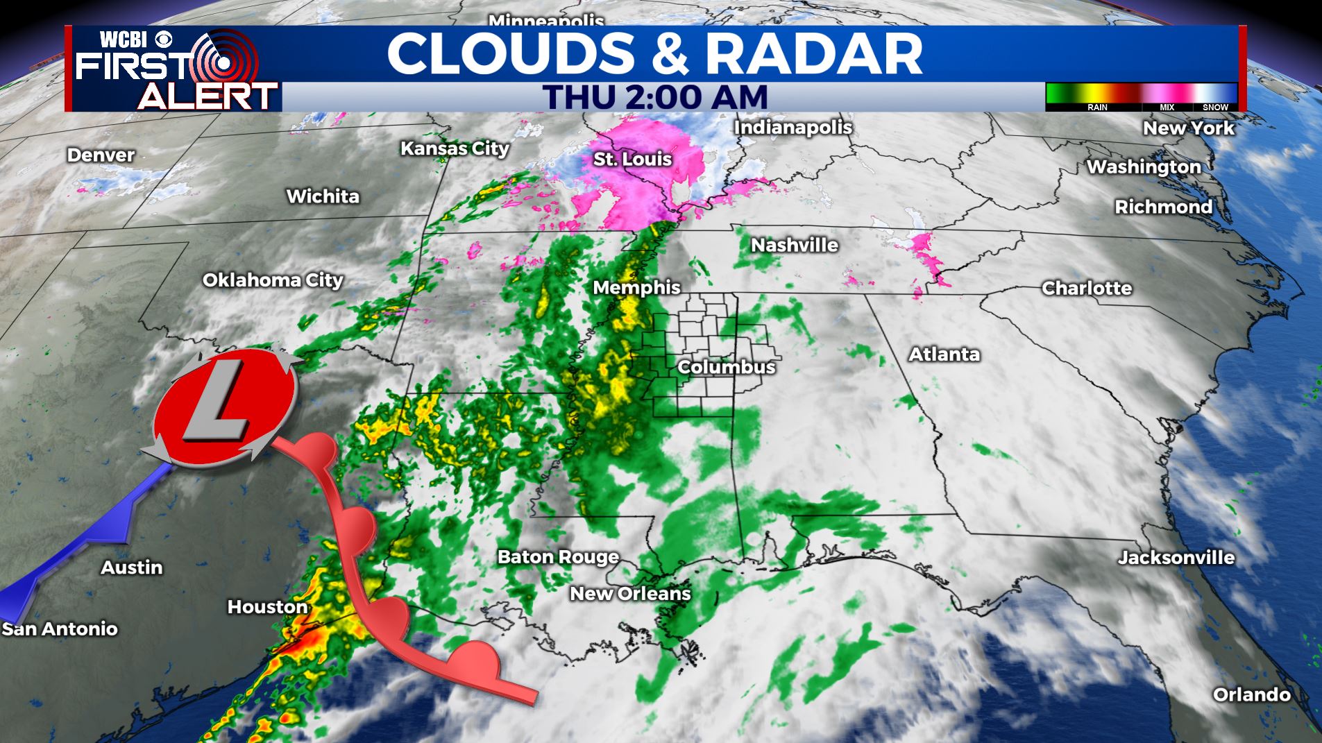
THURSDAY: Areas of widespread rain moves in during the morning, with moderate to heavier activity during the afternoon and evening hours. Highs below average & cool thanks to the cloud cover in the upper 40s. Winds SE 5 to 10 mph.
THURSDAY NIGHT: Cloudy with lingering rain showers. Lows near 40. SE winds light.
FRIDAY: Morning cloudy skies are possible but most of the day is looking dry & clearing up. Look for highs in the lower 50s with west winds 5-10 mph.
FRIDAY NIGHT: Mostly cloudy. Lows in the mid 30s.
SATURDAY: A mostly sunny and pleasant weekend is ahead with temperatures near average with highs in the mid 50s and overnight lows in the 30s.
SUNDAY: There’s a chance we could see a few scattered showers on Sunday as another system pushes through to our south with partly sunny skies. Highs in the mid 50s. Overnight lows near 40.
MONDAY & TUESDAY: A mix of sun and clouds. Highs warming up into the lower 60s by Tuesday with overnight lows moderating back into the lower 40s.
WEDNESDAY: More rain chances are possible. High temperatures remains in the lower 60s.
Stay connected with @WCBIWEATHER on Facebook, Twitter, Instagram and the WCBI News App


Leave a Reply