Tracking light scattered rain chances for Wednesday
SUMMARY: Light scattered rain showers return to the region for our Wednesday but rainfall amounts will be on the lighter side, mainly about less than a quarter of an inch. Our far southern counties could see about half of an inch. We’ll get a break on Thursday but a few more light showers are possible on Friday. The weekend continues to look great for us with more sunshine, especially on Sunday when temperatures may warm back up into the mid to upper 60s. More rain though is in the forecast for the first half of next week.
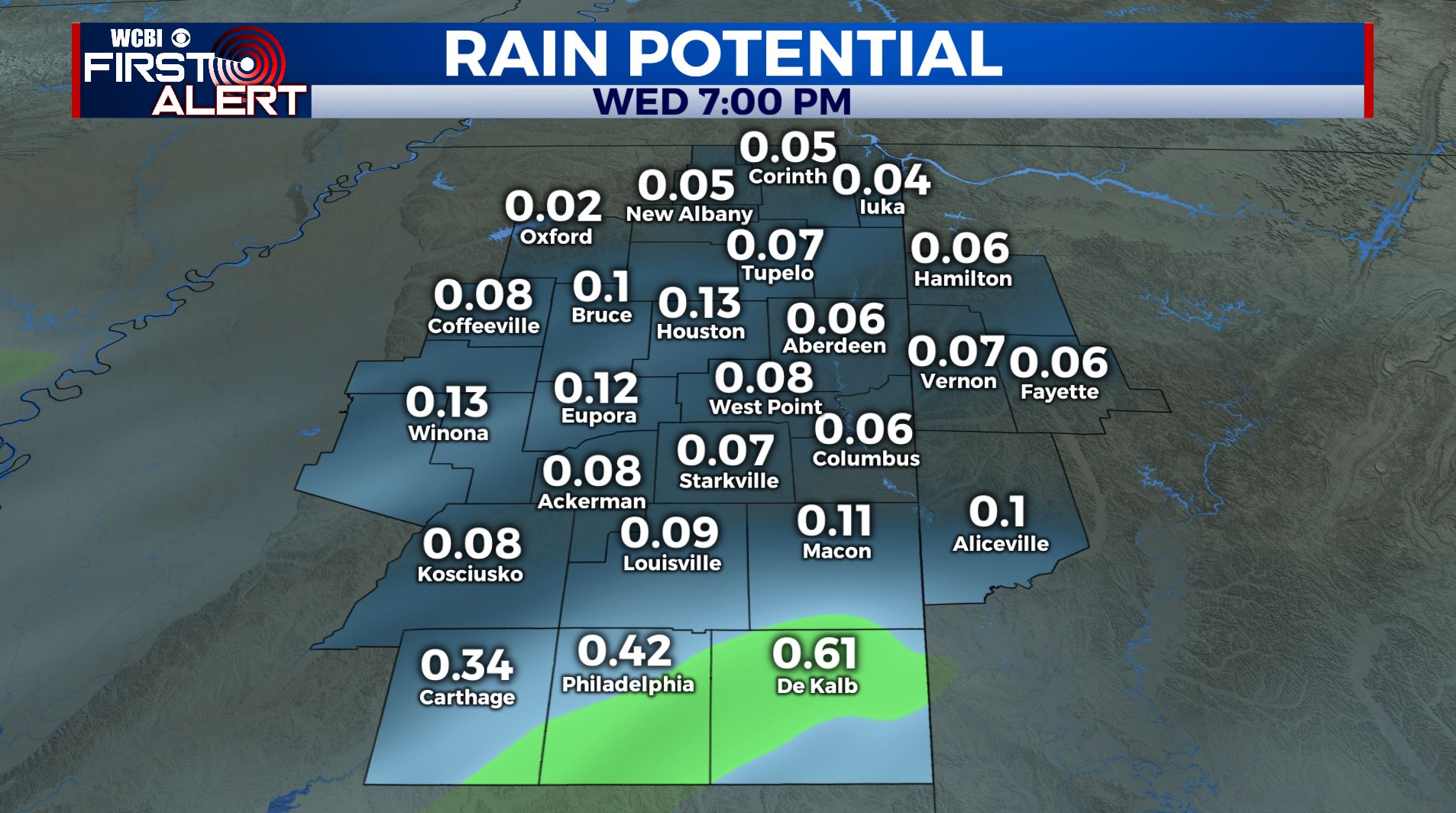
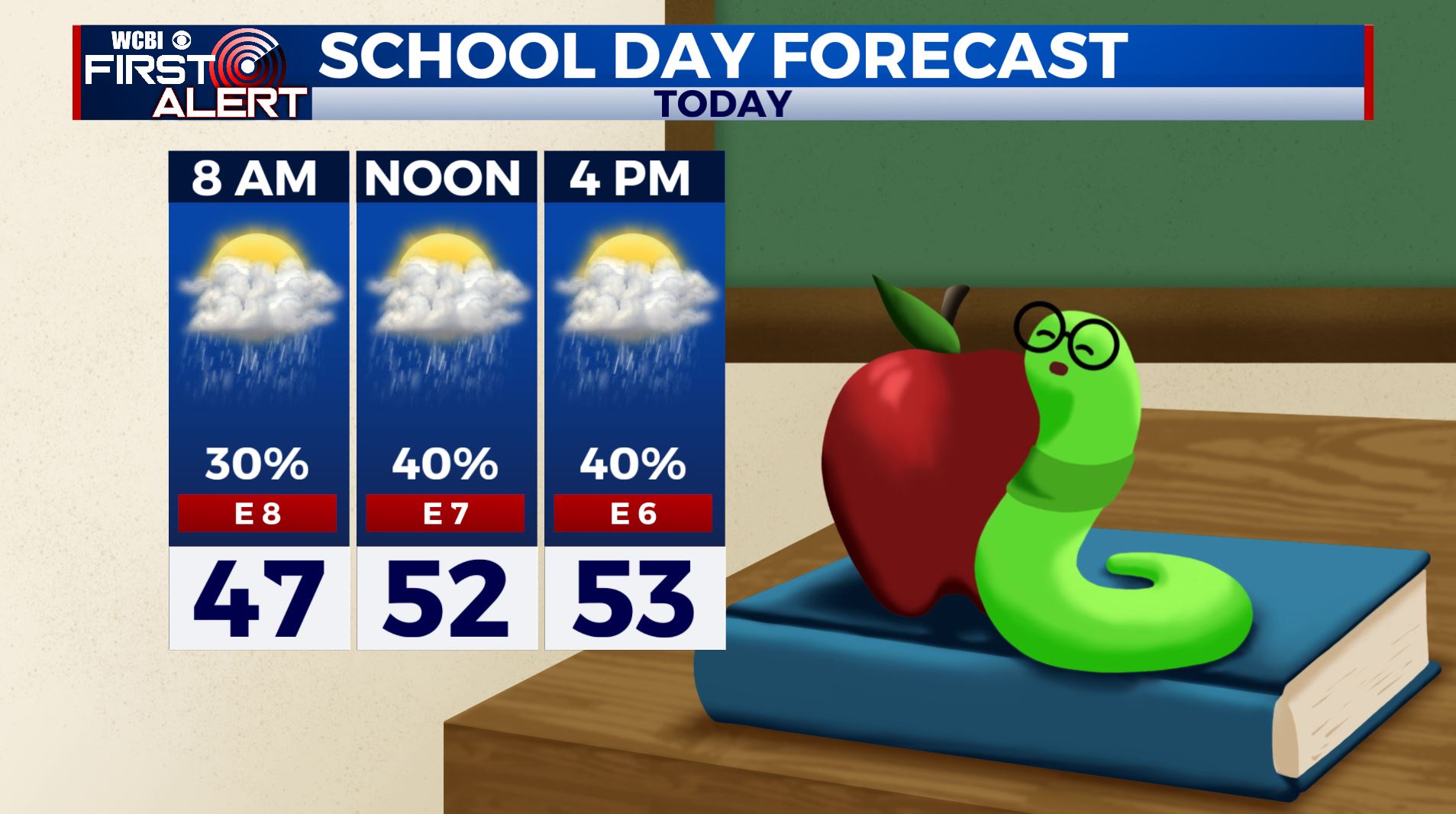
WEDNESDAY: Areas of light rain likely through the afternoon. Highs in the middle to upper 50s. A bit breezy with an east wind 5-15 mph.
WEDNESDAY NIGHT: Cloudy with patchy drizzle and patchy fog forming after midnight. Lows in the upper 30s to lower 40s. Light NE wind.
THURSDAY: A mix of sun & clouds after some morning fog & drizzle. Highs in the upper 50s. Lows in the upper 30s to lower 40s Thursday night. N wind 5-10 mph.
FRIDAY: Mostly cloudy with another chance of scattered showers. Highs in the lower to mid 50s. Upper 30s for overnight lows Friday night.
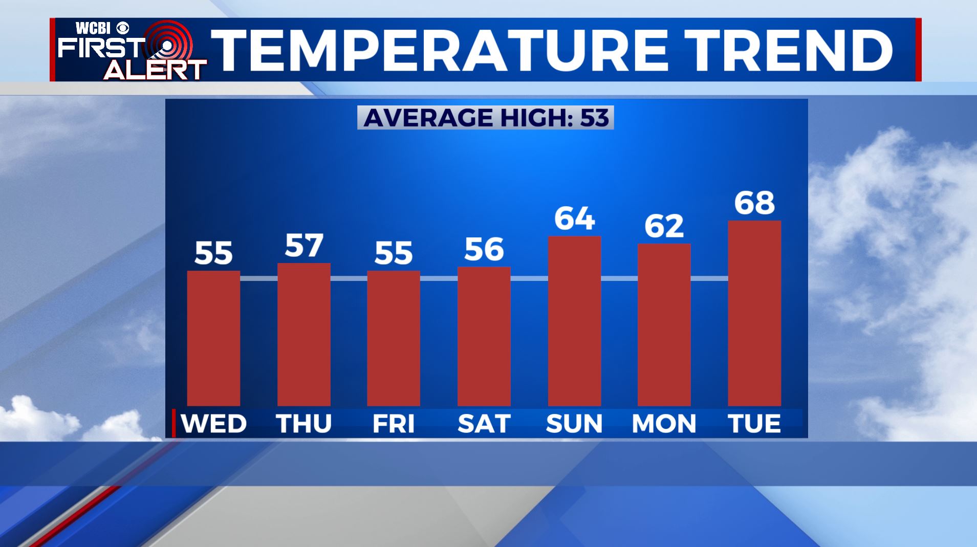
SATURDAY: Becoming sunny. Highs in the middle to upper 50s. Upper 30s to around 40 Saturday night under mainly clear skies.
SUNDAY: Sunny skies and mild. High temperatures warming up in the mid to possibly upper 60s.
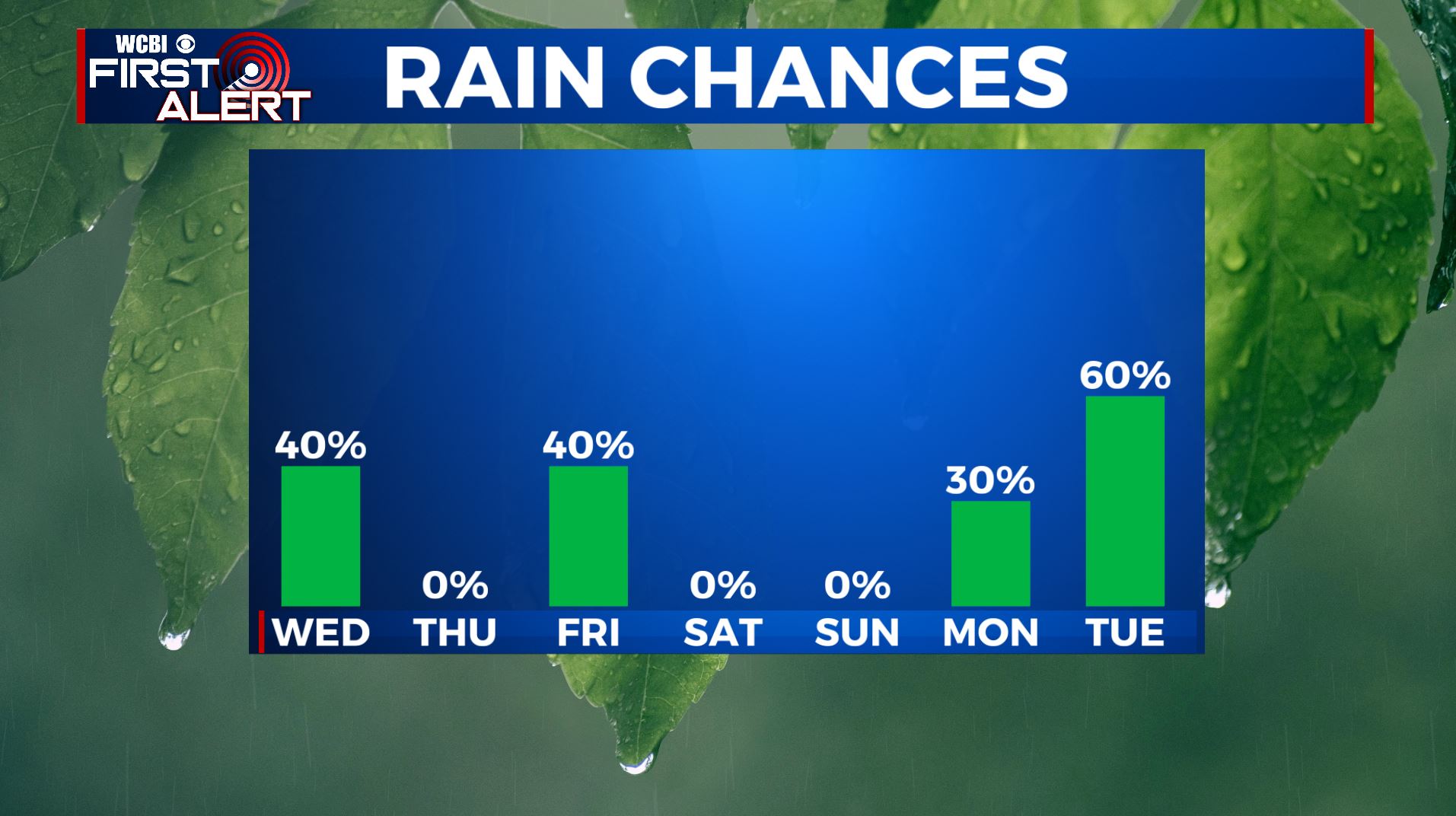
MONDAY-TUESDAY: Rain showers are likely to return. We’ll remain mild with lower 60s Monday and perhaps a shot at the upper 60s to near 70 by Tuesday.
MID/LATE NEXT WEEK: Data suggest a cool down may be on the way for the region. We’ll keep an eye on it.
Stay connected with @WCBIWEATHER on Facebook, Twitter, Instagram and the WCBI News App.


Leave a Reply