A cooler & dreary Wednesday makes way for warmer & drier weather late week
SUMMARY: A quick moving disturbance will give us some light rain showers followed by cool, cloudy, and breezy conditions on Wednesday. Pretty nice weather sets up for the end of the work week and for the upcoming weekend with temperatures gradually warming up. Early next week looks to be mild but rain and storms chances will be going back up. There could be more strong to severe storms in the region next Tuesday or Wednesday.
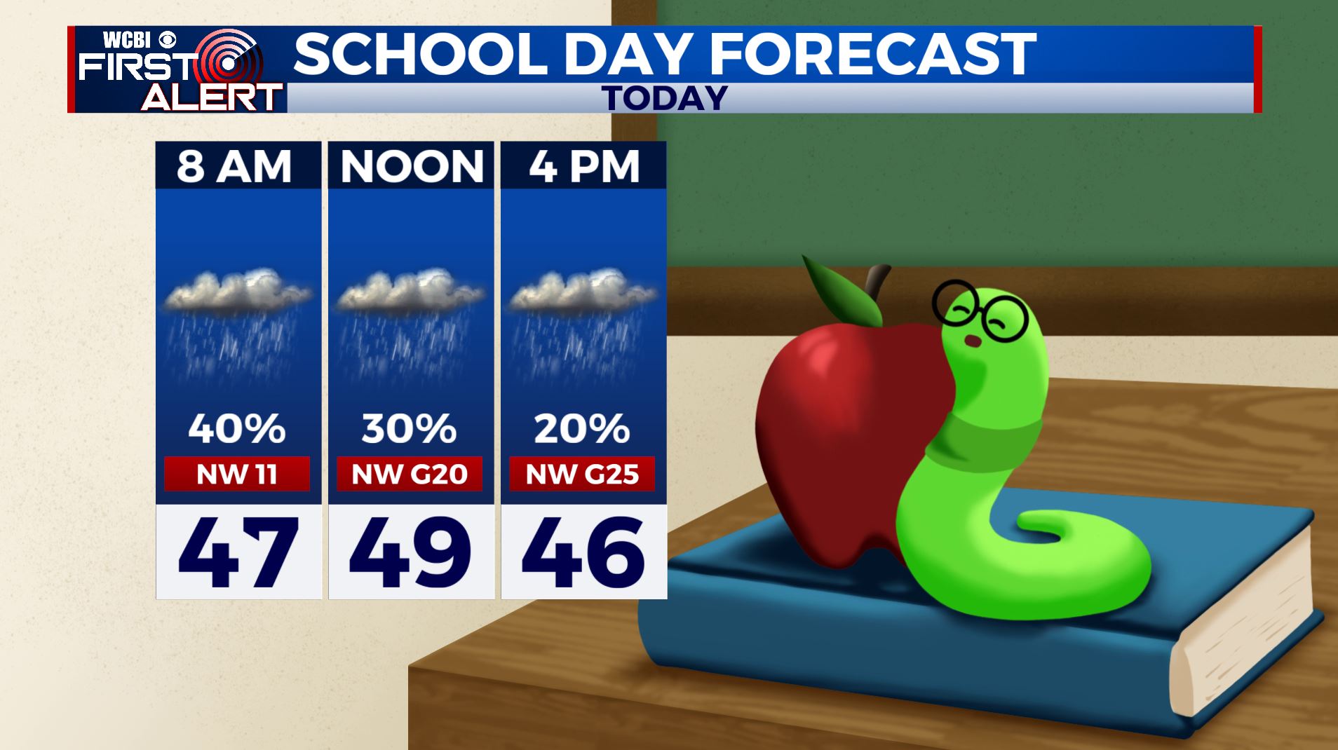
WEDNESDAY: We are waking up to light rain showers this Wednesday morning as a quick moving disturbance pushes through. We’ll have a cooler, cloudy, and breezy day ahead with NW winds picking up to 10-20, gusting up to 25 mph. Highs only in the upper 40s.
WEDNESDAY NIGHT: Gradual clearing. Much colder lows in the upper 20s to around 30.
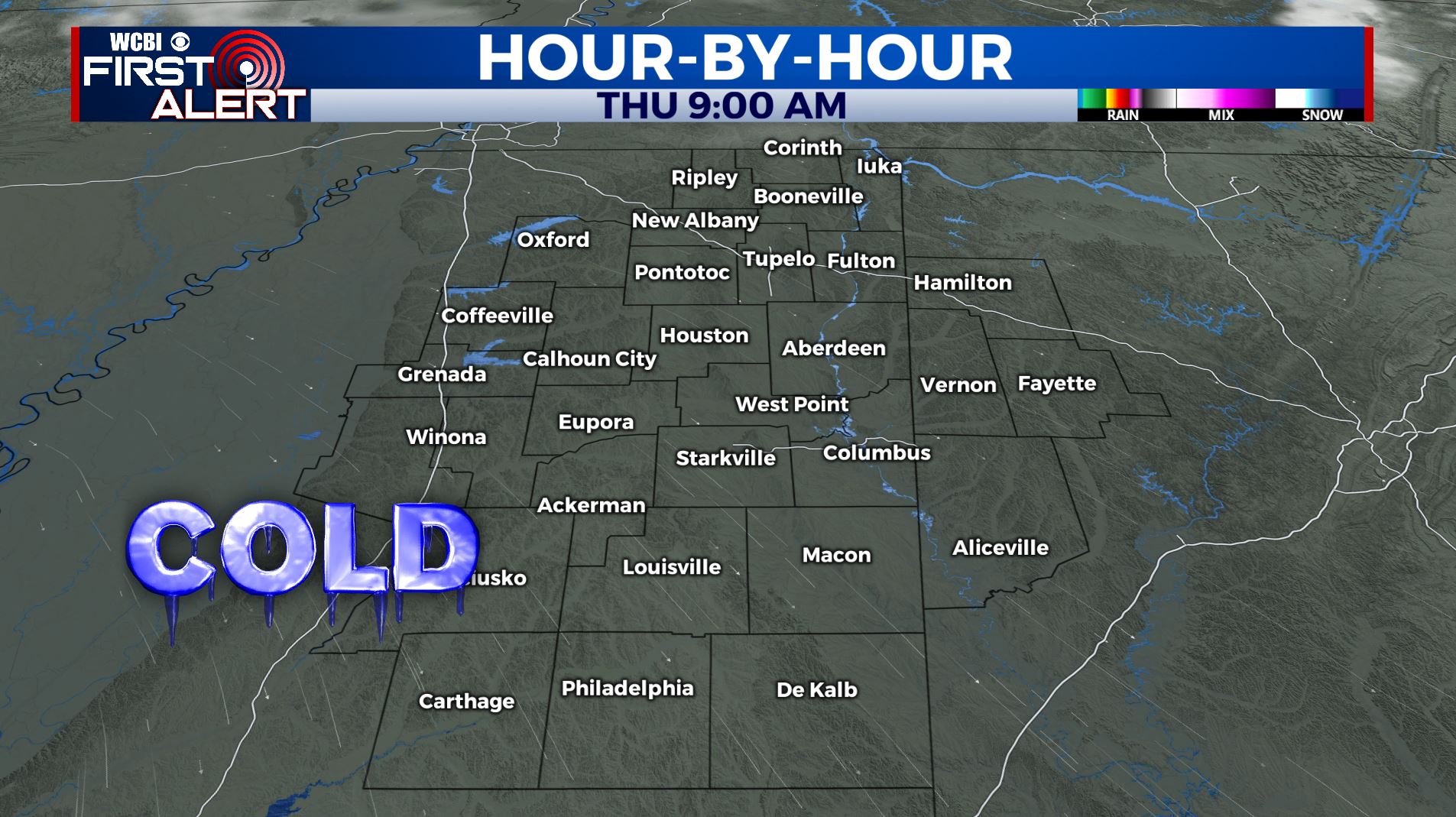
THURSDAY: A sunny and cool day. Highs in the upper 40s to near 50. NW Wind 5-10 mph.
THURSDAY NIGHT: Partly cloudy. Lows near freezing.
FRIDAY: Mostly sunny. Highs in the low to mid 50s.
FRIDAY NIGHT: Partly to mostly cloudy. A weak system could produce some light rain mixed with some flakes Friday night so stay tuned for updates on that. Lows in the 30s.
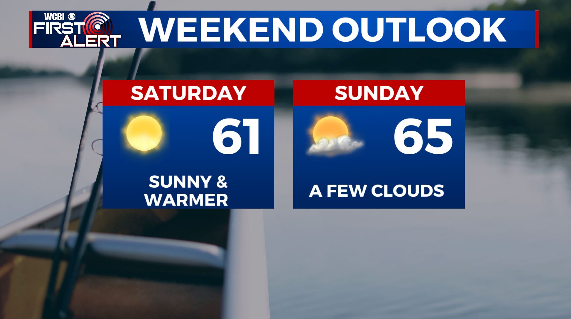
SATURDAY: Lots of sunshine. Highs in the upper 50s to lower 60s.
SATURDAY NIGHT: Mainly clear. Lows near 40.
SUNDAY: A mix of sun & clouds. Highs in the low to mid 60s.
MONDAY: Mostly cloudy and milder. Highs in the upper 60s to around 70. Areas of showers are possible with the chance of rain.
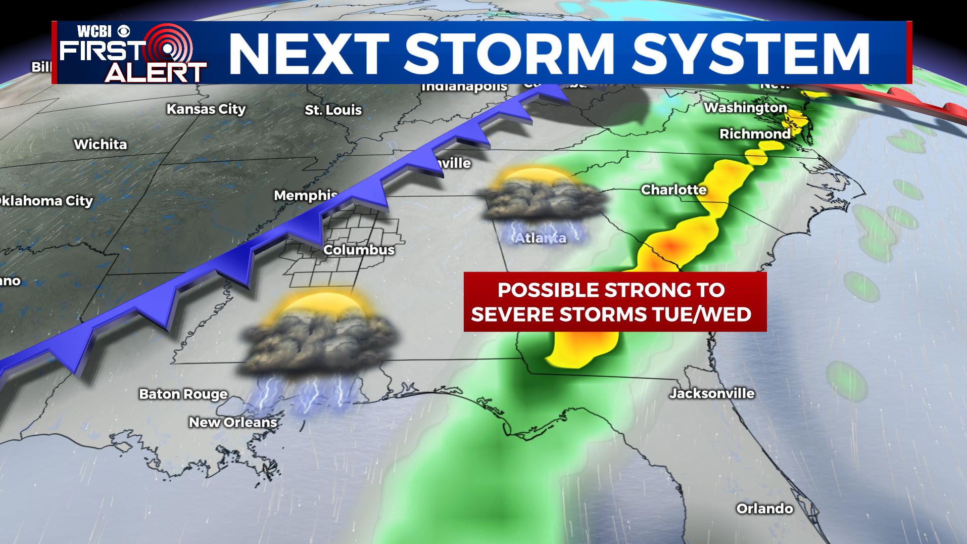
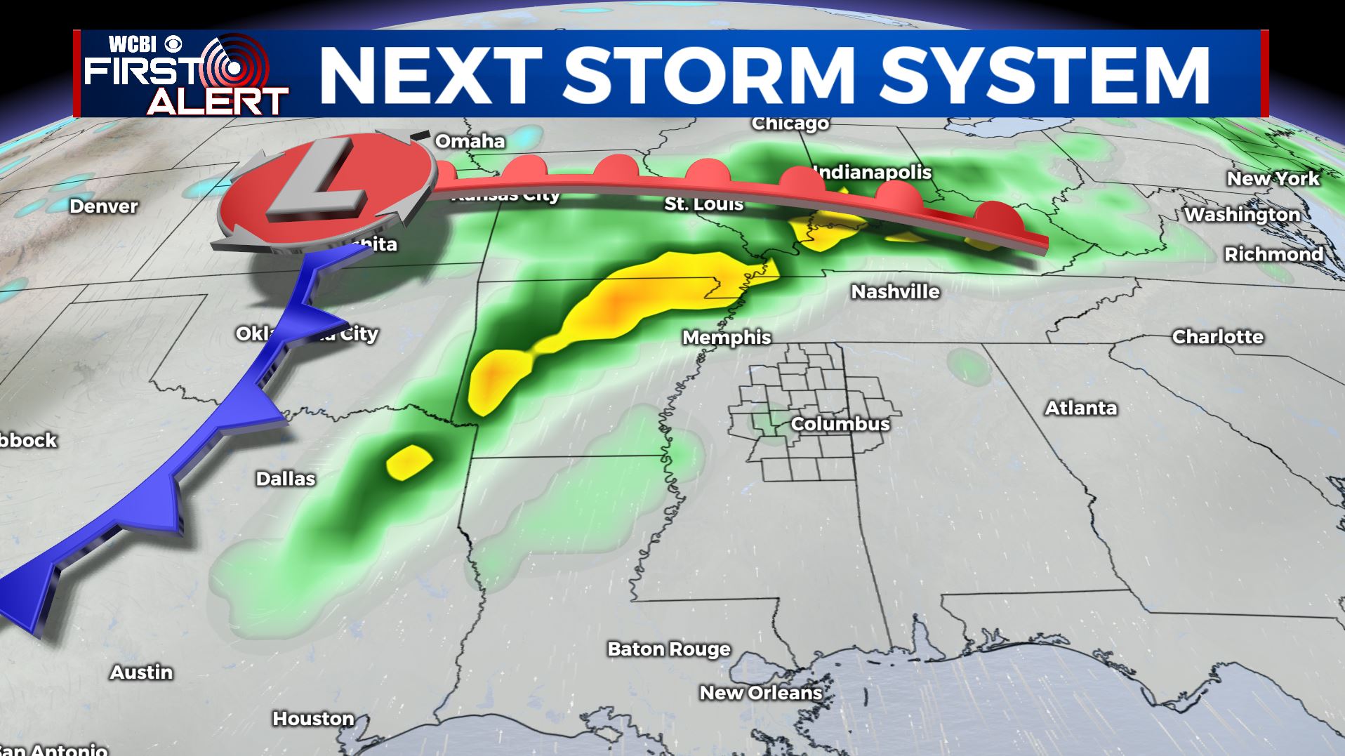
TUESDAY-WEDNESDAY: The next major weather system for us may produce strong to severe storms and more heavy rain. It’s something we’ll continue to monitor during the coming days.
Follow @WCBIWEATHER on Facebook, Twitter, Instagram, and the WCBI News App


Leave a Reply