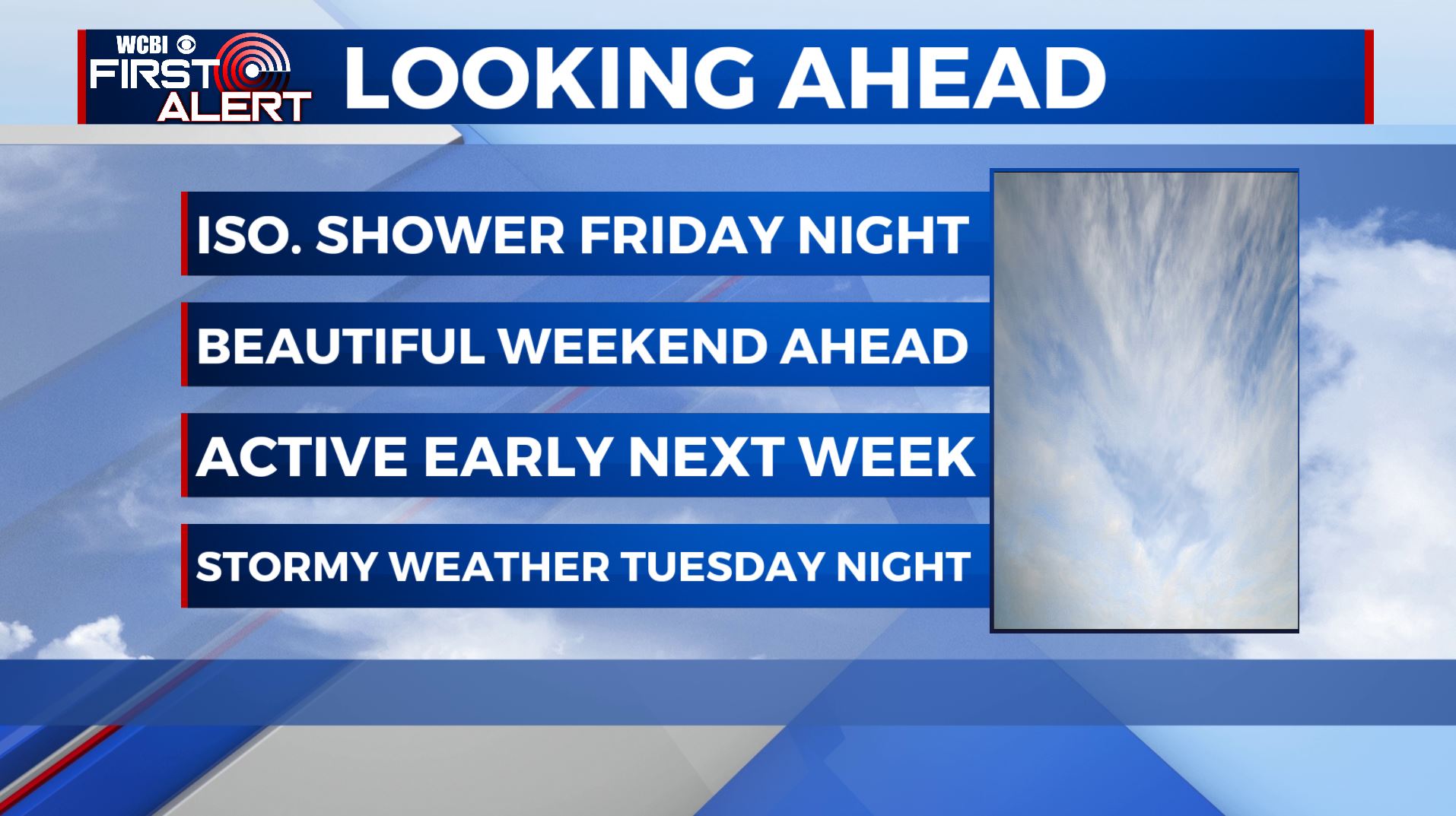
A decent Friday making way for a beautiful weekend
SUMMARY: A few weak disturbances will pass through the Friday morning and night but not expecting much with some cloud cover and maybe an isolated stray shower or sprinkle. A beautiful weekend is ahead for us with lots of sunshine and warmer temperatures. Our next best chance of rain and storms will come Monday through Wednesday. There could be some strong to severe storms Tuesday evening/night into Wednesday we’ll need to watch closely.
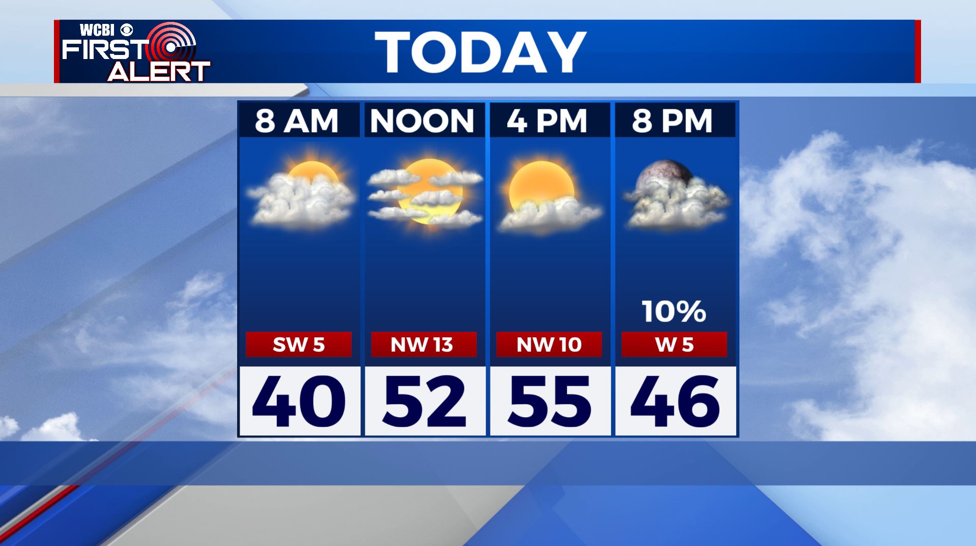
FRIDAY: We’re waking up to some cloud cover and maybe a stray sprinkle in our far northern counties as a weak disturbance pushes through. A mix of sun & clouds by the afternoon. Still cool with highs in the mid 50s. Winds SW/NW 5-15 mph.
FRIDAY NIGHT: Variably cloudy with the chance of a few isolated showers as a second weak disturbance pushes through. Skies will clear up by morning. Lows in the mid 30s.
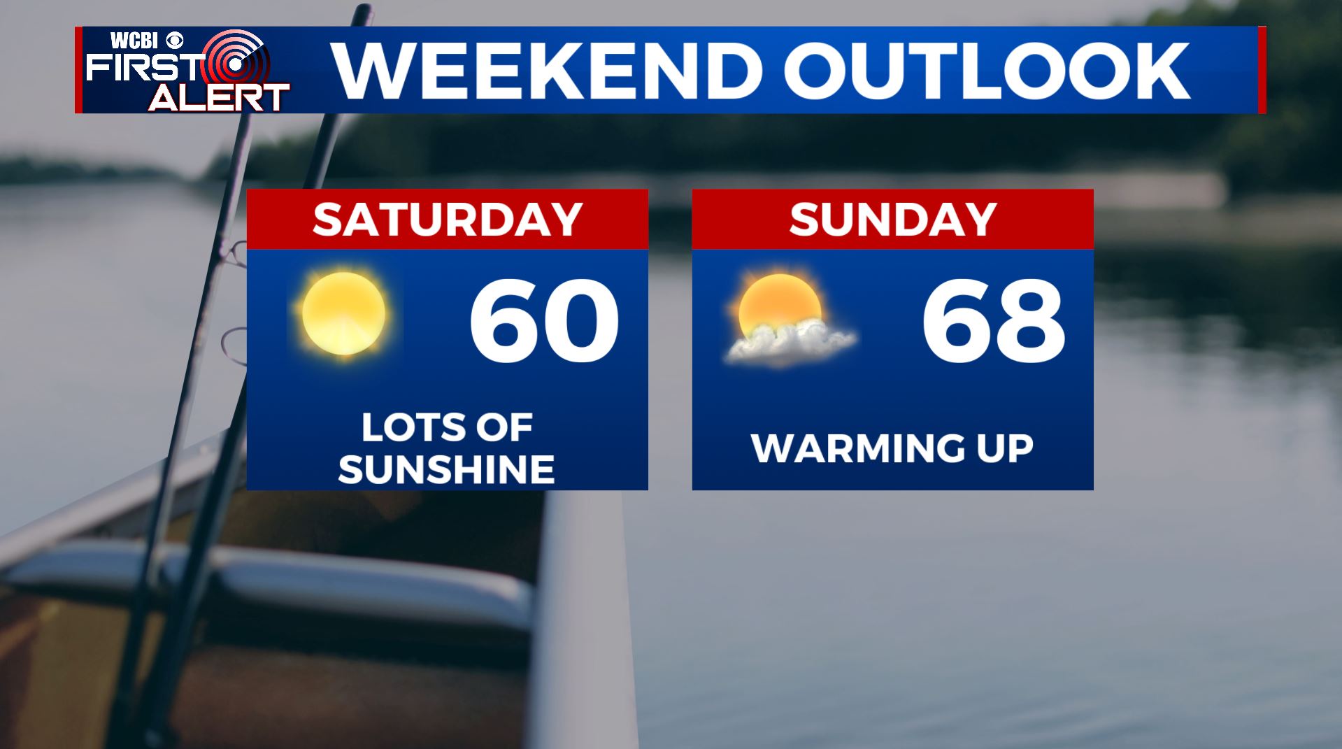
SATURDAY: Lots of sunshine as high pressure moves in. Highs warming up a bit in the upper 50s to lower 60s.
SATURDAY NIGHT: Mainly clear. Lows near 40.
SUNDAY: A mix of sun & clouds. High temperatures continue to warm up into the mid to upper 60s.
MONDAY: Mostly cloudy and milder. Highs in the upper 60s to around 70. Areas of rain are possible as an active weather pattern returns.
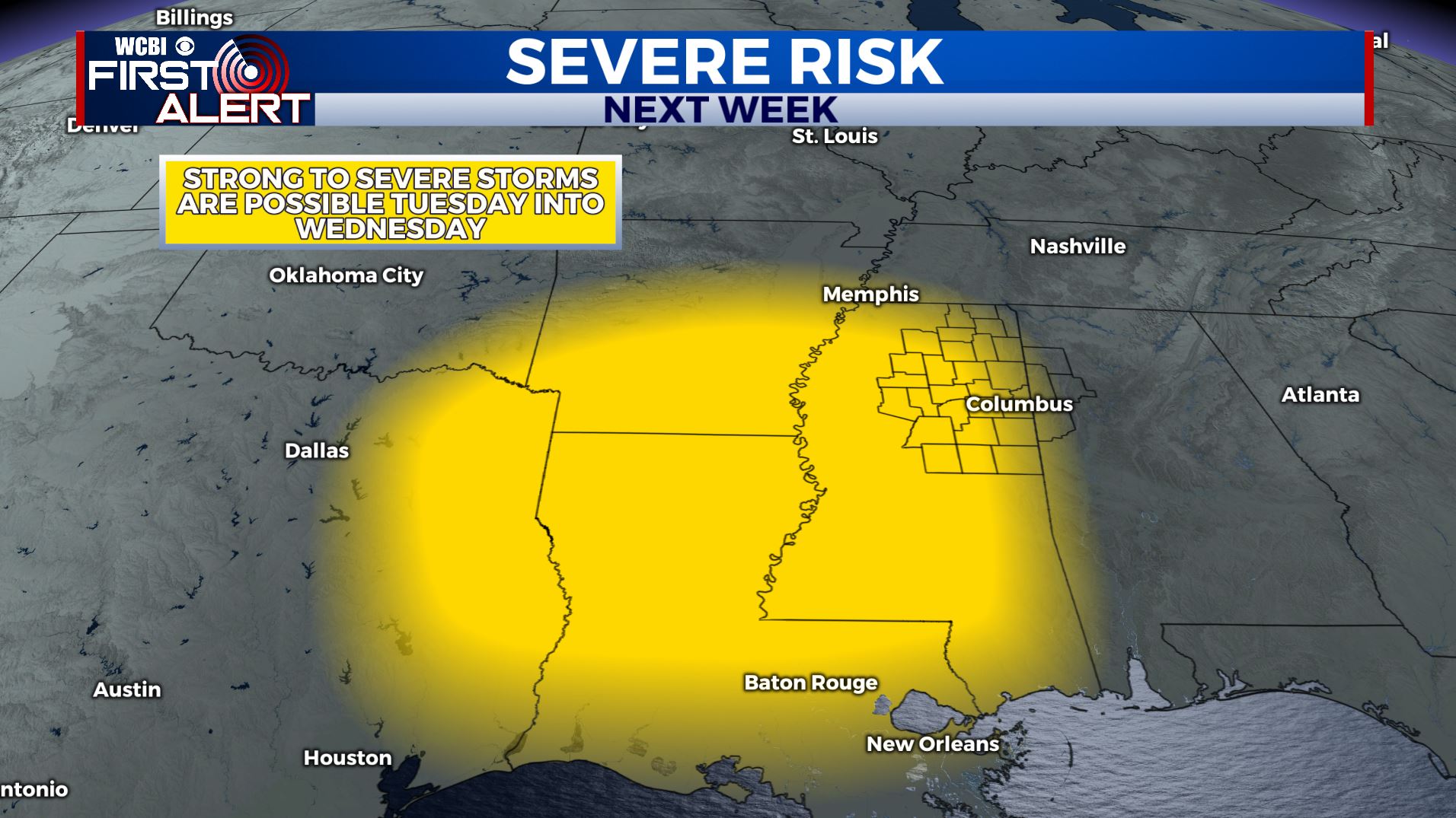
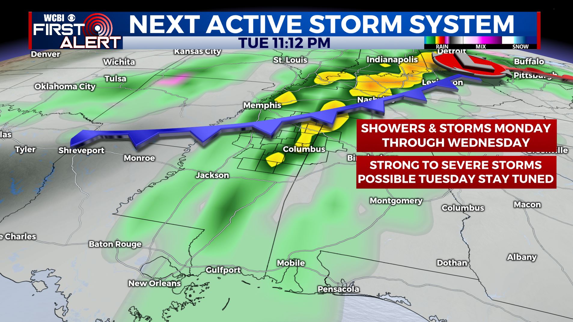
TUESDAY-WEDNESDAY: Rain and storms are possible Tuesday into Wednesday with an upper area of low pressure and a strong cold front passing through. Some strong to severe weather may occur Tuesday evening and night. All modes of severe weather are possible so stay tuned for details. Total rainfall between Monday and Wednesday may end up being 2″ to over 5″ and that could easily cause more flooding issues around the region. Stay with us over the coming days as we fine tune timing and any impacts.
Follow @WCBIWEATHER on Facebook, Twitter, Instagram, and the WCBI News App


Leave a Reply