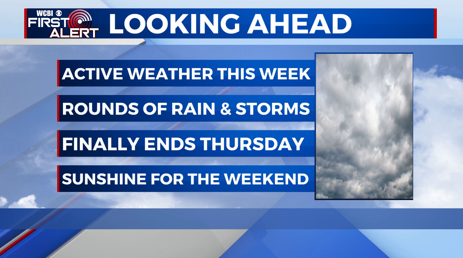
An active weather pattern returns for a new work week
SUMMARY: A complex storm system is expected to affect the area Monday through early Thursday. A cold front will push through Monday Night into Tuesday. The front heads south and stalls south of our area Tuesday afternoon through Wednesday. That’s a good set-up to prevent severe weather locally. We could be dealing with rain amounts anywhere from 1-2 maybe 3 inches in total this week. Another beautiful weekend is ahead for us.
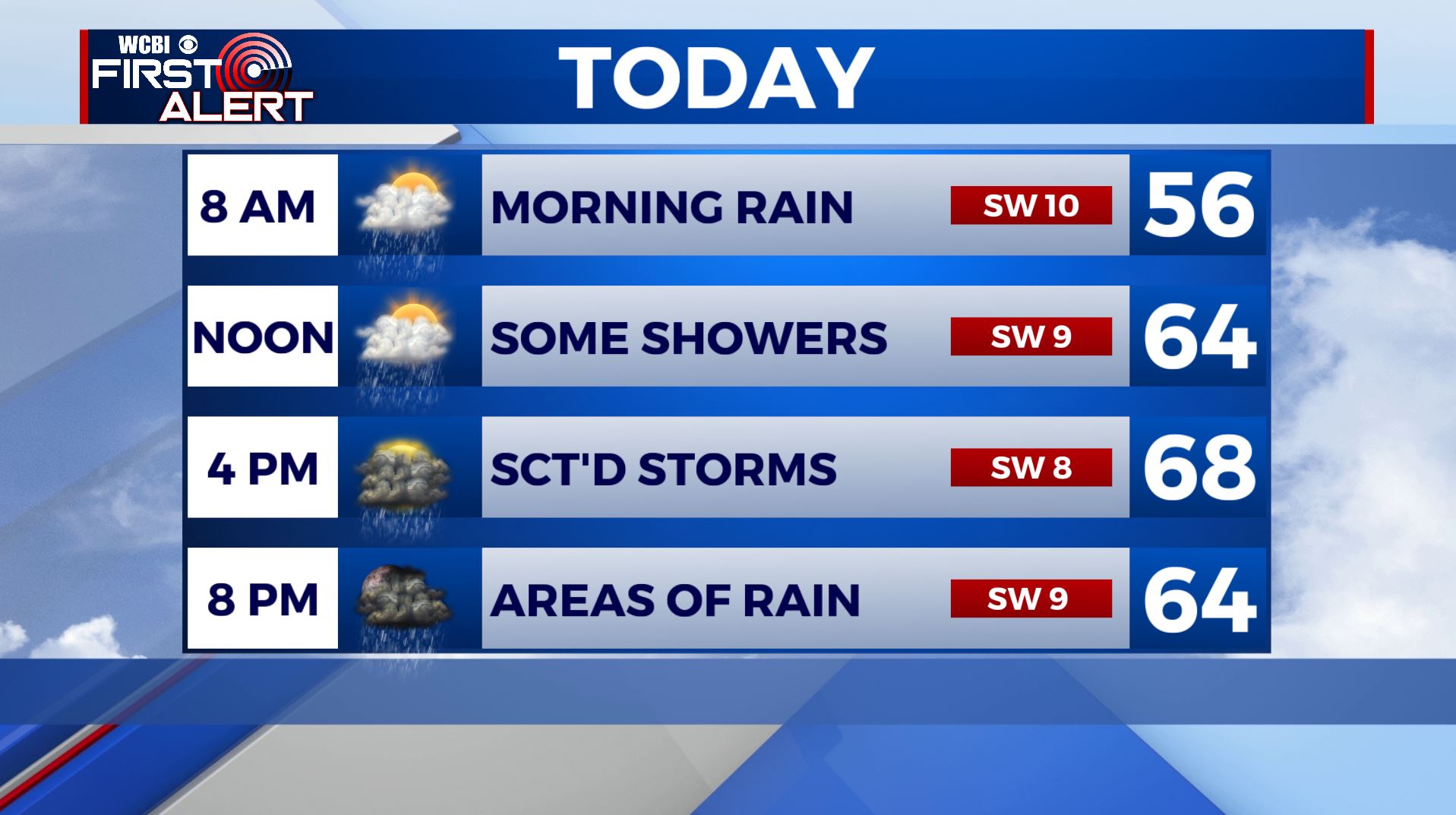
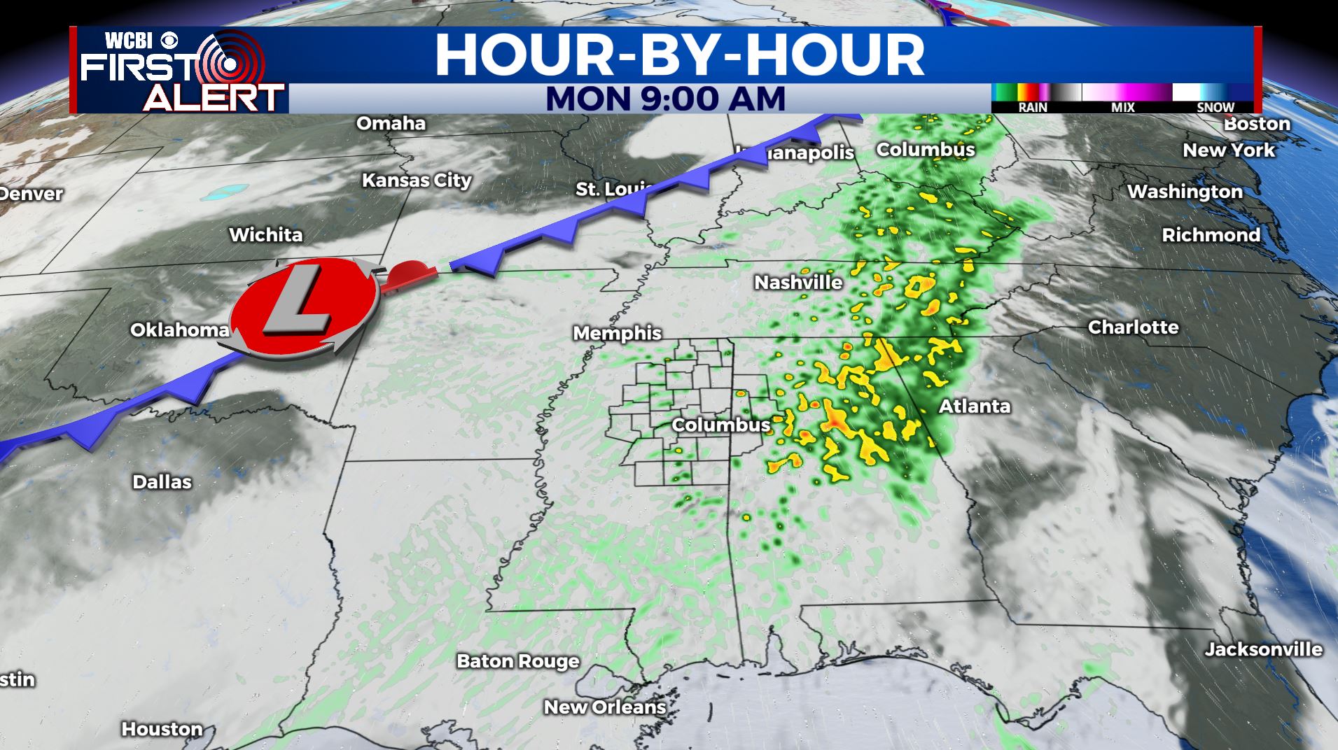
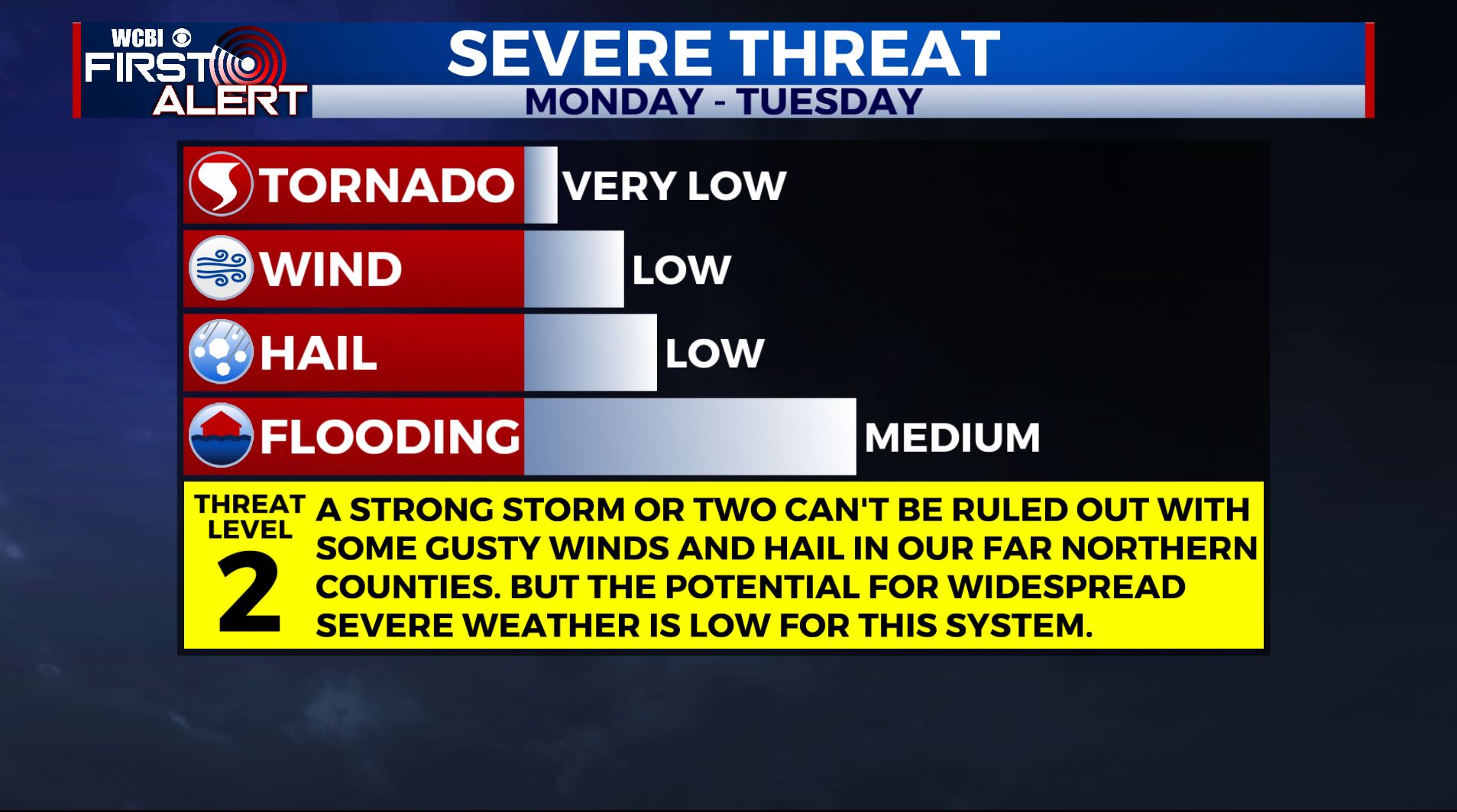
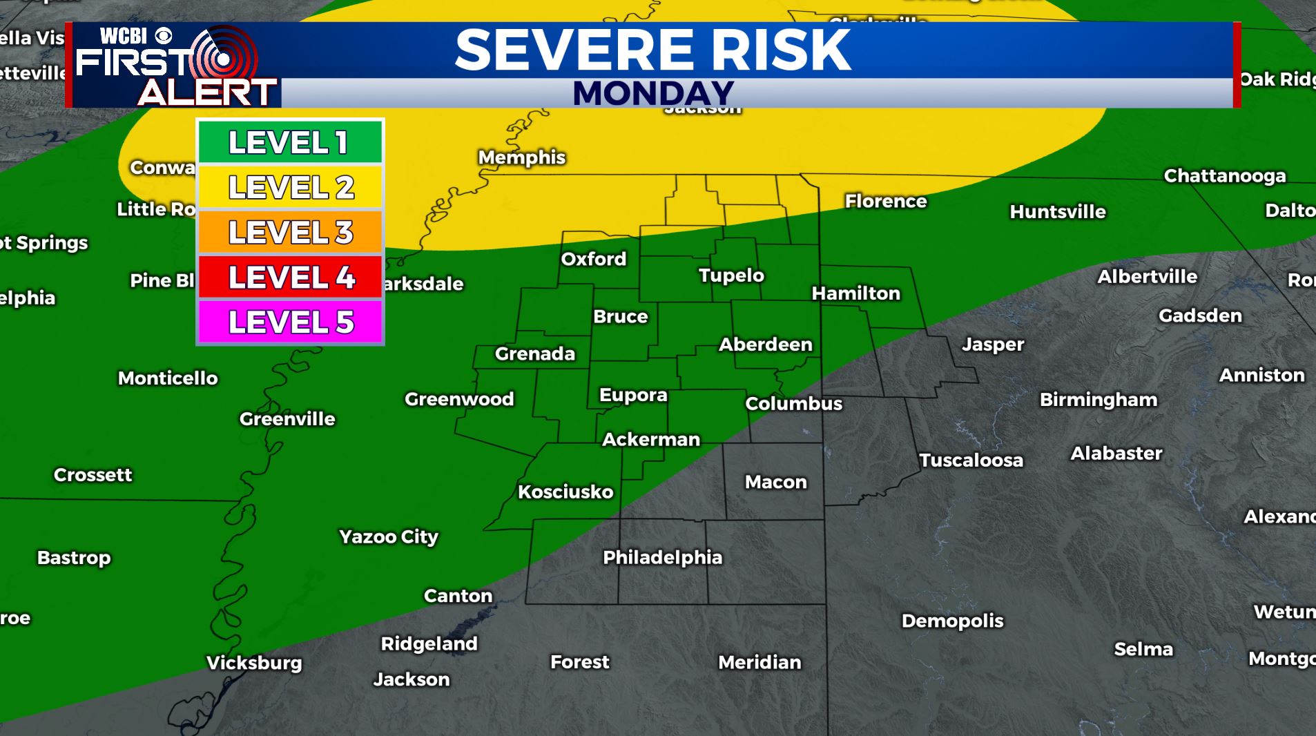
MONDAY: We’re waking up to areas of rain this Monday morning. A few rumbles of thunder, but overall severe weather not expected. Areas of rain with an embedded thunderstorm can’t be ruled out late afternoon into the evening hours. An isolated strong storm is possible in some areas with wind and hail the main threat. We’re under a Level 1-2 Risk for later on today for heavy rain, gusty winds and hail especially in our far northern counties in Mississippi near the Tennessee line. Look for highs in the upper 60s.
MONDAY NIGHT: Rain & thundershowers will continue into Monday Night. Overnight lows down into the upper 50s to lower 60s.
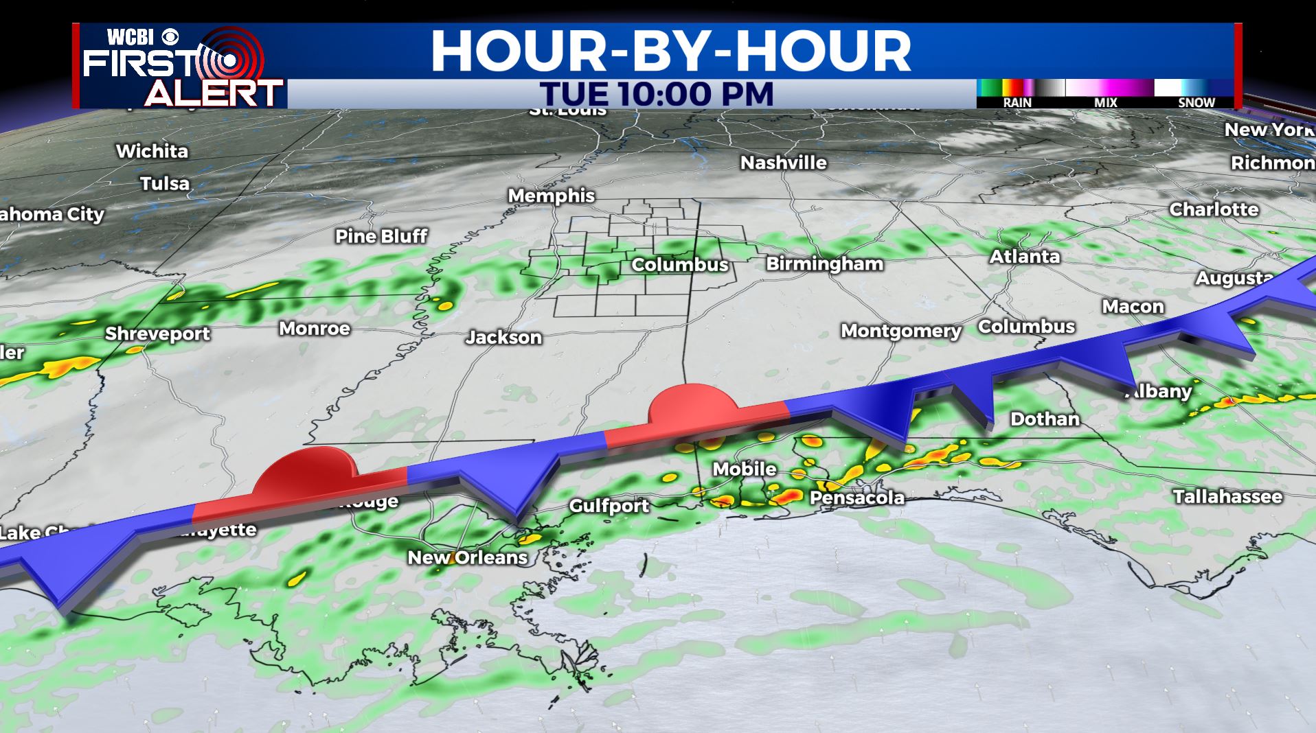
TUESDAY: More batches of rain and storms will pass through the region. With the cold front pushing south towards the Gulf Coast and the track of the low staying along the coast, this would help bring in cooler air and keep us more on track for thundershowers. Things could shift around, but we’re growing confident in lesser chances for severe weather locally, aside from a stray strong storm or two. Regardless, batches of rain and storms remain a safe bet with highs near 70 and lows in the 50s.
WEDNESDAY: We’ll continue to see widespread chances of thundershowers push through the region. It will depend on how our cold front settles through and where the passing of the low will be located. Look for temps much cooler in the upper 50s with lows in the 40s.
THURSDAY: It appears we’ll have some lingering rain showers in the region during the morning hours. Then we will see a mix of sun and clouds into the afternoon and evening. Look for highs in the lower 60s with lows down in the 40s.
FRIDAY – NEXT WEEKEND: Thankfully, we’ll have another great end to the week with lots of sunshine. Highs generally in the 60s, though temperatures could vary as we move forth. Stay tuned!
Stay connected with @WCBIWEATHER on Facebook, Twitter, Instagram, and the WCBI News App


Leave a Reply