Another warm day for Friday before storms move in this weekend
SUMMARY: Highs will once again be well into the 80s on Friday. Several new record highs may once again be established in the region. The next chance of strong to severe storms will be Saturday afternoon into Saturday night. Cooler temperatures move back in next week. Next chances for showers & storms will be on Tuesday.
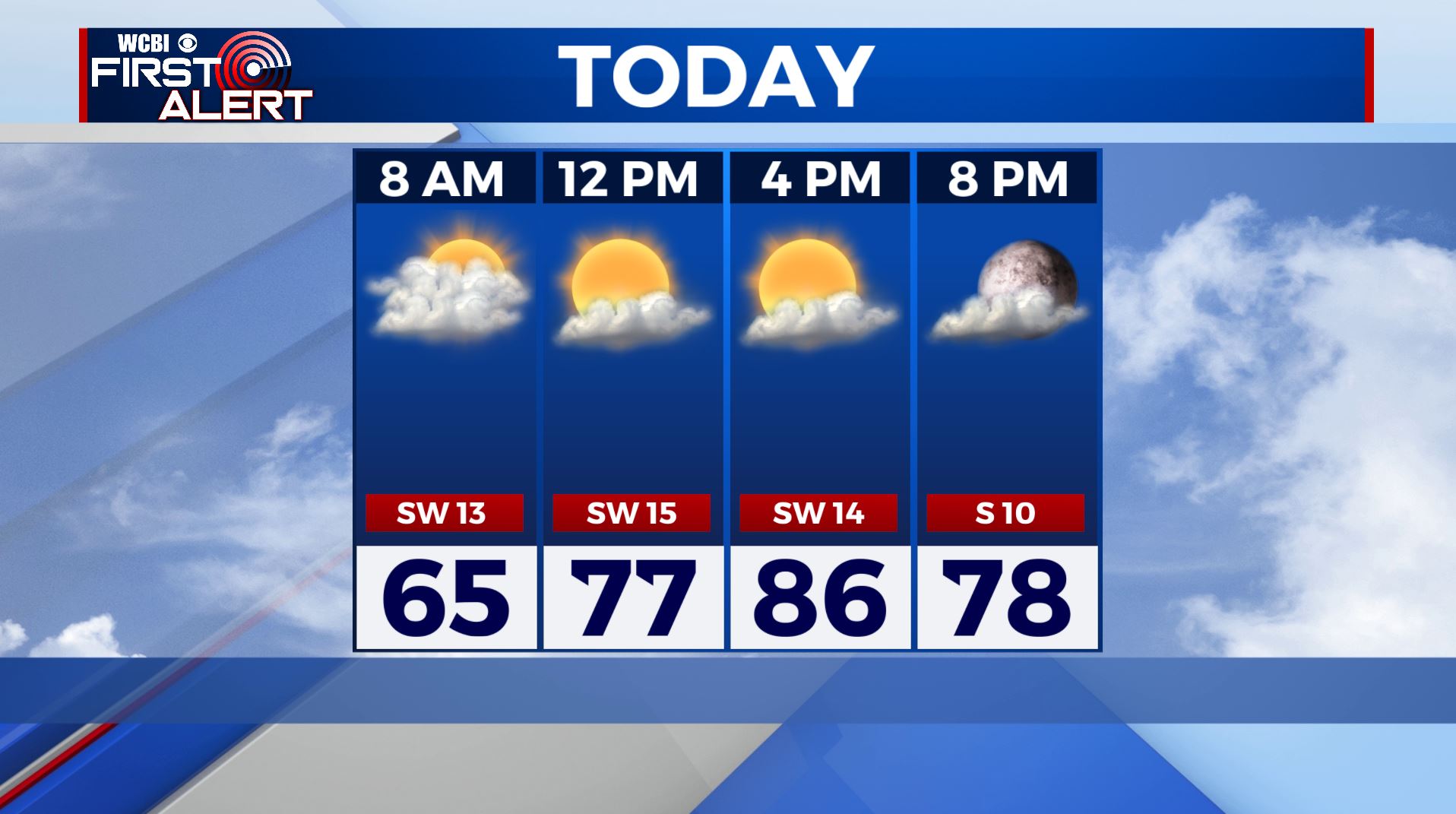
FRIDAY: Waking up to some clouds this morning, but we’ll see some more sunshine by the afternoon. Highs in the mid to upper 80s. Some new record highs are possible once again. Breezy SW winds 5-10 mph.
FRIDAY NIGHT: Clouds fill back in during the overnight hours. Lows in the mid 60s.
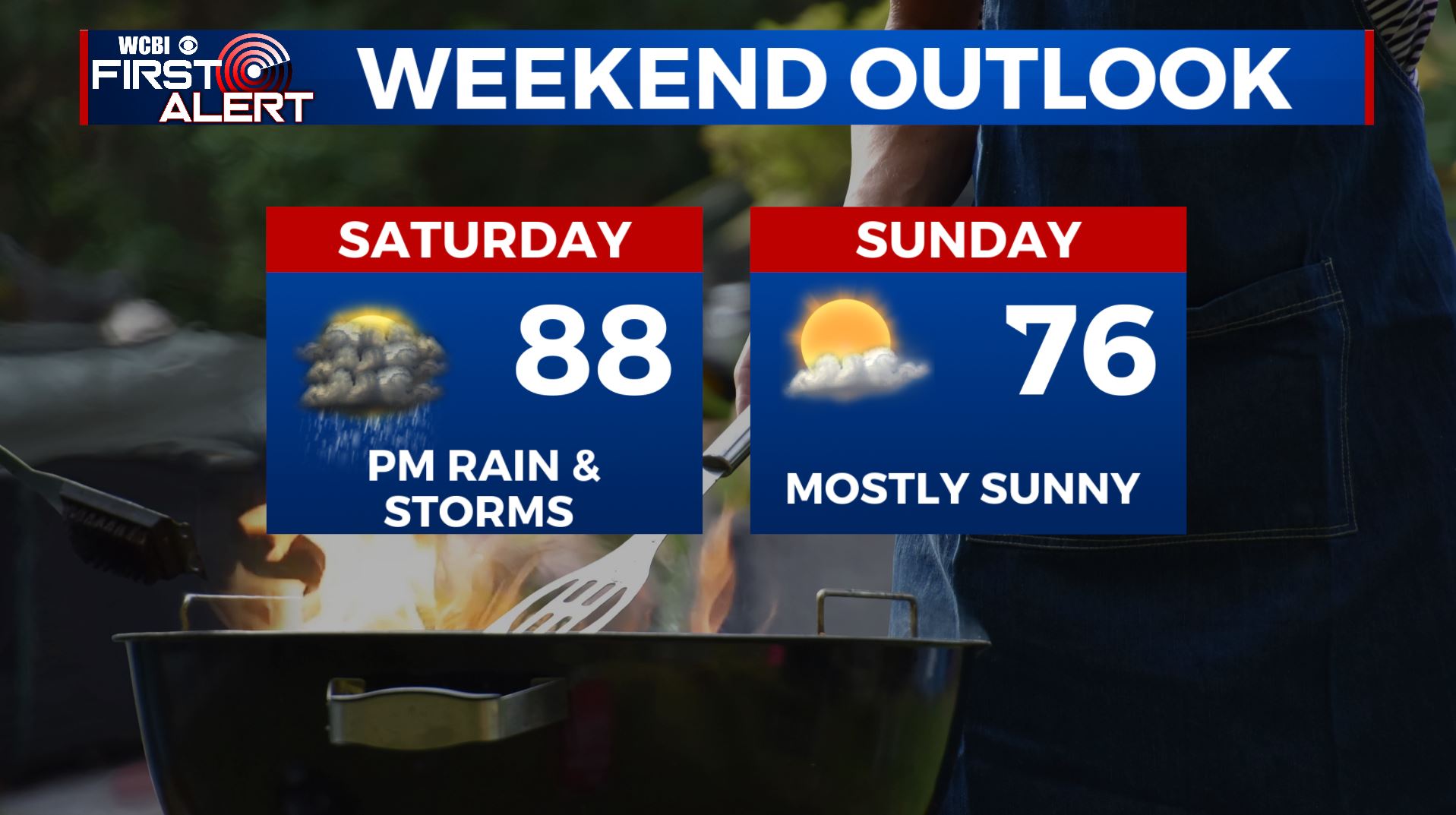
SATURDAY: Mostly cloudy to start with a mix of sun and clouds developing during the day. Southerly breezes keep high temperatures well into the 80s.
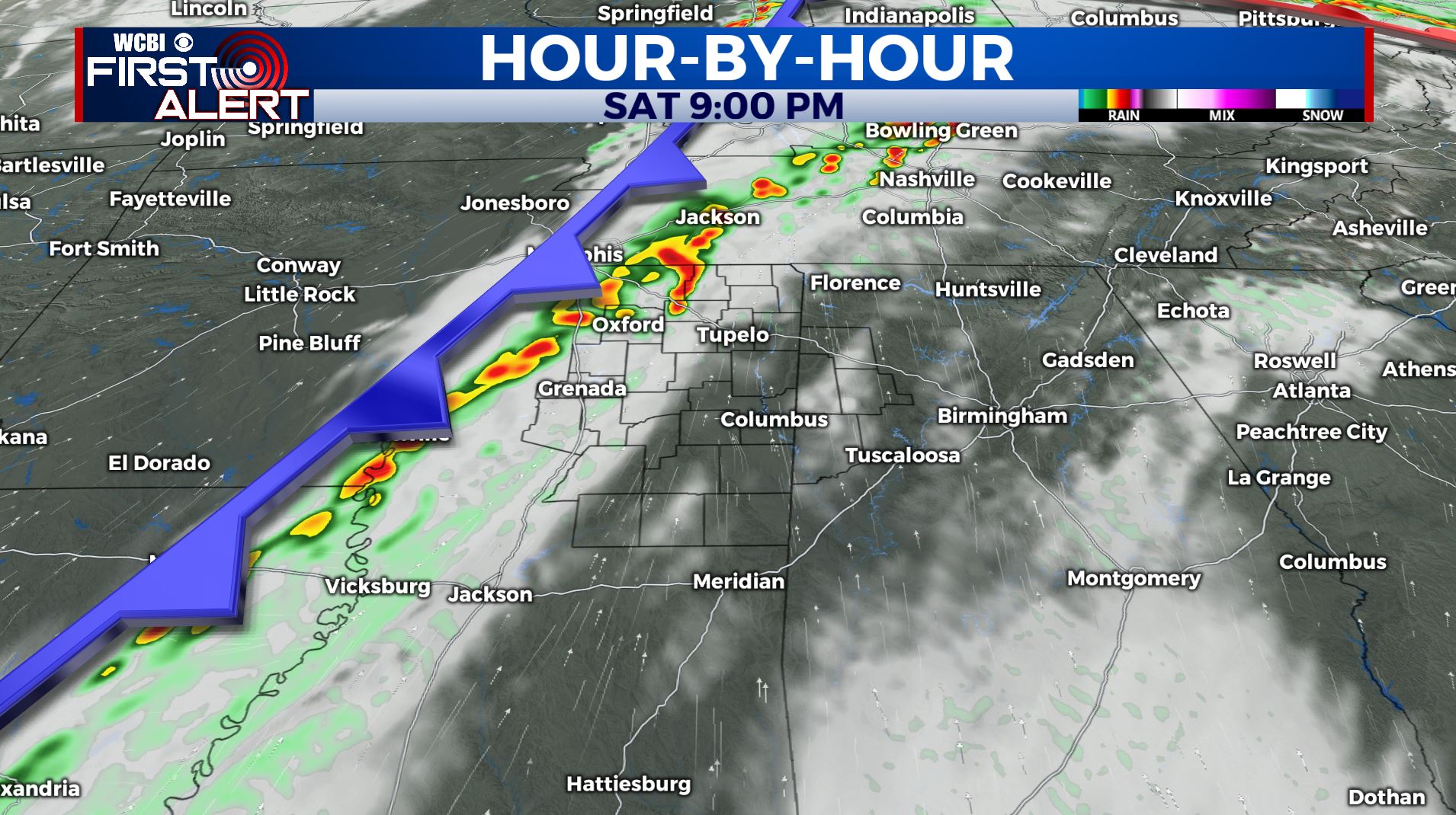
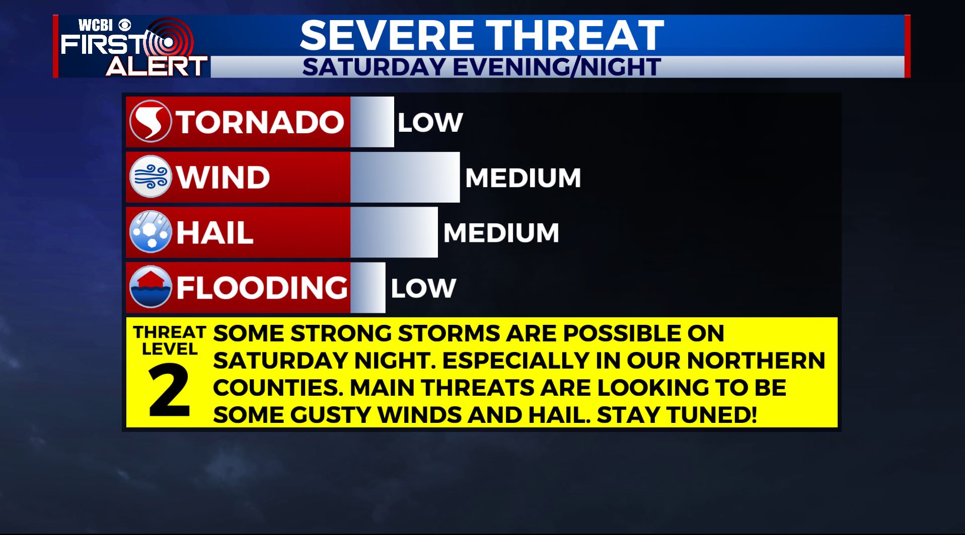
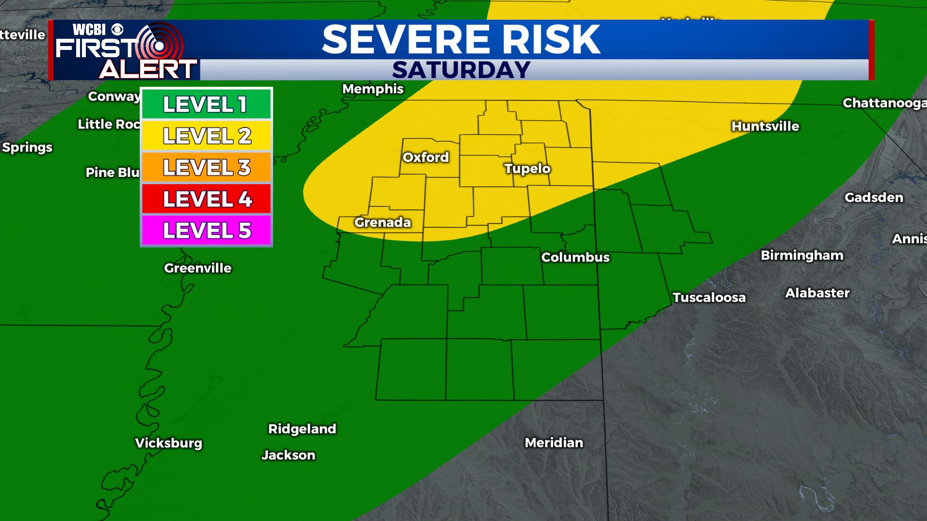
SATURDAY EVENING/NIGHT: A line of storms is expected to move across the area as a strong cold front pushes through. We’re right now under a Level 1-2 Risk as damaging wind gusts and hail appear to be the main threats if strong to severe storms does occur. Lows will be in the upper 50s by sunrise.
SUNDAY: High pressure will be moving back in behind our cold front, allowing mostly sunny skies to return. A pleasant day is likely with highs in the lower 70s.
MONDAY: A mix of sun & clouds with a slight chance for a stray shower late in the day. Better chances of showers & storms by Monday night. High temperatures in the lower to mid 70s.
TUESDAY: Mostly cloudy with chances for showers and storms likely. High temperatures in the mid 70s.
WEDNESDAY: Partly sunny skies with a slight chance for a stray shower. Highs below average & cooler in the mid 60s.
THURSDAY: Mostly sunny skies with highs in the upper 60s so remaining cool.
Stay connected with @WCBIWEATHER on Facebook, Twitter, Instagram, and the WCBI News App


Leave a Reply